Toggle navigation
LMEC Home
Exhibitions
Georeferencing
Tools for Teachers
Collections
My Favorites
Sign Up / Log In
Search
Search the map portal
Map Collection
Map Collection
Map Sets
Search
Search
Search for
Search In
All Fields
Creator
Title
Subject
Place
Search All Digital Collections
Advanced Search
1676 Results
My Search
Start Over
More Like
commonwealth-oai:sj13f069k
Remove constraint More Like: commonwealth-oai:sj13f069k
Filter your Search
Place
North and Central America
1,647
United States
1,385
Suffolk (county)
761
Boston
754
Massachusetts
678
Canada
205
New York
195
Quebec
111
more
Place
»
Topic
Boston (Mass.)--Maps
752
United States--History--Revolution, 1775-1783--Maps
330
United States--History--French and Indian War, 1754-1763--Maps
149
City planning--Massachusetts--Boston--Maps
104
Real property--Massachusetts--Boston--Maps
99
Landowners--Massachusetts--Boston--Maps
74
Urban renewal--Massachusetts--Boston--Maps
63
Massachusetts--Maps
55
more
Topic
»
Date
Date range begin
–
Date range end
Current results range from
1700
to
2023
View distribution
Creator
Boston Redevelopment Authority
114
Rocque, Mary Ann
29
Geo. H. Walker & Co
27
Holland, Samuel, 1728-1801
25
Jefferys, Thomas, -1771
25
Montrésor, John, 1736-1799
25
Bellin, Jacques Nicolas, 1703-1772
24
Boynton, George W., d. 1884
21
more
Creator
»
Format
Maps/Atlases
1,660
Manuscripts
13
Drawings/Illustrations
11
Documents
5
Prints
1
Georeferenced
Yes
97
No
1,579
Collection
American Revolutionary War-Era Maps
942
William L. Clements Library Collection
909
Norman B. Leventhal Map & Education Center Collection
623
Boston and New England Maps
584
Urban Maps
493
Boston Redevelopment Authority Collection
120
Mapping Boston Collection
20
Maps from AAS
14
more
Collection
»
Available to use
No known restrictions
696
Creative Commons license
38
Search Constraints
Sort by relevance
relevance
title
date (asc)
date (desc)
Number of results to display per page
20 per page
10
per page
20
per page
50
per page
100
per page
View results as:
grid view
map view
Search Results
1301.
A map or draft of a certain tract and parcell of arable and low land of Collo. Henry Beekman being situate & lying within the...
1302.
Mappa geographica Americae Septentrionalis ad emendatiora exemplaria adhuc edita jussu Acad. Reg. Scient. et eleg. litt. descripta
1303.
Maumee Bay
1304.
Middlesex Canal : copy'd from the survey of Mr. Thompson
1305.
Moosehead Lake and the immediate area to the west : Québec July 25th, 1761
1306.
Mr. Clarke's lot, Batavia
1307.
Mr. Mathew's draft of the Scioto & Ohio Companies purchase
1308.
Mr. Wilkinsons plat of ye Cherekee country
1309.
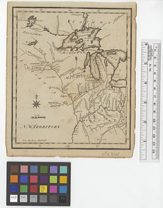
N. W. Territory
1310.
Narragansett Bay and the surrounding shores
1311.
Neu und verbesseter plan der st. u. hafens Havanah auf der ins. Cvba mit den wasser tiefen, sand, baencken und klippen...
1312.
A new & accurate chart of the western or Atlantic Ocean : drawn from the most approved modern map &c.
1313.
A new and accurate chart of the harbour of Boston, in New England, in North America
1314.
A new and accurate map of Connecticut and Rhode Island from the best authorities
1315.
A new and accurate map of New Jersey, from the best authorities
1316.
A new and accurate map of North America laid down according to the latest and most approved observations, and discoveries
1317.
A new and accurate map of the English empire in North America : representing their rightful claim as confirm'd by charters, &...
1318.
A new and accurate map of the English empire in North America : representing their rightful claim as confirm'd by charters, and...
1319.
A new and accurate map of the island of Antigua or Antego, taken from surveys and adjusted by astronl. observations, containing...
1320.
A new and accurate map of the present seat of war in North America
‹ Prev
Next ›
1
2
…
62
63
64
65
66
67
68
69
70
…
83
84