Toggle navigation
LMEC Home
Exhibitions
Georeferencing
Tools for Teachers
Collections
My Favorites
Sign Up / Log In
Search
Search the map portal
Map Collection
Map Collection
Map Sets
Search
Search
Search for
Search In
All Fields
Creator
Title
Subject
Place
Search All Digital Collections
Advanced Search
970 Results
My Search
Start Over
More Like
commonwealth-oai:r4950j238
Remove constraint More Like: commonwealth-oai:r4950j238
Filter your Search
Place
North and Central America
944
United States
678
Canada
205
New York
199
Quebec
111
Pennsylvania
90
New Jersey
62
Virginia
49
more
Place
»
Topic
United States--History--Revolution, 1775-1783--Maps
305
United States--History--French and Indian War, 1754-1763--Maps
149
Pennsylvania--Maps
50
Saint Lawrence River--Maps
43
Maryland--Maps
37
New York (State)--Maps
32
Newport (R.I.)--Maps
27
New Jersey--Maps
23
more
Topic
»
Date
Date range begin
–
Date range end
Current results range from
1700
to
1931
View distribution
Creator
Rocque, Mary Ann
29
Bellin, Jacques Nicolas, 1703-1772
26
Holland, Samuel, 1728-1801
25
Montrésor, John, 1736-1799
25
Jefferys, Thomas, -1771
24
Clinton, Henry, Sir, 1738?-1795
19
Robert Sayer and John Bennett (Firm)
15
Hills, John, active 1777-1819
13
more
Creator
»
Format
Maps/Atlases
954
Drawings/Illustrations
11
Documents
5
Manuscripts
1
Prints
1
Georeferenced
Yes
19
No
951
Collection
American Revolutionary War-Era Maps
921
William L. Clements Library Collection
909
Norman B. Leventhal Map & Education Center Collection
52
American Antiquarian Society Collection
7
MacLean Collection Map Library
2
Urban Maps
2
Available to use
No known restrictions
52
Search Constraints
Sort by relevance
relevance
title
date (asc)
date (desc)
Number of results to display per page
20 per page
10
per page
20
per page
50
per page
100
per page
View results as:
grid view
map view
Search Results
841.
Siege of Charleston, South Carolina 1780
842.
Siege of Charlestown 1780
843.
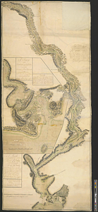
Siege of Yorktown
844.
Situation des posten zu Denyses Ferry auf Long Island wie solcher den 7ten October 1781 von furste : Braunshweig und Hessen...
845.
Situation of ye rebels just before the attack upon Trenton
846.
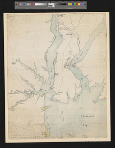
Sketch from information of the different roads about Freehold in the Jerseys
847.
Sketch of different passes into Canada from our lower provinces
848.
Sketch of Dumplin Point with a project for a battery of 4 guns and a redout for 90 men; with a barrack in the battery
849.
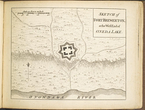
Sketch of Fort Brewerton at the west end of Oneda Lake
850.
Sketch of Fort Edward, Novr. 30th, 1756
851.
Sketch of forts Clinton and Montgomery stormed the 6th October 1777 by the troops under the command of Sr. Henry Clinton K:B:...
852.
A sketch of Haddonfield : West New Jersey County
853.
A sketch of Hallifax with its environs and the works, as executed in June 1776
854.
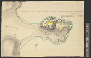
Sketch of Howland's Point with a project for its defence
855.
A sketch of Lloyd's Neck : particularly shewing the situation of the redoubt, encampment of the troops, with the ground...
856.
A sketch of New-London or Groton, with the attacks made on Forts Trumbull & Griswold by the British troops under the command of...
857.
A sketch of part of the island of Ste Lucie
858.
Sketch of part of the island of Ste. Lucie : computed at about 2500 feet to 1 inch
859.
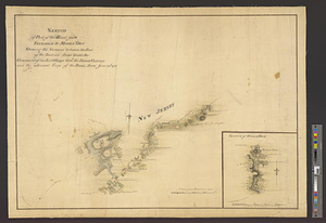
A sketch of part of the river St. John on the north side of the Bay of Fundy from Partridge Island in the latitude of 45.22...
860.
Sketch of part of the road from Freehold to Midde Town shewing the skirmish between the rear of the British army under the...
‹ Prev
Next ›
1
2
…
39
40
41
42
43
44
45
46
47
48
49