Toggle navigation
LMEC Home
Exhibitions
Georeferencing
Tools for Teachers
Collections
My Favorites
Sign Up / Log In
Search
Search the map portal
Map Collection
Map Collection
Map Sets
Search
Search
Search for
Search In
All Fields
Creator
Title
Subject
Place
Search All Digital Collections
Advanced Search
1253 Results
My Search
Start Over
More Like
commonwealth-oai:pv63kz90b
Remove constraint More Like: commonwealth-oai:pv63kz90b
Filter your Search
Place
North and Central America
1,221
United States
960
Canada
227
New York
193
Quebec
111
Pennsylvania
61
New Jersey
57
Massachusetts
53
more
Place
»
Topic
United States--History--Revolution, 1775-1783--Maps
330
United States--Maps
330
United States--History--French and Indian War, 1754-1763--Maps
151
Saint Lawrence River--Maps
44
Elections--United States--Maps
36
Railroads--United States--Maps
34
Canada--Maps
29
Newport (R.I.)--Maps
27
more
Topic
»
Date
Date range begin
–
Date range end
Current results range from
1700
to
2023
View distribution
Creator
Paullin, Charles Oscar, 1868 or 1869-1944
70
Wright, John Kirtland, 1891-1969
70
Rocque, Mary Ann
29
Bellin, Jacques Nicolas, 1703-1772
26
Holland, Samuel, 1728-1801
25
Jefferys, Thomas, -1771
25
Montrésor, John, 1736-1799
25
Clinton, Henry, Sir, 1738?-1795
19
more
Creator
»
Format
Maps/Atlases
1,235
Drawings/Illustrations
11
Documents
5
Manuscripts
5
Prints
3
Books
1
Objects/Artifacts
1
Posters
1
Georeferenced
Yes
67
No
1,186
Collection
American Revolutionary War-Era Maps
959
William L. Clements Library Collection
909
Norman B. Leventhal Map & Education Center Collection
296
Maps from AAS
27
MacLean Collection Map Library
11
Boston and New England Maps
5
Newberry Library Collection
3
Urban Maps
3
more
Collection
»
Available to use
No known restrictions
223
Creative Commons license
9
Search Constraints
Sort by relevance
relevance
title
date (asc)
date (desc)
Number of results to display per page
20 per page
10
per page
20
per page
50
per page
100
per page
View results as:
grid view
map view
Search Results
881.
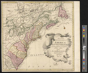
Mappa geographica Americae Septentrionalis ad emendatiora exemplaria adhuc edita jussu Acad. Reg. Scient. et eleg. litt. descripta
882.
Maumee Bay
883.
Middlesex Canal : copy'd from the survey of Mr. Thompson
884.
Moosehead Lake and the immediate area to the west : Québec July 25th, 1761
885.
Mr. Clarke's lot, Batavia
886.
Mr. Mathew's draft of the Scioto & Ohio Companies purchase
887.
Mr. Wilkinsons plat of ye Cherekee country
888.
N. W. Territory
889.
Narragansett Bay and the surrounding shores
890.
Neu und verbesseter plan der st. u. hafens Havanah auf der ins. Cvba mit den wasser tiefen, sand, baencken und klippen...
891.
A new & accurate chart of the western or Atlantic Ocean : drawn from the most approved modern map &c.
892.
A new and accurate chart of the harbour of Boston, in New England, in North America
893.
A new and accurate map of Connecticut and Rhode Island from the best authorities
894.
A new and accurate map of New Jersey, from the best authorities
895.
A new and accurate map of North America laid down according to the latest and most approved observations, and discoveries
896.
A new and accurate map of the English empire in North America : representing their rightful claim as confirm'd by charters, &...
897.
A new and accurate map of the English empire in North America : representing their rightful claim as confirm'd by charters, and...
898.
A new and accurate map of the island of Antigua or Antego, taken from surveys and adjusted by astronl. observations, containing...
899.
A new and accurate map of the present seat of war in North America
900.
A new and accurate map of the present war in North America
‹ Prev
Next ›
1
2
…
41
42
43
44
45
46
47
48
49
…
62
63