Toggle navigation
LMEC Home
Exhibitions
Georeferencing
Tools for Teachers
Collections
My Favorites
Sign Up / Log In
Search
Search the map portal
Map Collection
Map Collection
Map Sets
Search
Search
Search for
Search In
All Fields
Creator
Title
Subject
Place
Search All Digital Collections
Advanced Search
978 Results
My Search
Start Over
More Like
commonwealth-oai:n2971z39v
Remove constraint More Like: commonwealth-oai:n2971z39v
Filter your Search
Place
North and Central America
950
United States
690
Canada
205
New York
192
Quebec
111
Massachusetts
91
Suffolk (county)
73
Boston
66
more
Place
»
Topic
United States--History--Revolution, 1775-1783--Maps
330
United States--History--French and Indian War, 1754-1763--Maps
149
Saint Lawrence River--Maps
43
Boston (Mass.)--Aerial views
41
Newport (R.I.)--Maps
27
New York (State)--Maps
24
Hudson River (N.Y. and N.J.)--Maps
21
Québec (Québec)--Maps
21
more
Topic
»
Date
Date range begin
–
Date range end
Current results range from
1700
to
1980
View distribution
Creator
Rocque, Mary Ann
29
Holland, Samuel, 1728-1801
25
Jefferys, Thomas, -1771
25
Montrésor, John, 1736-1799
25
Bellin, Jacques Nicolas, 1703-1772
24
Clinton, Henry, Sir, 1738?-1795
19
Robert Sayer and John Bennett (Firm)
16
Hills, John, active 1777-1819
13
more
Creator
»
Format
Maps/Atlases
962
Drawings/Illustrations
11
Documents
5
Manuscripts
5
Prints
2
Georeferenced
Yes
4
No
974
Collection
American Revolutionary War-Era Maps
929
William L. Clements Library Collection
909
Norman B. Leventhal Map & Education Center Collection
49
Boston and New England Maps
44
Urban Maps
40
Maps from AAS
7
Boston Redevelopment Authority Collection
3
Newberry Library Collection
3
more
Collection
»
Available to use
No known restrictions
52
Creative Commons license
5
Search Constraints
Sort by relevance
relevance
title
date (asc)
date (desc)
Number of results to display per page
20 per page
10
per page
20
per page
50
per page
100
per page
View results as:
grid view
map view
Search Results
601.
Maumee Bay
602.
Middlesex Canal : copy'd from the survey of Mr. Thompson
603.
Moosehead Lake and the immediate area to the west : Québec July 25th, 1761
604.
Mr. Clarke's lot, Batavia
605.
Mr. Mathew's draft of the Scioto & Ohio Companies purchase
606.
Mr. Wilkinsons plat of ye Cherekee country
607.
N. W. Territory
608.
Narragansett Bay and the surrounding shores
609.
Neu und verbesseter plan der st. u. hafens Havanah auf der ins. Cvba mit den wasser tiefen, sand, baencken und klippen...
610.
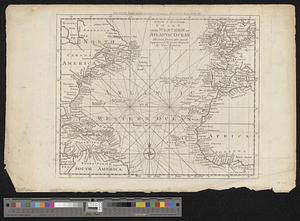
A new & accurate chart of the western or Atlantic Ocean : drawn from the most approved modern map &c.
611.
A new and accurate chart of the harbour of Boston, in New England, in North America
612.
A new and accurate map of Connecticut and Rhode Island from the best authorities
613.
A new and accurate map of New Jersey, from the best authorities
614.
A new and accurate map of North America laid down according to the latest and most approved observations, and discoveries
615.
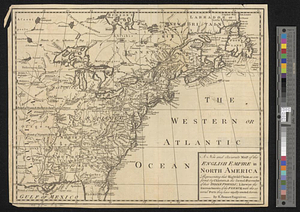
A new and accurate map of the English empire in North America : representing their rightful claim as confirm'd by charters, &...
616.
A new and accurate map of the English empire in North America : representing their rightful claim as confirm'd by charters, and...
617.
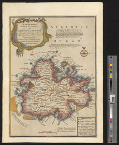
A new and accurate map of the island of Antigua or Antego, taken from surveys and adjusted by astronl. observations, containing...
618.
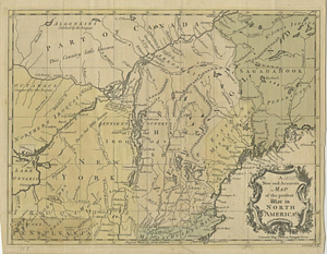
A new and accurate map of the present seat of war in North America
619.
A new and accurate map of the present war in North America
620.
A new and accurate map of the province of Nova Scotia, in North America; from the latest observations
‹ Prev
Next ›
1
2
…
27
28
29
30
31
32
33
34
35
…
48
49