Toggle navigation
LMEC Home
Exhibitions
Georeferencing
Tools for Teachers
Collections
My Favorites
Sign Up / Log In
Search
Search the map portal
Map Collection
Map Collection
Map Sets
Search
Search
Search for
Search In
All Fields
Creator
Title
Subject
Place
Search All Digital Collections
Advanced Search
938 Results
My Search
Start Over
More Like
commonwealth-oai:k356f1598
Remove constraint More Like: commonwealth-oai:k356f1598
Filter your Search
Place
North and Central America
912
United States
626
Canada
231
New York
193
Quebec
113
Pennsylvania
60
New Jersey
54
Nova Scotia
48
more
Place
»
Topic
United States--History--Revolution, 1775-1783--Maps
305
United States--History--French and Indian War, 1754-1763--Maps
149
Saint Lawrence River--Maps
43
Newport (R.I.)--Maps
27
New York (State)--Maps
25
Hudson River (N.Y. and N.J.)--Maps
21
Québec (Québec)--Maps
21
Louisbourg (N.S.)--Maps
20
more
Topic
»
Date
Date range begin
–
Date range end
Current results range from
1700
to
1921
View distribution
Creator
Rocque, Mary Ann
29
Bellin, Jacques Nicolas, 1703-1772
25
Holland, Samuel, 1728-1801
25
Jefferys, Thomas, -1771
25
Montrésor, John, 1736-1799
25
Clinton, Henry, Sir, 1738?-1795
19
Robert Sayer and John Bennett (Firm)
15
Hills, John, active 1777-1819
13
more
Creator
»
Format
Maps/Atlases
922
Drawings/Illustrations
11
Documents
5
Prints
1
Georeferenced
No
938
Collection
American Revolutionary War-Era Maps
916
William L. Clements Library Collection
909
Norman B. Leventhal Map & Education Center Collection
22
Library and Archives Canada Collection
4
MacLean Collection Map Library
3
Available to use
No known restrictions
22
Search Constraints
Sort by relevance
relevance
title
date (asc)
date (desc)
Number of results to display per page
20 per page
10
per page
20
per page
50
per page
100
per page
View results as:
grid view
map view
Search Results
21.
Coal fields of Manitoba and Saskatchewan
22.
Manitoba
23.
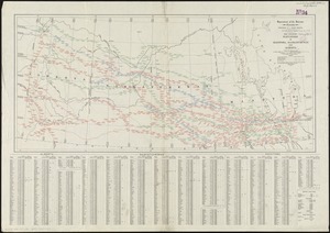
Manitoba : map showing disposition of lands
24.
Manitoba : map showing disposition of lands
25.
Manitoba : map showing disposition of lands
26.
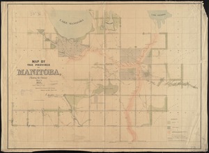
Map of Manitoba
27.
Map of Manitoba
28.
Map of Manitoba
29.
Map of Manitoba shewing provincial government lands for sale
30.
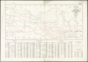
Map of the province of Manitoba, shewing the surveys effected in 1871
31.
Map showing branches of chartered banks in Manitoba, Saskatchewan and Alberta
32.
Map showing elevators in Manitoba, Saskatchewan and Alberta
33.
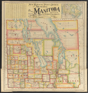
New railway, post office and municipal map of Manitoba : compiled from the latest government surveys and other official sources
34.
15 lots of 440a each in Great Lot no. 4 of Macomb purchase : 6600 acres within 2 miles of the St. Lawrence Turnpike & 1/2 mile...
35.
The above is a connection of the three surveys which I have been able to make on Peters Creek, of yours to gether with John...
36.
An accurate map of Canada, with the adjacent countries; exhibiting the late seat of war between the English & French in those...
37.
An accurate map of New York in North America from a late survey
38.
An accurate map of the British empire in Nth. America as settled by the preliminaries in 1762
39.
An accurate map of the island of St. Christophers, from an actual survey; shewing the parishes, churches; and rivers; also the...
40.
An accurate map of the West Indies : exhibiting not only all the islands possess'd by the English, French, Spaniards & Dutch...
‹ Prev
Next ›
1
2
3
4
5
6
…
46
47