Toggle navigation
LMEC Home
Exhibitions
Georeferencing
Tools for Teachers
Collections
My Favorites
Sign Up / Log In
Search
Search the map portal
Map Collection
Map Collection
Map Sets
Search
Search
Search for
Search In
All Fields
Creator
Title
Subject
Place
Search All Digital Collections
Advanced Search
938 Results
My Search
Start Over
More Like
commonwealth-oai:k356f1598
Remove constraint More Like: commonwealth-oai:k356f1598
Filter your Search
Place
North and Central America
912
United States
626
Canada
231
New York
193
Quebec
113
Pennsylvania
60
New Jersey
54
Nova Scotia
48
more
Place
»
Topic
United States--History--Revolution, 1775-1783--Maps
305
United States--History--French and Indian War, 1754-1763--Maps
149
Saint Lawrence River--Maps
43
Newport (R.I.)--Maps
27
New York (State)--Maps
25
Hudson River (N.Y. and N.J.)--Maps
21
Québec (Québec)--Maps
21
Louisbourg (N.S.)--Maps
20
more
Topic
»
Date
Date range begin
–
Date range end
Current results range from
1700
to
1921
View distribution
Creator
Rocque, Mary Ann
29
Bellin, Jacques Nicolas, 1703-1772
25
Holland, Samuel, 1728-1801
25
Jefferys, Thomas, -1771
25
Montrésor, John, 1736-1799
25
Clinton, Henry, Sir, 1738?-1795
19
Robert Sayer and John Bennett (Firm)
15
Hills, John, active 1777-1819
13
more
Creator
»
Format
Maps/Atlases
922
Drawings/Illustrations
11
Documents
5
Prints
1
Georeferenced
No
938
Collection
American Revolutionary War-Era Maps
916
William L. Clements Library Collection
909
Norman B. Leventhal Map & Education Center Collection
22
Library and Archives Canada Collection
4
MacLean Collection Map Library
3
Available to use
No known restrictions
22
Search Constraints
Sort by relevance
relevance
title
date (asc)
date (desc)
Number of results to display per page
20 per page
10
per page
20
per page
50
per page
100
per page
View results as:
grid view
map view
Search Results
201.
Fort Harmar at the Ohio and Muskingum Rivers, ca. 1786
202.
Fort Independence to Slaughter's Landing
203.
Fort Lafayette and Verplank Point
204.
Fort Lee
205.
Fort Pitt
206.
Fort William Henry
207.
Forts of the Highlands, ca. 1777
208.
Four wood lots in no 3
209.
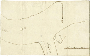
Fragment of map showing two small fortifications
210.
French draught of Lake Champlain & Lake George with remarks of an English prisoner who return'd from Quebec to Fort Edward by...
211.
From Fishkill Creek to the Croton River
212.
From Freehold toward Trenton
213.
A front view of Fort George Majabigwaduce June 1780
214.
Gabarus Bay
215.
Gardiners Bay
216.
Gaspee Bay
217.
A general map of North America drawn from the best surveys 1795
218.
A general map of the middle British colonies, in America; viz Virginia, Maryland, Delaware, Pensilvania, New-Jersey, New-York,...
219.
A general map of the southern British colonies in America comprehending North and South Carolina, Georgia, East and West...
220.
A general plan of the harbours of Port Royal and Kingston Jamaica with the channels leading thereto, and the kays and shoals...
‹ Prev
Next ›
1
2
…
7
8
9
10
11
12
13
14
15
…
46
47