Toggle navigation
LMEC Home
Exhibitions
Georeferencing
Tools for Teachers
Collections
My Favorites
Sign Up / Log In
Search
Search the map portal
Map Collection
Map Collection
Map Sets
Search
Search
Search for
Search In
All Fields
Creator
Title
Subject
Place
Search All Digital Collections
Advanced Search
942 Results
My Search
Start Over
More Like
commonwealth-oai:df660720p
Remove constraint More Like: commonwealth-oai:df660720p
Filter your Search
Place
North and Central America
916
United States
654
Canada
205
New York
199
Quebec
111
Pennsylvania
91
New Jersey
62
Nova Scotia
48
more
Place
»
Topic
United States--History--Revolution, 1775-1783--Maps
305
United States--History--French and Indian War, 1754-1763--Maps
149
Pennsylvania--Maps
50
Saint Lawrence River--Maps
43
New York (State)--Maps
32
Newport (R.I.)--Maps
27
New Jersey--Maps
22
Hudson River (N.Y. and N.J.)--Maps
21
more
Topic
»
Date
Date range begin
–
Date range end
Current results range from
1700
to
1921
View distribution
Creator
Rocque, Mary Ann
29
Bellin, Jacques Nicolas, 1703-1772
25
Holland, Samuel, 1728-1801
25
Montrésor, John, 1736-1799
25
Jefferys, Thomas, -1771
24
Clinton, Henry, Sir, 1738?-1795
19
Robert Sayer and John Bennett (Firm)
15
Hills, John, active 1777-1819
13
more
Creator
»
Format
Maps/Atlases
926
Drawings/Illustrations
11
Documents
5
Manuscripts
1
Prints
1
Georeferenced
Yes
7
No
935
Collection
American Revolutionary War-Era Maps
917
William L. Clements Library Collection
909
Norman B. Leventhal Map & Education Center Collection
27
Maps from AAS
4
Boston Athenaeum, Cartographic Collection
1
MacLean Collection Map Library
1
Urban Maps
1
Available to use
No known restrictions
27
Search Constraints
Sort by relevance
relevance
title
date (asc)
date (desc)
Number of results to display per page
20 per page
10
per page
20
per page
50
per page
100
per page
View results as:
grid view
map view
Search Results
41.
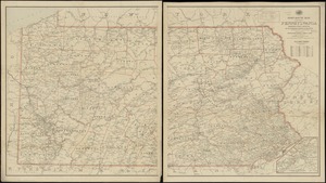
Pennsylvania
42.
Post route map of the state of Pennsylvania showing post offices and the intermediate distances on mail routes in operation on...
43.
Post route map of the state of Pennsylvania showing post offices with the intermediate distances on mail routes in operation on...
44.
Post route map of the states of Pennsylvania, New Jersey, Delaware, and Maryland and of the District of Columbia with adjacent...
45.
Rail road map of Pennsylvania
46.
Rail road map of Pennsylvania
47.
Sketch showing a feasible canal route, Allegheny River to Lake Erie.
48.
The state of Pennsylvania : reduced with permission from Reading Howells map
49.
A survey of the empire group : with a complete distance table, a compendious index of cities and post offices, with populations...
50.
A survey of the empire group : with a complete distance table, a compendious index of cities and post offices, with populations...
51.
The tourist's pocket map of Pennsylvania : exhibiting its internal improvements, roads, distances, &c
52.
15 lots of 440a each in Great Lot no. 4 of Macomb purchase : 6600 acres within 2 miles of the St. Lawrence Turnpike & 1/2 mile...
53.
The above is a connection of the three surveys which I have been able to make on Peters Creek, of yours to gether with John...
54.
An accurate map of Canada, with the adjacent countries; exhibiting the late seat of war between the English & French in those...
55.
An accurate map of New York in North America from a late survey
56.
An accurate map of the British empire in Nth. America as settled by the preliminaries in 1762
57.
An accurate map of the island of St. Christophers, from an actual survey; shewing the parishes, churches; and rivers; also the...
58.
An accurate map of the West Indies : exhibiting not only all the islands possess'd by the English, French, Spaniards & Dutch...
59.
An accurate map of the West Indies, containing the Bahama & Caribbe islands the Great & Little Antilles; with the Leward and...
60.
Action between Genl. St Clairs army & that of the American Indians Novr. 4th 1791 : collected from his public letter
‹ Prev
Next ›
1
2
3
4
5
6
7
…
47
48