Sketch showing a feasible canal route, Allegheny River to Lake Erie.
Item Information
- Title:
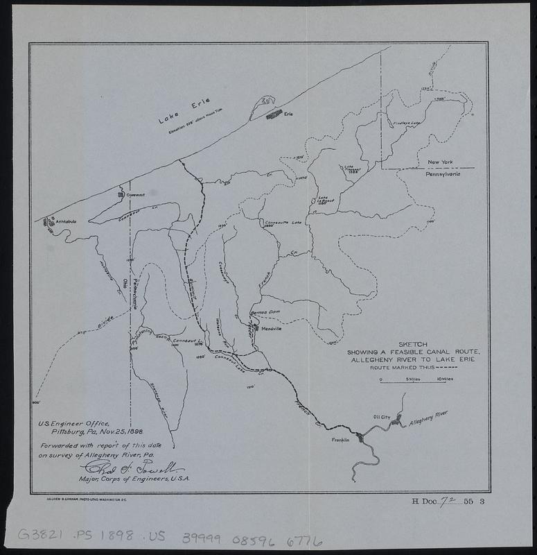
- Sketch showing a feasible canal route, Allegheny River to Lake Erie.
- Cartographer:
- United States. Army. Corps of Engineers
- Date:
-
[1899]
- Format:
-
Maps/Atlases
- Location:
-
Boston Public Library
Norman B. Leventhal Map & Education Center - Collection (local):
-
Norman B. Leventhal Map & Education Center Collection
- Subjects:
-
Pennsylvania--Maps
Canals--Pennsylvania--Maps
- Places:
-
Pennsylvania
- Extent:
- 1 map ; 19 x 20 cm
- Terms of Use:
-
No known copyright restrictions.
No known restrictions on use.
- Publisher:
-
[Washington] :
[Government Printing Office]
- Scale:
-
Scale approximately 1:590,000
- Language:
-
English
- Notes:
-
"U.S. Engineer Office, Pittsburg, Pa. Nov. 25, 1898. Forwarded with report of this date on survey of Allegheny River, Pa. Chas. F. Powell, major, Corps of Engineers, U.S.A."
In lower right: H Doc 72 55 3.
From Congressional serial set, 55th Congress, 3d session, House reports (Washington : Government Printing Office, 1899).
- Notes (date):
-
This date is inferred.
- Identifier:
-
06_01_018367
- Call #:
-
G3821.P5 1898 .U5
- Barcode:
-
39999085966776