Toggle navigation
LMEC Home
Exhibitions
Georeferencing
Tools for Teachers
Collections
My Favorites
Sign Up / Log In
Search
Search the map portal
Map Collection
Map Collection
Map Sets
Search
Search
Search for
Search In
All Fields
Creator
Title
Subject
Place
Search All Digital Collections
Advanced Search
964 Results
My Search
Start Over
More Like
commonwealth-oai:2n49z233t
Remove constraint More Like: commonwealth-oai:2n49z233t
Filter your Search
Place
North and Central America
938
United States
663
Canada
215
New York
193
Quebec
116
Maine
65
Pennsylvania
60
New Jersey
54
more
Place
»
Topic
United States--History--Revolution, 1775-1783--Maps
305
United States--History--French and Indian War, 1754-1763--Maps
149
Maine--Maps
53
Saint Lawrence River--Maps
44
Newport (R.I.)--Maps
27
New York (State)--Maps
25
Hudson River (N.Y. and N.J.)--Maps
21
Québec (Québec)--Maps
21
more
Topic
»
Date
Date range begin
–
Date range end
Current results range from
1700
to
1983
View distribution
Creator
Rocque, Mary Ann
29
Holland, Samuel, 1728-1801
26
Montrésor, John, 1736-1799
26
Bellin, Jacques Nicolas, 1703-1772
24
Jefferys, Thomas, -1771
24
Clinton, Henry, Sir, 1738?-1795
19
Robert Sayer and John Bennett (Firm)
15
Hills, John, active 1777-1819
13
more
Creator
»
Format
Maps/Atlases
948
Drawings/Illustrations
11
Documents
5
Manuscripts
3
Objects/Artifacts
1
Prints
1
Georeferenced
Yes
3
No
961
Collection
American Revolutionary War-Era Maps
923
William L. Clements Library Collection
909
Norman B. Leventhal Map & Education Center Collection
39
Boston and New England Maps
31
American Antiquarian Society Collection
8
Library and Archives Canada Collection
4
Applied Geographics, Inc. Records
3
MacLean Collection Map Library
2
more
Collection
»
Available to use
No known restrictions
39
Creative Commons license
1
Search Constraints
Sort by relevance
relevance
title
date (asc)
date (desc)
Number of results to display per page
20 per page
10
per page
20
per page
50
per page
100
per page
View results as:
grid view
map view
Search Results
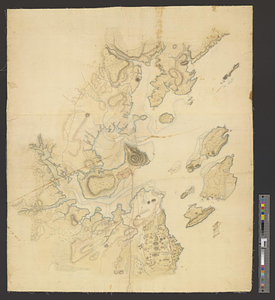
221.
Falmouth, Maine
222.
Flatbush
223.
La Floride divisée en Floride et Caroline
224.
Flynt Jenkins sold to Taylor Foster &c plans 1778
225.
Fort Bedford
226.
Fort Edward to Ticonderoga
227.
Fort Germain and neighboring posts
228.
Fort Halifax and the Kennebec River : Québec July 25th, 1761
229.
Fort Harmar at the Ohio and Muskingum Rivers, ca. 1786
230.
Fort Independence to Slaughter's Landing
231.
Fort Lafayette and Verplank Point
232.
Fort Lee
233.
Fort Pitt
234.
Fort William Henry
235.
Forts of the Highlands, ca. 1777
236.
Four wood lots in no 3
237.
Fragment of map showing two small fortifications
238.
From Fishkill Creek to the Croton River
239.
From Freehold toward Trenton
240.
A front view of Fort George Majabigwaduce June 1780
‹ Prev
Next ›
1
2
…
8
9
10
11
12
13
14
15
16
…
48
49