Toggle navigation
LMEC Home
Exhibitions
Georeferencing
Tools for Teachers
Collections
My Favorites
Sign Up / Log In
Search
Search the map portal
Map Collection
Map Collection
Map Sets
Search
Search
Search for
Search In
All Fields
Creator
Title
Subject
Place
Search All Digital Collections
Advanced Search
1007 Results
My Search
Start Over
More Like
commonwealth-oai:2b88vb28r
Remove constraint More Like: commonwealth-oai:2b88vb28r
Filter your Search
Place
North and Central America
977
United States
709
Canada
209
New York
200
Quebec
112
Pennsylvania
90
Virginia
73
New Jersey
62
more
Place
»
Topic
United States--History--Revolution, 1775-1783--Maps
306
United States--History--French and Indian War, 1754-1763--Maps
162
Pennsylvania--Maps
50
Virginia--Maps
47
Saint Lawrence River--Maps
43
Maryland--Maps
37
New York (State)--Maps
33
Newport (R.I.)--Maps
27
more
Topic
»
Date
Date range begin
–
Date range end
Current results range from
1700
to
1931
View distribution
Creator
Rocque, Mary Ann
29
Jefferys, Thomas, -1771
27
Bellin, Jacques Nicolas, 1703-1772
26
Holland, Samuel, 1728-1801
25
Montrésor, John, 1736-1799
25
Clinton, Henry, Sir, 1738?-1795
19
Robert Sayer and John Bennett (Firm)
15
Hills, John, active 1777-1819
13
more
Creator
»
Format
Maps/Atlases
991
Drawings/Illustrations
11
Documents
5
Manuscripts
1
Prints
1
Georeferenced
Yes
28
No
979
Collection
American Revolutionary War-Era Maps
939
William L. Clements Library Collection
909
Norman B. Leventhal Map & Education Center Collection
76
American Antiquarian Society Collection
14
Richard H. Brown Revolutionary War Map Collection at Mount Vernon
4
MacLean Collection Map Library
3
Urban Maps
2
New-York Historical Society Collection
1
Available to use
No known restrictions
77
Creative Commons license
4
Search Constraints
Sort by relevance
relevance
title
date (asc)
date (desc)
Number of results to display per page
20 per page
10
per page
20
per page
50
per page
100
per page
View results as:
grid view
map view
Search Results
121.
Parish of St. Michelle. Parish of St. John Baptist. Parish of St. Vertier
122.
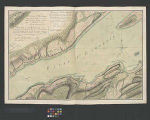
Parish of St. Nicholas. The Parish of St. Augustin
123.
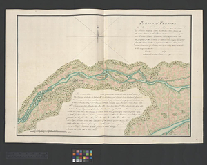
Parish of Terbone
124.
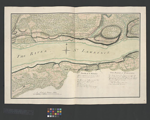
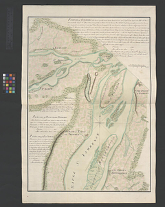
Parish of the Ecureuils. Parish of Point aux Trembles. Parish of St. Antoine. Parish of St. Croix
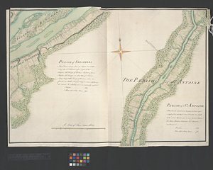
125.
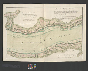
Parish of Varrenes. Parish of Pointe aux Trembles. Parish of La Chenais
126.
Parish of Vercheres. Parish of St. Antoine
127.
Part of the Richelieu River showing Fort de St. Ieant
128.
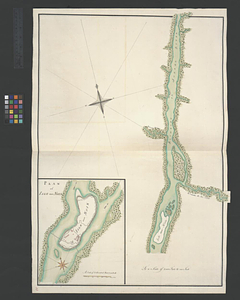
Part of the Richelieu River showing Isle aux Noix
129.
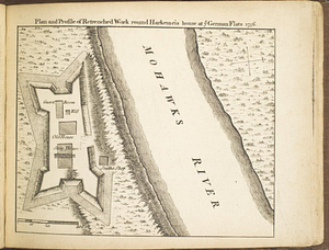
Plan and profile of retrenched work round Harkemeis house at ye German Flats 1756
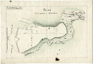
130.
Plan de la pointe à Rochefort
131.
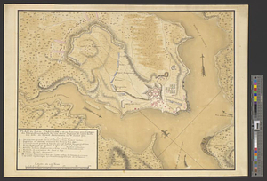
Plan du fort de Carillon et de ses environs avec l'attaque des retranchments faite par une armee Angloise de 25000 homes aux...
132.
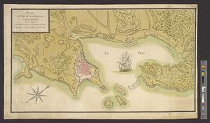
Plan du port et de la ville de Louisbourg en l'Isle Royale et des attaques faites par les Anglois pandent le siege depuis le 8...
133.
Plan du port et de la ville de Louisbourg en l'Isle Royale, et des Attaques faites par les Anglois pendant le Siége depuis le 8...
134.
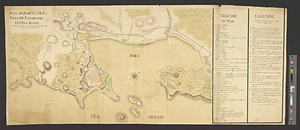
Plan of Fort [Brewerton] at the west end of Onnide Lake
135.
Plan of Fort Edward situated lat. 43 lon. 72 30'
136.
Plan of Fort Frederick at Albany
137.
A plan of Fort Frederick, situated at the entrance of St. John's River : lat 47 long. 66 30'
138.
Plan of Fort Frontenac
139.
Plan of Fort le Quesne, built by the French at the fort of the Ohio and monongahela in 1754
140.
A plan of Fort Ligonier done by Theodosius McDonald for George Morton : February 8th annoque domini 1760
‹ Prev
Next ›
1
2
3
4
5
6
7
8
9
10
11
…
50
51

![Plan of Fort [Brewerton] at the west end of Onnide Lake](https://bpldcassets.blob.core.windows.net/derivatives/metadata/commonwealth-oai:639615613/image_thumbnail_300.jpg)


