Toggle navigation
LMEC Home
Exhibitions
Georeferencing
Tools for Teachers
Collections
My Favorites
Sign Up / Log In
Search
Search the map portal
Map Collection
Map Collection
Map Sets
Search
Search
Search for
Search In
All Fields
Creator
Title
Subject
Place
Search All Digital Collections
Advanced Search
8707 Results
My Search
Start Over
More Like
commonwealth:zg64xs56c
Remove constraint More Like: commonwealth:zg64xs56c
Filter your Search
Place
North and Central America
5,930
United States
4,845
Massachusetts
2,078
Europe
1,396
Suffolk (county)
1,045
Boston
1,018
Canada
451
Asia
439
more
Place
»
Topic
Boston (Mass.)--Maps
586
United States--Maps
282
Real property--Massachusetts--Boston--Maps
175
Massachusetts--Maps
162
Landowners--Massachusetts--Boston--Maps
133
North America--Maps--Early works to 1800
105
New England--Maps
102
Europe--Maps
79
more
Topic
»
Date
Date range begin
–
Date range end
Current results range from
1482
to
2023
View distribution
Creator
United States. Hydrographic Office
594
O.H. Bailey & Co
148
Des Barres, Joseph F. W. (Joseph Frederick Wallet), 1722-1824
123
United States. Post Office Dept
120
Ptolemy, 2nd cent
100
Walling, Henry Francis, 1825-1888
94
Geological Survey (U.S.)
86
Jefferys, Thomas, -1771
86
more
Creator
»
Format
Maps/Atlases
8,647
Manuscripts
215
Prints
56
Books
36
Objects/Artifacts
10
Drawings/Illustrations
8
Posters
5
Georeferenced
Yes
869
No
7,838
Collection
Norman B. Leventhal Map & Education Center Collection
8,693
Boston and New England Maps
2,232
Urban Maps
2,023
Maritime Charts and Atlases
1,083
American Revolutionary War-Era Maps
628
Boston Redevelopment Authority Collection
87
William L. Clements Library Collection
6
MacLean Collection Map Library
3
more
Collection
»
Available to use
No known restrictions
8,552
Creative Commons license
48
Search Constraints
Sort by relevance
relevance
title
date (asc)
date (desc)
Number of results to display per page
20 per page
10
per page
20
per page
50
per page
100
per page
View results as:
grid view
map view
Search Results
21.
A two-way street between the Americas
22.
Carta del Mar Pacifico del nord che comprendela costa nord est d'Asia e la costa-nord ouest d'America riconosciute nel 1778 e79...
23.
A chart shewing the tract of Capt. Cook's last voyage, 1799
24.
Amerique Septentrionale
25.
Carte nouvelle des posséssions angloises en Amérique dressée pour l'intelligence de la guerre présente et divisée suivant les...
26.
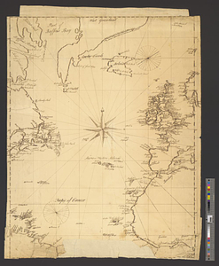
A chart of the gulf stream
27.
[Chart of the Gulf Stream]
28.
Map of the powers at war with Great Britain, 1783
29.
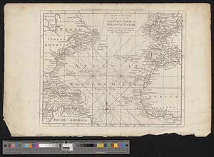
A new & accurate chart of the western or Atlantic Ocean : drawn from the most approved modern map &c.
30.
A new and accurate map of the English empire in North America : representing their rightful claim as confirm'd by charters, and...
31.
A new and accurate map of the English empire in North America : representing their rightful claim as confirm'd by charters, and...
32.
North Atlantic Ocean, ca. 1785
33.
Triangles on Mercator projection between St. Augustine and Cape Breton and St. Augustine and Cape Ortegal
34.
Americae siue noui orbis, noua descriptio
35.
L'Amerique divisée en tous ses pays et etats
36.
The 100th anniversary map of Abraham Lincoln's visit to Massachusetts, September 11-23, 1848
37.
1630 shoreline
38.
1879. Progress map of the U.S. Geographical Surveys west of the 100th Meridian : prepared under the direction of 1st Lieut....
39.
1903 Map of Salem and surrounding places
40.
19th annual convention of the National Association of Real Estate Boards : at Tulsa, June 7 to June 11 in 1926
‹ Prev
Next ›
1
2
3
4
5
6
…
435
436


![[Chart of the Gulf Stream]](https://bpldcassets.blob.core.windows.net/derivatives/images/commonwealth:z603vr47j/image_thumbnail_300.jpg)