Toggle navigation
LMEC Home
Exhibitions
Georeferencing
Tools for Teachers
Collections
My Favorites
Sign Up / Log In
Search
Search the map portal
Map Collection
Map Collection
Map Sets
Search
Search
Search for
Search In
All Fields
Creator
Title
Subject
Place
Search All Digital Collections
Advanced Search
8743 Results
My Search
Start Over
More Like
commonwealth:zc77wd39k
Remove constraint More Like: commonwealth:zc77wd39k
Filter your Search
Place
North and Central America
5,971
United States
4,891
Massachusetts
2,079
Europe
1,396
Suffolk (county)
1,046
Boston
1,019
Canada
463
Asia
438
more
Place
»
Topic
Boston (Mass.)--Maps
586
United States--Maps
330
Real property--Massachusetts--Boston--Maps
175
Massachusetts--Maps
162
Landowners--Massachusetts--Boston--Maps
133
North America--Maps--Early works to 1800
103
New England--Maps
102
Europe--Maps
79
more
Topic
»
Date
Date range begin
–
Date range end
Current results range from
1482
to
2023
View distribution
Creator
United States. Hydrographic Office
595
O.H. Bailey & Co
148
Des Barres, Joseph F. W. (Joseph Frederick Wallet), 1722-1824
123
United States. Post Office Dept
120
Ptolemy, 2nd cent
100
Walling, Henry Francis, 1825-1888
94
Geological Survey (U.S.)
87
Jefferys, Thomas, -1771
85
more
Creator
»
Format
Maps/Atlases
8,683
Manuscripts
215
Prints
56
Books
36
Objects/Artifacts
10
Drawings/Illustrations
8
Posters
5
Georeferenced
Yes
871
No
7,872
Collection
Norman B. Leventhal Map & Education Center Collection
8,700
Boston and New England Maps
2,233
Urban Maps
2,023
Maritime Charts and Atlases
1,083
American Revolutionary War-Era Maps
657
Boston Redevelopment Authority Collection
87
Maps from AAS
20
William L. Clements Library Collection
13
more
Collection
»
Available to use
No known restrictions
8,556
Creative Commons license
50
Search Constraints
Sort by relevance
relevance
title
date (asc)
date (desc)
Number of results to display per page
20 per page
10
per page
20
per page
50
per page
100
per page
View results as:
grid view
map view
Search Results
4821.
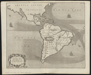
Mappa æstivarum insularum alias Bermudas dictarum, ad ostia Mexicani æstuary iacentium in latitudine graduum 32 minutorum 25 ab...
4822.
Mappa fluxus et refluxus rationes in isthmo Americano, in Freto Magellanico, cæterisque Americæ litoribus exhibens
4823.
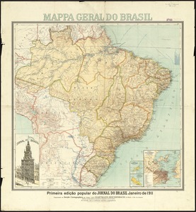
Mappa geral do Brasil
4824.
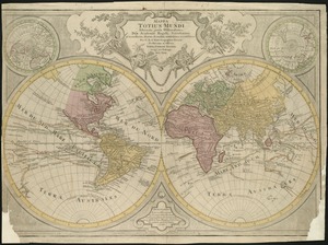
Mappa totius mundi : adornata juxta observationes dnn. academiae regalis scientiarum et nonnullorum aliorum secundum...
4825.
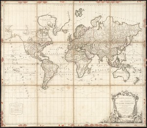
Mappe Monde ou carte générale du globe terrestre dessinée suivant les regles de la projection des cartes réduites
4826.
Mappe-monde
4827.
Mappemonde ou Description du globe terrestre
4828.
Mappemonde projetée sur l'horizon d'Angers
4829.
Mappmonde ou description generale du globe terrestre
4830.
Maps from General plan for Boston : preliminary report, December, 1950
4831.
Maps illustrating cruises of John Paul Jones in British waters : [Great Britain and Ireland]
4832.
Map[s] illustrating the military operations of the Atlanta campaign ... 1864
4833.
Maps of Dorchester and Quincy
4834.
Maps of Europe
4835.
Maps of Providence, R.I., 1650, 1765, 1770
4836.
Maps of the Far East, illustrating Russo-Japanese War
4837.
Maps of the vicinities of thirty-two of the principal cities and towns in the Union
4838.
Maps showing the Toledo, Delphos & Burlington Railroad and its connections
4839.
Maps with a moral
4840.
Mar del nort
‹ Prev
Next ›
1
2
…
238
239
240
241
242
243
244
245
246
…
437
438


![Map[s] illustrating the military operations of the Atlanta campaign ... 1864](https://bpldcassets.blob.core.windows.net/derivatives/images/commonwealth:3f463432v/image_thumbnail_300.jpg)