Toggle navigation
LMEC Home
Exhibitions
Georeferencing
Tools for Teachers
Collections
My Favorites
Sign Up / Log In
Search
Search the map portal
Map Collection
Map Collection
Map Sets
Search
Search
Search for
Search In
All Fields
Creator
Title
Subject
Place
Search All Digital Collections
Advanced Search
441 Results
My Search
Start Over
More Like
commonwealth:z603vv806
Remove constraint More Like: commonwealth:z603vv806
Filter your Search
Place
North and Central America
367
United States
300
New England
97
Canada
48
New York
44
Middle Atlantic
40
North America
39
Suffolk (county)
38
more
Place
»
Topic
New England--Maps--Early works to 1800
97
Middle Atlantic States--Maps--Early works to 1800
38
United States--History--Revolution, 1775-1783--Maps--Early works to 1800
38
North America--Maps--Early works to 1800
27
Northeastern States--Maps--Early works to 1800
19
Boston (Mass.)--History--Revolution, 1775-1783--Maps--Early works to 1800
18
United States--Maps--Early works to 1800
15
Indians of North America--Maps--Early works to 1800
14
more
Topic
»
Date
Date range begin
–
Date range end
Current results range from
1617
to
1999
View distribution
Creator
Jefferys, Thomas, -1771
38
Faden, William, 1749-1836
36
Le Rouge, Georges-Louis
24
Sayer, Robert, 1725-1794
24
Des Barres, Joseph F. W. (Joseph Frederick Wallet), 1722-1824
22
Jefferys, Thomas, d. 1771
14
Robert Sayer and John Bennett (Firm)
12
Korn, Christoph Heinrich, 1726-1783
10
more
Creator
»
Format
Maps/Atlases
398
Prints
32
Manuscripts
27
Drawings/Illustrations
9
Books
2
Georeferenced
Yes
21
No
420
Collection
American Revolutionary War-Era Maps
386
Richard H. Brown Revolutionary War Map Collection at Mount Vernon
293
Norman B. Leventhal Map & Education Center Collection
89
Boston and New England Maps
37
Mapping Boston Collection
24
MacLean Collection Map Library
15
Maritime Charts and Atlases
15
Sidney R. Knafel Map Collection at Phillips Academy
15
more
Collection
»
Available to use
Creative Commons license
337
No known restrictions
69
Search Constraints
Sort by relevance
relevance
title
date (asc)
date (desc)
Number of results to display per page
20 per page
10
per page
20
per page
50
per page
100
per page
View results as:
grid view
map view
Search Results
301.
Partie occidentale de la Virginie, Pensylvanie, Maryland, et Caroline septle. la Rivière d'Ohio, et toutes celles qui s'y...
302.
Partie septentrionale des possessions angloise en Amérique : pour servire d'intelligence à la guerre présente entre les...
303.
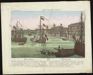
Philadelphia = : Philadelphie
304.
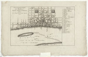
Philadelphie, par Easburn, arpenteur general de Pensilvanie
305.
The Phoenix and the Rose engaged by the enemy's fire ships and galleys on the 16 Augst. 1776
306.
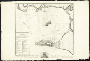
Plan de Boston
307.
Plan de Boston
308.
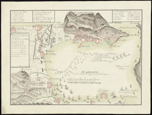
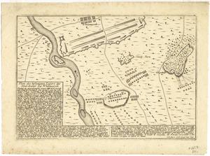
[Plan de Gibraltar]
309.
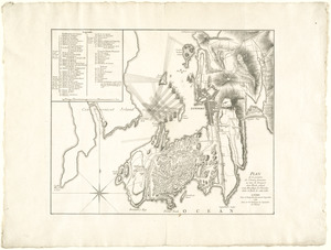
Plan de Gibraltar
310.
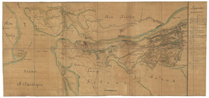
Plan de la position de l'armée française au tour de Newport dans Rhode Island et du mouillage de l'escadre dans la rade de...
311.
Plan de la ville de Louisbourg avec les ouvrages d'attaque des Anglais pour sa reddition, ainsi que ceux des assiegés pr. la...
312.
Plan de la ville du Cap Francois et de ses environs dans l'Isle St. Domingue
313.
Plan de la ville et des forts de Gibraltar, avec la Baye d'Algesiras
314.
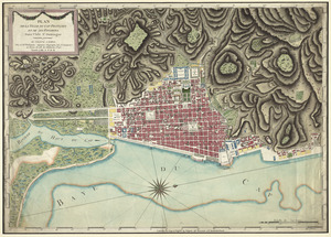
Plan de la ville et du port de Boston : capitale de la Nouvelle Angleterre
315.
Plan de l'armée de Cornwallis attaquée et faitte prisoniere dans York Town : le 19 8bre par l'armée combinée Francaise et...
316.
Plan der belagerung der stadt Gibraltar im jahr 1779, 1780, 1781
317.
Plan der gegend des Ohio Flusses, wo ohnweit da von am 9 July 1755, zwischen denen Franzofichen u. Engl trouppen ein hiziges...
318.
Plan der gegend und stadt von Philadelphia
319.
Plan des befestigten lagers der Amerikaner bey Whitemarsh
320.
Plan des environs de New York (manuscrit) - Position du camp de l'armée combinée à Philippsburg du 6 juillet au 19 août -...
‹ Prev
Next ›
1
2
…
12
13
14
15
16
17
18
19
20
…
22
23


![[Plan de Gibraltar]](https://bpldcassets.blob.core.windows.net/derivatives/images/commonwealth:z603vt83t/image_thumbnail_300.jpg)