Toggle navigation
LMEC Home
Exhibitions
Georeferencing
Tools for Teachers
Collections
My Favorites
Sign Up / Log In
Search
Search the map portal
Map Collection
Map Collection
Map Sets
Search
Search
Search for
Search In
All Fields
Creator
Title
Subject
Place
Search All Digital Collections
Advanced Search
555 Results
My Search
Start Over
More Like
commonwealth:z603vt92s
Remove constraint More Like: commonwealth:z603vt92s
Filter your Search
Place
North and Central America
414
North America
236
United States
193
South America
50
Canada
43
New York
34
Suffolk (county)
31
Boston
29
more
Place
»
Topic
North America--Maps--Early works to 1800
240
South America--Maps--Early works to 1800
47
United States--Maps--Early works to 1800
20
Great Britain--Colonies--America--Maps--Early works to 1800
18
Boston (Mass.)--History--Revolution, 1775-1783--Maps--Early works to 1800
16
Canada--Maps--Early works to 1800
14
United States--History--French and Indian War, 1754-1763--Maps--Early works to 1800
12
West Indies--Maps--Early works to 1800
12
more
Topic
»
Date
Date range begin
–
Date range end
Current results range from
1528
to
1850
View distribution
Creator
Jefferys, Thomas, -1771
42
Faden, William, 1749-1836
35
Sayer, Robert, 1725-1794
33
Le Rouge, Georges-Louis
28
Des Barres, Joseph F. W. (Joseph Frederick Wallet), 1722-1824
21
Mitchell, John, 1711-1768
19
Moll, Herman, d. 1732
18
Gibson, J. (John), active 1750-1792
14
more
Creator
»
Format
Maps/Atlases
512
Prints
32
Manuscripts
25
Drawings/Illustrations
9
Books
2
Georeferenced
Yes
17
No
538
Collection
American Revolutionary War-Era Maps
453
Richard H. Brown Revolutionary War Map Collection at Mount Vernon
293
Norman B. Leventhal Map & Education Center Collection
151
MacLean Collection Map Library
60
New York Public Library Collection
32
Mapping Boston Collection
10
Sidney R. Knafel Map Collection at Phillips Academy
8
Boston and New England Maps
6
more
Collection
»
Available to use
Creative Commons license
339
No known restrictions
145
Search Constraints
Sort by relevance
relevance
title
date (asc)
date (desc)
Number of results to display per page
20 per page
10
per page
20
per page
50
per page
100
per page
View results as:
grid view
map view
Search Results
361.
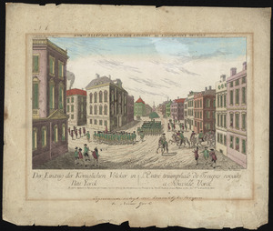
Der einzug der königlichen völcker in Neu Yorck = : L'entré triumphale de troupes royales á Nouvelle Yorck
362.
Exact plan of General Gage's lines on Boston Neck in America
363.
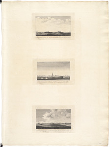
A front view of the lines taken from the advanced post near Browns house : A view of the harbour of Boston taken from Fort Hill...
364.
A general map of the middle British colonies, in America : viz Virginia, Màriland, Dèlaware, Pensilvania, New-Jersey,...
365.
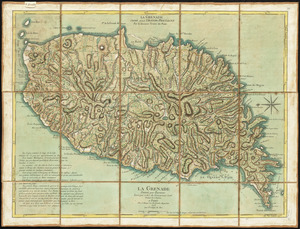
La Grenade : divisée par paroisses
366.
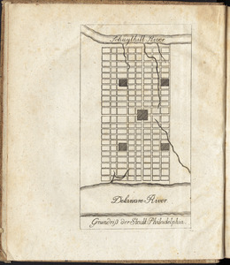
Grundriss der stadt Philadelphia
367.
Grundriss des nördlichen theils der Neujorks Insel : nebst den am 16. Novbr. 1776. eroberten Fort Washington nun das Fort...
368.
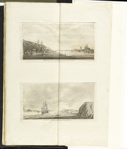
The harbour and part of the town of Havannah : The entrance of Havannah, from within the harbour
369.
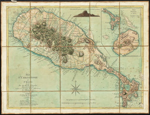
Isle St. Christophe ou St. Kitts
370.
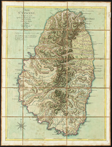
Isle St. Vincent
371.
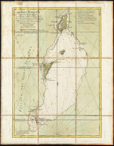
Les Isles Turques d'après les levées de 1753 par le sloop l'Aigle et l'Emeraude par ordre du Gouverneur de St. Domingue...
372.
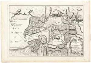
L'isthme de l'Acadie, Baye du Beaubassin, en Anglois Shegnekto, environs du Fort Beausejour
373.
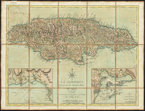
La Jamaique
374.
Karte von dem Ostlichen-Stucke von Neu Franckreich oder Canada in America : besonders aber Acadia und Neu Schottland
375.
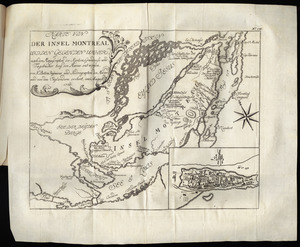
Karte von der Insel Montreal und den gegenden umher, nach den manuscripten der karten, grundrisse und tagebücher beÿ der...
376.
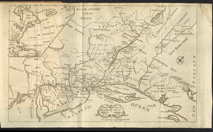
Karte von Neu England, Neu Yorck und Pensilvanien
377.
Krigs theatreni i America, 1777 = : seat of war in America, 1777
378.
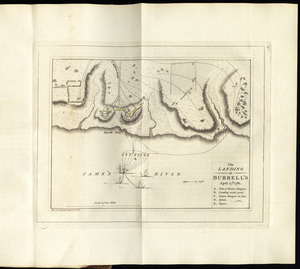
The landing at Burrell's, April 17th. 1781
379.
A large and particular plan of Shegnekto Bay, and the circumjacent country, with the forts and settlements of the French 'till...
380.
Lauff des flusses St. Laurentzi von Quebec bis an den See Ontario : 2. bladt
‹ Prev
Next ›
1
2
…
15
16
17
18
19
20
21
22
23
…
27
28