Toggle navigation
LMEC Home
Exhibitions
Georeferencing
Tools for Teachers
Collections
My Favorites
Sign Up / Log In
Search
Search the map portal
Map Collection
Map Collection
Map Sets
Search
Search
Search for
Search In
All Fields
Creator
Title
Subject
Place
Search All Digital Collections
Advanced Search
331 Results
My Search
Start Over
More Like
commonwealth:z603vt60h
Remove constraint More Like: commonwealth:z603vt60h
Filter your Search
Place
North and Central America
264
United States
202
Suffolk (county)
64
Boston
62
New York
32
Massachusetts
31
Canada
27
North America
27
more
Place
»
Topic
Boston (Mass.)--History--Revolution, 1775-1783--Maps--Early works to 1800
45
Fortification--Massachusetts--Boston--Maps--Early works to 1800
21
Bunker Hill, Battle of, Boston, Mass., 1775--Maps--Early works to 1800
20
North America--Maps--Early works to 1800
18
Boston Harbor (Mass.)--Maps--Early works to 1800
12
Boston (Mass.)--Maps--Early works to 1800
11
United States--History--Revolution, 1775-1783--Maps--Early works to 1800
11
Vues d'optique
10
more
Topic
»
Date
Date range begin
–
Date range end
Current results range from
1740
to
1799
View distribution
Creator
Faden, William, 1749-1836
36
Jefferys, Thomas, -1771
29
Le Rouge, Georges-Louis
23
Des Barres, Joseph F. W. (Joseph Frederick Wallet), 1722-1824
21
Sayer, Robert, 1725-1794
19
Page, Thomas Hyde, Sir, 1746-1821
12
Korn, Christoph Heinrich, 1726-1783
11
Raspe, Gabriel Nicolaus, 1712-1785
11
more
Creator
»
Format
Maps/Atlases
288
Prints
32
Manuscripts
27
Drawings/Illustrations
9
Books
2
Georeferenced
Yes
15
No
316
Collection
American Revolutionary War-Era Maps
329
Richard H. Brown Revolutionary War Map Collection at Mount Vernon
293
Boston and New England Maps
31
Norman B. Leventhal Map & Education Center Collection
30
Mapping Boston Collection
16
Urban Maps
9
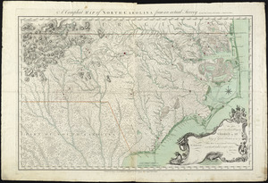
Library of Congress Collection
4
MacLean Collection Map Library
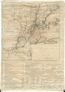
2
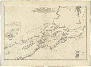
more
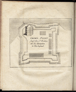
Collection
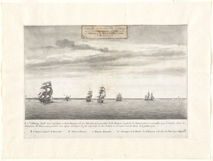
»
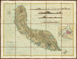
Available to use
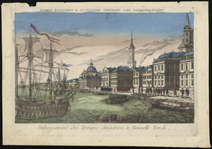
Creative Commons license
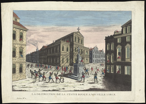
312
No known restrictions
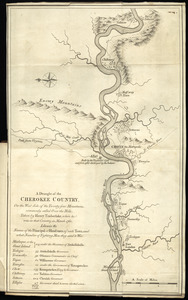
17
Search Constraints
Sort by relevance
relevance
title
date (asc)
date (desc)
Number of results to display per page
20 per page
10
per page
20
per page
50
per page
100
per page
View results as:
grid view
map view
Search Results
121.
A chart of the Harbour of Boston, with the soundings, sailing-marks, and other directions
122.
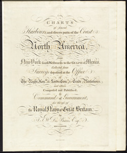
Charts of several harbours, and divers parts of the coast of North America, from New York south westwards to the Gulph of Mexico
123.
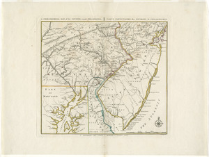
A chorographical map, of the country, round Philadelphia = : carte particuliere, des environs de Philadelphie
124.
A chorographical map of the northern department of North-America
125.
A chorographical map of the Province of New-York in North America, divided into counties, manors, patents and townships :...
126.
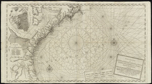
The coast of a part of New England, New York, New Jersey, Pensilvania, Maryland, Virginia, and part of North Carolina &c. with...
127.
The coast of a part of North Carolina, South Carolina, Georgia and part of East Florida, with the bays, soundings, banks, roks,...
128.
The coast of New Schotland, New England, the gulph and river of St. Laurence : the islands of New Foundland, Cape Breton, St....
129.
A compleat map of North-Carolina from an actual survey
130.
Connecticut and parts adjacent
131.
Connecticut and parts adjacent
132.
The country twenty five miles round New York
133.
The course of Delaware River from Philadelphia to Chester, exhibiting the several works erected by the rebels to defend its...
134.
Crown Point : sonst Fort St. Frederic, am See Champlain in Neu England
135.
Le Cte. d'Estaing laisse deux vaisseaux et trois frégates de son escadre à la poursuite de la frégate Anglaise la Mairmaide,...
136.
Curaçao : tiré des originaux Hollandois de Van Keulen ; dressé sur les dernieres observations
137.
Débarquement des troupes Angloises à Nouvelle Yorck
138.
La destruction de la statue royale a Nouvelle Yorck
139.
[Dorchester Neck]
140.
A draught of the Cherokee Country : on the west side of the Twenty Four Mountains, commonly called Over the Hills
‹ Prev
Next ›
1
2
3
4
5
6
7
8
9
10
11
…
16
17


![[Dorchester Neck]](https://bpldcassets.blob.core.windows.net/derivatives/images/commonwealth:dz010v59b/image_thumbnail_300.jpg)