Toggle navigation
LMEC Home
Exhibitions
Georeferencing
Tools for Teachers
Collections
My Favorites
Sign Up / Log In
Search
Search the map portal
Map Collection
Map Collection
Map Sets
Search
Search
Search for
Search In
All Fields
Creator
Title
Subject
Place
Search All Digital Collections
Advanced Search
380 Results
My Search
Start Over
More Like
commonwealth:z603vt21t
Remove constraint More Like: commonwealth:z603vt21t
Filter your Search
Place
North and Central America
286
United States
166
North America
88
South America
70
Mesoamerica
63
America
57
New York
31
Suffolk (county)
31
more
Place
»
Topic
America--Maps--Early works to 1800
78
Western Hemisphere--Maps--Early works to 1800
58
North America--Maps--Early works to 1800
23
Boston (Mass.)--History--Revolution, 1775-1783--Maps--Early works to 1800
16
Vues d'optique
10
Gibraltar--History--Siege, 1779-1783--Maps--Early works to 1800
9
New York (N.Y.)--Pictorial works--Early works to 1800
9
United States--History--French and Indian War, 1754-1763--Maps--Early works to 1800
9
more
Topic
»
Date
Date range begin
–
Date range end
Current results range from
1520
to
1802
View distribution
Creator
Faden, William, 1749-1836
33
Jefferys, Thomas, -1771
29
Le Rouge, Georges-Louis
24
Des Barres, Joseph F. W. (Joseph Frederick Wallet), 1722-1824
21
Sayer, Robert, 1725-1794
20
Korn, Christoph Heinrich, 1726-1783
11
Raspe, Gabriel Nicolaus, 1712-1785
11
Simcoe, John Graves, 1752-1806
10
more
Creator
»
Format
Maps/Atlases
337
Prints
32
Manuscripts
23
Drawings/Illustrations
9
Books
2
Georeferenced
Yes
14
No
366
Collection
American Revolutionary War-Era Maps
308
Richard H. Brown Revolutionary War Map Collection at Mount Vernon
293
Norman B. Leventhal Map & Education Center Collection
66
Sidney R. Knafel Map Collection at Phillips Academy
10
MacLean Collection Map Library
6
New York Public Library Collection
5
Boston and New England Maps
4
Mapping Boston Collection
3
more
Collection
»
Available to use
Creative Commons license
301
No known restrictions
63
Search Constraints
Sort by relevance
relevance
title
date (asc)
date (desc)
Number of results to display per page
20 per page
10
per page
20
per page
50
per page
100
per page
View results as:
grid view
map view
Search Results
341.
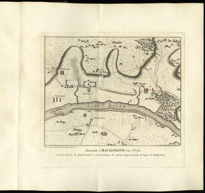
Skirmish at Richmond Jan. 5th. 1781
342.
A south east view of the city of New York, in North America = Vue de sud est de la ville de New York, dans l'Amerique...
343.
A south west view of the city of New York, in North America = Vue de sud ouest de la ville de New York, dans l'Amerique...
344.
Ste. Lucie : d'après les plans levés par les Anglois lors qu'ils le possedoient
345.
Suite du theatre de la guerre dans l'Amérique Septentrionale y compris le Golfe du Méxique
346.
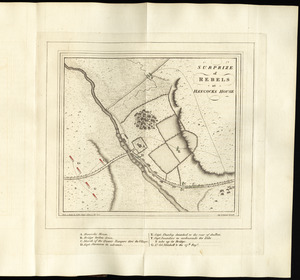
Surprize of rebels at Hancock's House
347.
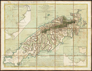
Tabago
348.
Der Teufels Belt gemeiniglich genannt der Lange Insels Sund
349.
[The burnt ruins of Charlestown from across the Charles River]
350.
[The coasts, rivers and inlets of the province of Georgia]
351.
Théatre de la guerre en Amerique, avec les Isles Antilles : projetté et assujettie aux observations
352.
The theatre of war in North America, with the roads and a table of the distances
353.
Theatrum belli in America Septentrionali
354.
Theodolite's pattern, shewing the provinces in North America which were in the respective possessions of England, France &...
355.
[Three views of South Carolina]
356.
To His Excellency Genl. Washington, Commander in Chief of the armies of the United States of America : this plan of the...
357.
To His Excellency Sr. Henry Moore, Bart., captain general and governour in chief in & over the province of New York & the...
358.
To the citizens of Philadelphia this plan of the city and its environs : is respectfully dedicated by the editors
359.
To the Hone. Jno. Hancock, Esqre. president of ye Continental Congress, this map of the seat of civil war in America, is...
360.
To the right honourable, the Earl of Shelbourne, His Majesty's principal Secretary of State for the Southern Department : this...
‹ Prev
Next ›
1
2
…
14
15
16
17
18
19


![[The burnt ruins of Charlestown from across the Charles River]](https://bpldcassets.blob.core.windows.net/derivatives/images/commonwealth:dz010v71m/image_thumbnail_300.jpg)
![[The coasts, rivers and inlets of the province of Georgia]](https://bpldcassets.blob.core.windows.net/derivatives/images/commonwealth:z603vv37x/image_thumbnail_300.jpg)


![[Three views of South Carolina]](https://bpldcassets.blob.core.windows.net/derivatives/images/commonwealth:dz010v13q/image_thumbnail_300.jpg)