Toggle navigation
LMEC Home
Exhibitions
Georeferencing
Tools for Teachers
Collections
My Favorites
Sign Up / Log In
Search
Search the map portal
Map Collection
Map Collection
Map Sets
Search
Search
Search for
Search In
All Fields
Creator
Title
Subject
Place
Search All Digital Collections
Advanced Search
389 Results
My Search
Start Over
More Like
commonwealth:z603vs502
Remove constraint More Like: commonwealth:z603vs502
Filter your Search
Place
North and Central America
304
United States
257
Canada
52
North America
38
New York
31
Suffolk (county)
31
Boston
29
Charleston (county)
10
more
Place
»
Topic
United States--Maps--Early works to 1800
103
North America--Maps--Early works to 1800
29
Canada--Maps--Early works to 1800
28
Boston (Mass.)--History--Revolution, 1775-1783--Maps--Early works to 1800
16
United States--History--Revolution, 1775-1783--Maps--Early works to 1800
12
Vues d'optique
10
Gibraltar--History--Siege, 1779-1783--Maps--Early works to 1800
9
New York (N.Y.)--Pictorial works--Early works to 1800
9
more
Topic
»
Date
Date range begin
–
Date range end
Current results range from
1707
to
1830
View distribution
Creator
Faden, William, 1749-1836
38
Jefferys, Thomas, -1771
32
Le Rouge, Georges-Louis
23
Des Barres, Joseph F. W. (Joseph Frederick Wallet), 1722-1824
21
Sayer, Robert, 1725-1794
20
Robert Sayer and John Bennett (Firm)
12
Korn, Christoph Heinrich, 1726-1783
11
Raspe, Gabriel Nicolaus, 1712-1785
11
more
Creator
»
Format
Maps/Atlases
346
Prints
32
Manuscripts
23
Drawings/Illustrations
9
Books
2
Georeferenced
Yes
14
No
375
Collection
American Revolutionary War-Era Maps
377
Richard H. Brown Revolutionary War Map Collection at Mount Vernon
293
MacLean Collection Map Library
43
Norman B. Leventhal Map & Education Center Collection
30
New York Public Library Collection
15
Boston and New England Maps
4
New-York Historical Society Collection
4
Mapping Boston Collection
2
more
Collection
»
Available to use
Creative Commons license
312
No known restrictions
32
Search Constraints
Sort by relevance
relevance
title
date (asc)
date (desc)
Number of results to display per page
20 per page
10
per page
20
per page
50
per page
100
per page
View results as:
grid view
map view
Search Results
241.
North America from the French of Mr. D'Anville, improved with the back settlements of Virginia and course of Ohio, illustrated...
242.
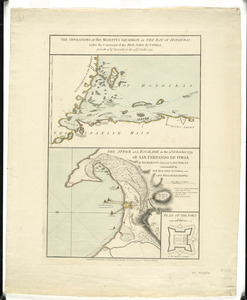
The operations of His Majesty's squadron in the Bay of Honduras, under the command of the Hon. John Luttrell from the 15th of...
243.
Order of battle of the army under the command of Lt. General Gage at Boston, July 17th, 1775
244.
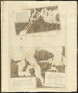
Oyster Bay and Huntington : Huntington Bay
245.
[Panoramic view of Newport, Rhode Island and the harbor showing the position of the French fleet and troop encampments]
246.
Partie occidentale de la Virginie, Pensylvanie, Maryland, et Caroline septle. la Rivière d'Ohio, et toutes celles qui s'y...
247.
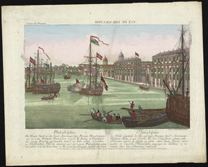
Philadelphia = : Philadelphie
248.
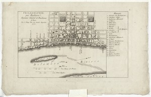
Philadelphie, par Easburn, arpenteur general de Pensilvanie
249.
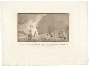
The Phoenix and the Rose engaged by the enemy's fire ships and galleys on the 16 Augst. 1776
250.
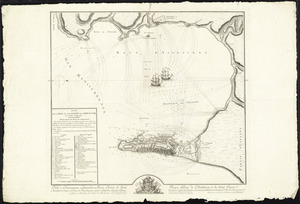
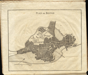
Plan de Boston
251.
Plan de Boston
252.
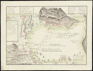
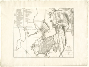
[Plan de Gibraltar]
253.
Plan de Gibraltar
254.
Plan de la position de l'armée française au tour de Newport dans Rhode Island et du mouillage de l'escadre dans la rade de...
255.
Plan de la ville de Louisbourg avec les ouvrages d'attaque des Anglais pour sa reddition, ainsi que ceux des assiegés pr. la...
256.
Plan de la ville du Cap Francois et de ses environs dans l'Isle St. Domingue
257.
Plan de la ville et des forts de Gibraltar, avec la Baye d'Algesiras
258.
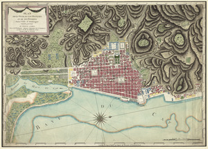
Plan de la ville et du port de Boston : capitale de la Nouvelle Angleterre
259.
Plan de l'armée de Cornwallis attaquée et faitte prisoniere dans York Town : le 19 8bre par l'armée combinée Francaise et...
260.
Plan der belagerung der stadt Gibraltar im jahr 1779, 1780, 1781
‹ Prev
Next ›
1
2
…
9
10
11
12
13
14
15
16
17
…
19
20


![[Panoramic view of Newport, Rhode Island and the harbor showing the position of the French fleet and troop encampments]](https://bpldcassets.blob.core.windows.net/derivatives/images/commonwealth:dz010v493/image_thumbnail_300.jpg)


![[Plan de Gibraltar]](https://bpldcassets.blob.core.windows.net/derivatives/images/commonwealth:z603vt83t/image_thumbnail_300.jpg)