Toggle navigation
LMEC Home
Exhibitions
Georeferencing
Tools for Teachers
Collections
My Favorites
Sign Up / Log In
Search
Search the map portal
Map Collection
Map Collection
Map Sets
Search
Search
Search for
Search In
All Fields
Creator
Title
Subject
Place
Search All Digital Collections
Advanced Search
409 Results
My Search
Start Over
More Like
commonwealth:z603vr69k
Remove constraint More Like: commonwealth:z603vr69k
Filter your Search
Place
North and Central America
330
United States
233
Canada
99
North America
45
Suffolk (county)
35
Boston
33
New York
33
New England
17
more
Place
»
Topic
Canada--Maps--Early works to 1800
79
United States--History--Revolution, 1775-1783--Maps--Early works to 1800
38
United States--Maps--Early works to 1800
38
North America--Maps--Early works to 1800
31
Boston (Mass.)--History--Revolution, 1775-1783--Maps--Early works to 1800
18
New England--Maps--Early works to 1800
15
Northeastern States--Maps--Early works to 1800
11
Antilles, Greater--Maps--Early works to 1800
10
more
Topic
»
Date
Date range begin
–
Date range end
Current results range from
1576
to
1800
View distribution
Creator
Faden, William, 1749-1836
38
Jefferys, Thomas, -1771
33
Le Rouge, Georges-Louis
24
Des Barres, Joseph F. W. (Joseph Frederick Wallet), 1722-1824
21
Sayer, Robert, 1725-1794
19
Bellin, Jacques Nicolas, 1703-1772
16
Robert Sayer and John Bennett (Firm)
14
Korn, Christoph Heinrich, 1726-1783
11
more
Creator
»
Format
Maps/Atlases
366
Prints
32
Manuscripts
24
Drawings/Illustrations
9
Books
2
Georeferenced
Yes
13
No
396
Collection
American Revolutionary War-Era Maps
393
Richard H. Brown Revolutionary War Map Collection at Mount Vernon
293
Norman B. Leventhal Map & Education Center Collection
48
MacLean Collection Map Library
40
Boston and New England Maps
8
Library and Archives Canada Collection
8
Maritime Charts and Atlases
5
New York Public Library Collection
5
more
Collection
»
Available to use
Creative Commons license
305
No known restrictions
52
Search Constraints
Sort by relevance
relevance
title
date (asc)
date (desc)
Number of results to display per page
20 per page
10
per page
20
per page
50
per page
100
per page
View results as:
grid view
map view
Search Results
241.
A map of the north west parts of the United States of America
242.
A map of the Province of New-York : reduc'd from the large drawing of that province, compiled from actual surveys by order of...
243.
[Map of the Siege of Mud Island Fort]
244.
A map of the United States of N. America
245.
Map of the western parts of the colony of Virginia, as far as the Mississipi
246.
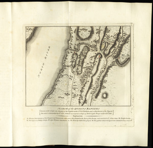
March of the Queens Rangers : Emmericks Corps, the Cavalry of the Legion under Lt. Col. Tarleton, and a detachment of the...
247.
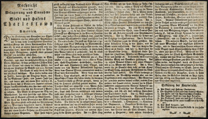
Nachricht von der belagerung und einnahme der stadt und hafens Charlestown in America
248.
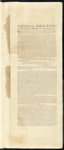
Nautical directions to sail into the harbour of New-York, &c.
249.
Neu Yorck = : La Nouvelle Yorck
250.
Neuester und acurater plan der weltberuhmten Englischen berg festung Gibraltar auf der Spitze von Spanien : derer wercher...
251.
A new and accurate map of the English empire in North America : representing their rightful claim as confirmed by charters, and...
252.
A new and correct chart of the coast of East Florida, and part of West Florida and Gulf of Mexico, Gulf of Florida or Cannel of...
253.
A new and correct map of North America, with the West India Islands : divided according to the last Treaty of Peace, concluded...
254.
A new chart of the coast of New England, Nova Scotia, and the islands of St. John, Cape Breton, Sable, the banks of St. Peters,...
255.
A new map of North America wherein the British Dominions in the continent of North America : and on the islands of the West...
256.
A new map of Nova Scotia, and Cape Britain : with the adjacent parts of New England and Canada, composed from a great number of...
257.
A new map of the British colonies in North America, shewing the seat of the present war, taken from the best surveys, compared...
258.
A new map of the western parts of Virginia, Pennsylvania, Maryland and North Carolina : comprehending the river Ohio, and all...
259.
[Noddle Island and the Mill Pond]
260.
North America from the French of Mr. D'Anville, improved with the back settlements of Virginia and course of Ohio, illustrated...
‹ Prev
Next ›
1
2
…
9
10
11
12
13
14
15
16
17
…
20
21

![[Map of the Siege of Mud Island Fort]](https://bpldcassets.blob.core.windows.net/derivatives/images/commonwealth:z603vr43f/image_thumbnail_300.jpg)


![[Noddle Island and the Mill Pond]](https://bpldcassets.blob.core.windows.net/derivatives/images/commonwealth:dz010v671/image_thumbnail_300.jpg)
