Toggle navigation
LMEC Home
Exhibitions
Georeferencing
Tools for Teachers
Collections
My Favorites
Sign Up / Log In
Search
Search the map portal
Map Collection
Map Collection
Map Sets
Search
Search
Search for
Search In
All Fields
Creator
Title
Subject
Place
Search All Digital Collections
Advanced Search
335 Results
My Search
Start Over
More Like
commonwealth:z603vr34g
Remove constraint More Like: commonwealth:z603vr34g
Filter your Search
Place
North and Central America
268
United States
187
New York
52
Canada
40
Suffolk (county)
31
Boston
29
North America
29
New England
19
more
Place
»
Topic
New York (State)--Maps--Early works to 1800
26
North America--Maps--Early works to 1800
19
Boston (Mass.)--History--Revolution, 1775-1783--Maps--Early works to 1800
16
New England--Maps--Early works to 1800
16
New Jersey--Maps--Early works to 1800
12
Saint Lawrence River--Maps--Early works to 1800
12
Northeastern States--Maps--Early works to 1800
11
Québec (Province)--Maps--Early works to 1800
10
more
Topic
»
Date
Date range begin
–
Date range end
Current results range from
1636
to
1799
View distribution
Creator
Faden, William, 1749-1836
35
Jefferys, Thomas, -1771
35
Des Barres, Joseph F. W. (Joseph Frederick Wallet), 1722-1824
26
Le Rouge, Georges-Louis
23
Sayer, Robert, 1725-1794
23
Korn, Christoph Heinrich, 1726-1783
11
Raspe, Gabriel Nicolaus, 1712-1785
11
Simcoe, John Graves, 1752-1806
10
more
Creator
»
Format
Maps/Atlases
292
Prints
32
Manuscripts
23
Drawings/Illustrations
9
Books
2
Georeferenced
Yes
14
No
321
Collection
American Revolutionary War-Era Maps
321
Richard H. Brown Revolutionary War Map Collection at Mount Vernon
293
Norman B. Leventhal Map & Education Center Collection
31
Maritime Charts and Atlases
8
New York Public Library Collection
8
Boston and New England Maps
4
Mapping Boston Collection
2
Sidney R. Knafel Map Collection at Phillips Academy
2
more
Collection
»
Available to use
Creative Commons license
304
No known restrictions
28
Search Constraints
Sort by relevance
relevance
title
date (asc)
date (desc)
Number of results to display per page
20 per page
10
per page
20
per page
50
per page
100
per page
View results as:
grid view
map view
Search Results
101.
Chart comprizing Greenland with the countries and islands about Baffin's and Hudson's Bays
102.
Chart containing the coasts of California, New Albion, and Russian discoveries to the north : with the peninsula of Kamchatka,...
103.
Chart containing the greater part of the South Sea to the south of the line, with islands dispersed thro' the same
104.
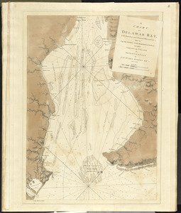
A chart of Delawar Bay, with soundings and nautical observations
105.
A chart of Delawar River from Bombay Hook to Ridley Creek, with soundings &c taken by Lt. Knight of the Navy
106.
A chart of New York Harbour with the soundings views of land marks and nautical directions : for the use of pilotage
107.
A chart of North and South America, including the Atlantic and Pacific Oceans, with the nearest coasts of Europe, Africa and Asia
108.
Chart of South America, comprehending the West Indies, with the adjacent islands, in the Southern Ocean, and South Sea
109.
Chart of the Atlantic Ocean, with the British, French, & Spanish settlements in North America, and the West Indies : as also on...
110.
Chart of the Banks of Newfoundland, drawn from a great number of hydrographical surveys, these charts are followed, according...
111.
A chart of the bay and harbour of Pensacola in the Province of West Florida
112.
[Chart of the coast of Georgia]
113.
[Chart of the coast of Georgia]
114.
[Chart of the Gulf Stream]
115.
A chart of the Harbour of Boston, with the soundings, sailing-marks, and other directions
116.
Charts of several harbours, and divers parts of the coast of North America, from New York south westwards to the Gulph of Mexico
117.
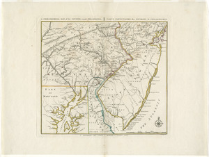
A chorographical map, of the country, round Philadelphia = : carte particuliere, des environs de Philadelphie
118.
The coast of a part of New England, New York, New Jersey, Pensilvania, Maryland, Virginia, and part of North Carolina &c. with...
119.
The coast of a part of North Carolina, South Carolina, Georgia and part of East Florida, with the bays, soundings, banks, roks,...
120.
The coast of New Schotland, New England, the gulph and river of St. Laurence : the islands of New Foundland, Cape Breton, St....
‹ Prev
Next ›
1
2
3
4
5
6
7
8
9
10
…
16
17


![[Chart of the coast of Georgia]](https://bpldcassets.blob.core.windows.net/derivatives/images/commonwealth:z603vv33t/image_thumbnail_300.jpg)
![[Chart of the coast of Georgia]](https://bpldcassets.blob.core.windows.net/derivatives/images/commonwealth:z603vv35c/image_thumbnail_300.jpg)
![[Chart of the Gulf Stream]](https://bpldcassets.blob.core.windows.net/derivatives/images/commonwealth:z603vr47j/image_thumbnail_300.jpg)