Toggle navigation
LMEC Home
Exhibitions
Georeferencing
Tools for Teachers
Collections
My Favorites
Sign Up / Log In
Search
Search the map portal
Map Collection
Map Collection
Map Sets
Search
Search
Search for
Search In
All Fields
Creator
Title
Subject
Place
Search All Digital Collections
Advanced Search
138 Results
My Search
Start Over
More Like
commonwealth:z603vn621
Remove constraint More Like: commonwealth:z603vn621
Filter your Search
Place
North and Central America
115
United States
68
Canada
13
San Juan
8
Florida
7
Mississippi
7
Añasco
6
Boston Harbor
6
more
Place
»
Topic
Manuscript maps--Early works to 1800
138
Añasco (P.R.)--Maps--Early works to 1800
6
Coasts--Florida--Maps--Early works to 1800
6
Coasts--Puerto Rico--Añasco--Maps--Early works to 1800
6
Coasts--Puerto Rico--Mayagüez--Maps--Early works to 1800
6
Mayagüez (P.R.)--Maps--Early works to 1800
6
San Juan (P.R.)--Maps, Manuscript--Early works to 1800
6
Aguadilla (P.R.)--Maps--Early works to 1800
5
more
Topic
»
Date
Date range begin
–
Date range end
Current results range from
1700
to
1899
View distribution
Creator
Dumont de Montigny
13
Adlum, John, 1759-1836
9
Bingham, William, 1752-1804
9
De Brahm, John Gerar William, 1717-approximately 1799
4
Real Escuela de Navegación (Cádiz, Spain)
4
Dampierre, chevalier de, fl. 1756
2
Finlay, Hugh, 1732-1801
2
Hamecourt, P. M. d', fl. 1772
2
more
Creator
»
Format
Manuscripts
138
Maps/Atlases
138
Georeferenced
Yes
2
No
136
Collection
American Revolutionary War-Era Maps
133
Library of Congress Collection
97
Newberry Library Collection
38
Maritime Charts and Atlases
17
Urban Maps
8
Boston and New England Maps
4
Norman B. Leventhal Map Center Collection
3
Available to use
Creative Commons license
97
No known restrictions
3
Search Constraints
Sort by date (desc)
relevance
title
date (asc)
date (desc)
Number of results to display per page
20 per page
10
per page
20
per page
50
per page
100
per page
View results as:
grid view
map view
Search Results
21.
20 tracts, Charleston
22.
Armstrong County
23.
Cawanesque
24.
Jefferson, Venango & Armstrong
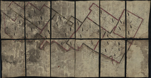
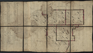
25.
Land ownership map of the William Bingham estate in Potter County, Pennsylvania
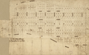
26.
The plot of Carroll'sburgh : [part of Washington D.C.]
27.
Susquehanna & Sinnemahoning
28.
Venango Co
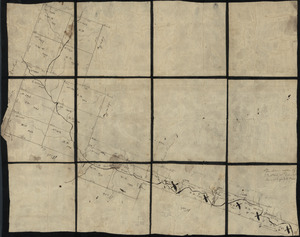
29.
W. Br. Pine Cr
30.
W. Su[q.?] Cr., Bradford Co
31.
Plano d. las aguadas d. Sn. Juan y Sn. Franco. d. Añasco en la ysla de Pto. Rico, año d. 1787
32.
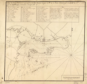
Plano de Puerto Real en la costa del S. de la Ysla Jamaica, 12 leguas al ote. de la Punta Oriental y por la latitud de...
33.
Nuevo plano de Puerto Rico
34.
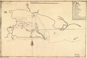
Pto. Rico
35.
Copia, del mapa de las Indias Occidentales : y del manifiesto que presentò D. Thomas Southuel, à la Superioridad, en el año...
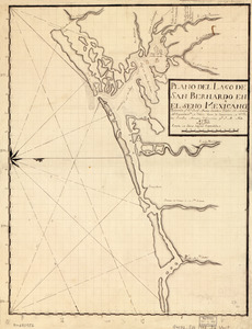
36.
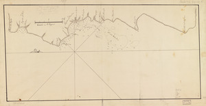
Plano del Lago de San Bernardo en el Seno Mexicano
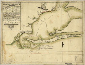
37.
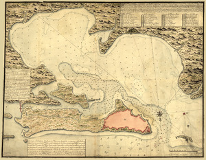
Plano de la bahia de Pansacola
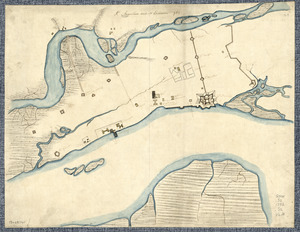
38.
St. Augustine and its environs
39.
Combat naval à la hauteur de la Baye de Chézapeake [sic] le 5 7bre. 1781
40.
Plan of the peninsula of Chesopeak [sic] Bay
‹ Prev
Next ›
1
2
3
4
5
6
7


![W. Su[q.?] Cr., Bradford Co](https://bpldcassets.blob.core.windows.net/derivatives/images/commonwealth:q524ng417/image_thumbnail_300.jpg)

![Combat naval à la hauteur de la Baye de Chézapeake [sic] le 5 7bre. 1781](https://bpldcassets.blob.core.windows.net/derivatives/images/commonwealth:z603vn12t/image_thumbnail_300.jpg)
![Plan of the peninsula of Chesopeak [sic] Bay](https://bpldcassets.blob.core.windows.net/derivatives/images/commonwealth:z603vn14c/image_thumbnail_300.jpg)