Toggle navigation
LMEC Home
Exhibitions
Georeferencing
Tools for Teachers
Collections
My Favorites
Sign Up / Log In
Search
Search the map portal
Map Collection
Map Collection
Map Sets
Search
Search
Search for
Search In
All Fields
Creator
Title
Subject
Place
Search All Digital Collections
Advanced Search
156 Results
My Search
Start Over
More Like
commonwealth:z603vn133
Remove constraint More Like: commonwealth:z603vn133
Filter your Search
Place
North and Central America
132
United States
83
Canada
13
Chesapeake Bay
12
San Juan
8
Florida
7
Mississippi
7
New York
7
more
Place
»
Topic
Manuscript maps--Early works to 1800
138
Nautical charts--Chesapeake Bay (Md. and Va.)--Early works to 1800
9
Chesapeake Bay (Md. and Va.)--Maps--Early works to 1800
8
Añasco (P.R.)--Maps--Early works to 1800
6
Coasts--Florida--Maps--Early works to 1800
6
Coasts--Puerto Rico--Añasco--Maps--Early works to 1800
6
Coasts--Puerto Rico--Mayagüez--Maps--Early works to 1800
6
Mayagüez (P.R.)--Maps--Early works to 1800
6
more
Topic
»
Date
Date range begin
–
Date range end
Current results range from
1638
to
1899
View distribution
Creator
Dumont de Montigny
14
Adlum, John, 1759-1836
9
Bingham, William, 1752-1804
9
De Brahm, John Gerar William, 1717-approximately 1799
4
Faden, William, 1749-1836
4
Hills, John, (Surveyor)
4
Real Escuela de Navegación (Cádiz, Spain)
4
Smith, Anthony, pilot of St. Marys
4
more
Creator
»
Format
Maps/Atlases
156
Manuscripts
145
Georeferenced
Yes
2
No
154
Collection
American Revolutionary War-Era Maps
147
Library of Congress Collection
98
Newberry Library Collection
45
Maritime Charts and Atlases
25
Norman B. Leventhal Map & Education Center Collection
11
Urban Maps
8
Boston and New England Maps
4
New York Public Library Collection
1
more
Collection
»
Available to use
Creative Commons license
100
No known restrictions
11
Search Constraints
Sort by relevance
relevance
title
date (asc)
date (desc)
Number of results to display per page
10 per page
10
per page
20
per page
50
per page
100
per page
View results as:
grid view
map view
Search Results
1.
Amerique Septentrionale : Acadie ou Nouvelle Ecosse aux anglois : Annapolis Royal
2.
Combat naval à la hauteur de la Baye de Chézapeake [sic] le 5 7bre. 1781
3.
Cours de l'Ohio depuis sa source jusqu'a sa jonction avec la Riviere d'Ouabache et les pais voisons
4.
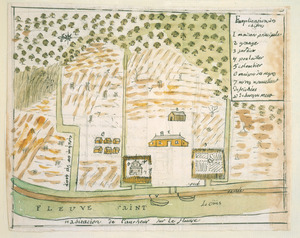
Habitation de l'autheur sur le fleuve
5.
Logement de l'autheur a la Nlle. Orleans
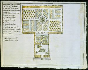
6.
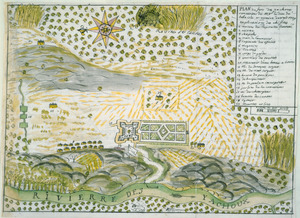
Plan du Fort des Yachoux, concession de Mgr. le duc de Belle Isle et associez, detruit 1729
7.
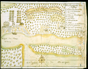
Plan du vieux Fort du Billoxi, 2 etablissement
8.
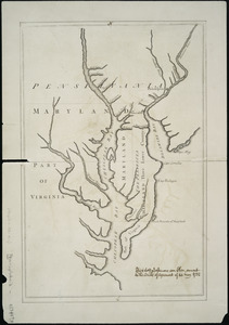
Lord Baltimore's own plan : proposed Maryland/Pennsylvania boundary
9.
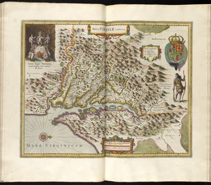
Nova Virginiae tabula
10.
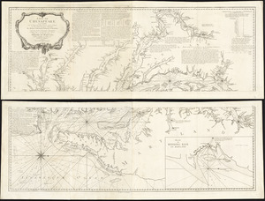
Baye de Chesapeake en 4 feuilles avec les bas fonds, passes, entrées, sondes et routes ou l'on donne les parties navigables...
‹ Prev
Next ›
1
2
3
4
5
…
15
16

![Combat naval à la hauteur de la Baye de Chézapeake [sic] le 5 7bre. 1781](https://bpldcassets.blob.core.windows.net/derivatives/images/commonwealth:z603vn12t/image_thumbnail_300.jpg)