Toggle navigation
LMEC Home
Exhibitions
Georeferencing
Tools for Teachers
Collections
My Favorites
Sign Up / Log In
Search
Search the map portal
Map Collection
Map Collection
Map Sets
Search
Search
Search for
Search In
All Fields
Creator
Title
Subject
Place
Search All Digital Collections
Advanced Search
265 Results
My Search
Start Over
More Like
commonwealth:z603vm790
Remove constraint More Like: commonwealth:z603vm790
Filter your Search
Place
North and Central America
260
New England
118
United States
81
New York
75
Maine
52
New Hampshire
30
Canada
24
Massachusetts
22
more
Place
»
Topic
New England--Maps
120
New York (State)--Maps
81
Maine--Maps
50
Railroads--New England--Maps
50
New Hampshire--Maps
31
Railroads--New York (State)--Maps
21
Massachusetts--Maps
20
Vermont--Maps
15
more
Topic
»
Date
Date range begin
–
Date range end
Current results range from
1700
to
2015
View distribution
Creator
United States. Post Office Dept
12
Carleton, Osgood, 1742-1816
7
Carey, Mathew, 1760-1839
6
Holland, Samuel, 1728-1801
5
Lewis, Samuel, 1753 or 4-1822
5
Geological Survey (U.S.)
4
National Publishing Company (Boston, Mass.)
4
Norman, John, 1748?-1817
4
more
Creator
»
Format
Maps/Atlases
265
Manuscripts
6
Objects/Artifacts
1
Georeferenced
Yes
29
No
236
Collection
Norman B. Leventhal Map Center Collection
183
Boston and New England Maps
115
American Revolutionary War-Era Maps
78
William L. Clements Library Collection
33
American Antiquarian Society Collection
26
Massachusetts Historical Society Map Collection
14
David Judkins Weaver Papers
4
Sidney R. Knafel Map Collection at Phillips Academy
4
more
Collection
»
Available to use
No known restrictions
184
Creative Commons license
16
Search Constraints
Sort by date (desc)
relevance
title
date (asc)
date (desc)
Number of results to display per page
20 per page
10
per page
20
per page
50
per page
100
per page
View results as:
grid view
map view
Search Results
1.
New England regional transportation map = Mapa do transporte regional da Nova Inglaterra = Nueva Inglaterra, mapa regional de...
2.
New England fishery, recreation and scenic resources
3.
Transportation map of New York
4.
Black in New England 1840
5.
Map of Ho-De-No-Sau-Nee-Ga or the people of the long house : compiled 1851 by Lewis H. Morgan & Ely S. Parker a Seneca sachem...
6.
A map of the state of Maine
7.
The Boston Globe ski map of northern New England and Canada
8.
State of Maine
9.
Limited edition, 500 only of a pictorial map covering the New England States U.S.A
10.
A pictorial map of the New England states U.S.A.
11.
Midsummer's marvels
12.
A canoeist's guide to New England's rivers
13.
Route and pictorial map of Maine
14.
A map of the Seneca villages and the Jesuit and French contacts 1615-1708
15.
A map of the Maine coast from York Harbor to Saco Bay : reminiscent & actual
16.
A map of the history of New York state
17.
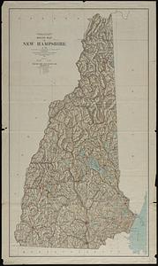
Relief map of New Hampshire
18.
New map of Boston giving all points of interest : with every railway & steamboat terminus, prominent hotels, theatres & public...
19.
Automobile map of New England showing the ideal tour
20.
Rand McNally official 1924 auto trails map Maine ; Rand McNally official 1924 auto trails map New Hampshire, Vermont
‹ Prev
Next ›
1
2
3
4
5
…
13
14