Toggle navigation
LMEC Home
Exhibitions
Georeferencing
Tools for Teachers
Collections
My Favorites
Sign Up / Log In
Search
Search the map portal
Map Collection
Map Collection
Map Sets
Search
Search
Search for
Search In
All Fields
Creator
Title
Subject
Place
Search All Digital Collections
Advanced Search
286 Results
My Search
Start Over
More Like
commonwealth:z603vj72n
Remove constraint More Like: commonwealth:z603vj72n
Filter your Search
Place
North and Central America
226
United States
132
Canada
74
Suffolk (county)
37
Boston
36
Boston Harbor
24
Nova Scotia
23
Massachusetts
17
more
Place
»
Topic
Manuscript maps--Early works to 1800
138
Coasts--Nova Scotia--Maps
62
Boston (Mass.)--Buildings, structures, etc--Maps, Manuscript--Early works to 1800
17
Nautical charts--Massachusetts--Boston Harbor--Early works to 1800
16
Boston Harbor (Mass.)--Maps--Early works to 1800
13
Fortification--Massachusetts--Boston--Maps, Manuscript--Early works to 1800
11
Coasts--Nova Scotia--Pictorial works
10
Nautical charts--Massachusetts--Boston Bay--Early works to 1800
9
more
Topic
»
Date
Date range begin
–
Date range end
Current results range from
1688
to
1899
View distribution
Creator
Des Barres, Joseph F. W. (Joseph Frederick Wallet), 1722-1824
101
Dumont de Montigny
14
Adlum, John, 1759-1836
9
Bingham, William, 1752-1804
9
Montrésor, John, 1736-1799
6
De Brahm, John Gerar William, 1717-approximately 1799
4
Page, Thomas Hyde, Sir, 1746-1821
4
Real Escuela de Navegación (Cádiz, Spain)
4
more
Creator
»
Format
Maps/Atlases
285
Manuscripts
170
Prints
1
Georeferenced
Yes
7
No
279
Collection
American Revolutionary War-Era Maps
277
Library of Congress Collection
229
Newberry Library Collection
39
Maritime Charts and Atlases
32
Boston and New England Maps
17
Norman B. Leventhal Map & Education Center Collection
17
Urban Maps
8
Mapping Boston Collection
7
more
Collection
»
Available to use
Creative Commons license
237
No known restrictions
10
Search Constraints
Sort by relevance
relevance
title
date (asc)
date (desc)
Number of results to display per page
20 per page
10
per page
20
per page
50
per page
100
per page
View results as:
grid view
map view
Search Results
1.
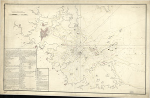
[Boston Harbour, with the surroundings, &c]
2.
Boston & harbour
3.
Boston Harbor, Massachusetts
4.
Puerto del Boston
5.
Plan d'une partie de la rade de Boston pour faire connaitre le dispositif de ses deffenses
6.
A chart of the harbour of Boston
7.
Plan de Boston avec les sondes et les directions pour la navigation : traduit de l'anglais
8.
Boston, its environs and harbour : with the rebels works raised against that town in 1775
9.
Boston, S. West part : No. 25
10.
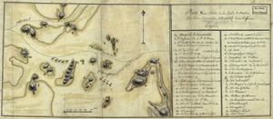
[A chart of Boston Bay and vicinity]
11.
A chart of Boston Bay and vicinity
12.
A chart of Boston Bay and vicinity
13.
Boston Harbour in New England
14.
Carte particuliere du havre de Boston : avec les sondes les bancs de Sable, les rochers les Amaies et les autres directions...
15.
Carte particuliere du havre de Boston : avec les sondes les bancs de Sable, les rochers les Amaies et les autres directions...
16.
A chart of the harbour of Boston
17.
A chart of the harbour of Boston
18.
A chart of the harbour of Boston
19.
A chart of the Harbour of Boston, with the soundings, sailing-marks, and other directions
20.
A chart of the Harbour of Boston, with the soundings, sailing-marks, and other directions
‹ Prev
Next ›
1
2
3
4
5
…
14
15
![[Boston Harbour, with the surroundings, &c]](https://bpldcassets.blob.core.windows.net/derivatives/images/commonwealth:t722hs94d/image_thumbnail_300.jpg)


![[A chart of Boston Bay and vicinity]](https://bpldcassets.blob.core.windows.net/derivatives/images/commonwealth:cj82m2976/image_thumbnail_300.jpg)


