Toggle navigation
LMEC Home
Exhibitions
Georeferencing
Tools for Teachers
Collections
My Favorites
Sign Up / Log In
Search
Search the map portal
Map Collection
Map Collection
Map Sets
Search
Search
Search for
Search In
All Fields
Creator
Title
Subject
Place
Search All Digital Collections
Advanced Search
300 Results
My Search
Start Over
More Like
commonwealth:z603vj614
Remove constraint More Like: commonwealth:z603vj614
Filter your Search
Place
North and Central America
237
United States
146
Canada
75
Suffolk (county)
61
Boston
60
Nova Scotia
24
Boston Harbor
16
Minas Basin
9
more
Place
»
Topic
Manuscript maps--Early works to 1800
138
Coasts--Nova Scotia--Maps
62
Fortification--Massachusetts--Boston--Maps--Early works to 1800
30
Boston (Mass.)--History--Revolution, 1775-1783--Maps--Early works to 1800
26
Boston (Mass.)--Buildings, structures, etc--Maps, Manuscript--Early works to 1800
17
Boston (Mass.)--History--Siege, 1775-1776--Maps--Early works to 1800
11
Fortification--Massachusetts--Boston--Maps, Manuscript--Early works to 1800
11
Coasts--Nova Scotia--Pictorial works
10
more
Topic
»
Date
Date range begin
–
Date range end
Current results range from
1700
to
1899
View distribution
Creator
Des Barres, Joseph F. W. (Joseph Frederick Wallet), 1722-1824
95
Dumont de Montigny
14
Adlum, John, 1759-1836
9
Bingham, William, 1752-1804
9
Page, Thomas Hyde, Sir, 1746-1821
9
Aitken, Robert, 1735-1802
7
Montrésor, John, 1736-1799
7
Beaurain, Jean de, 1696-1771
5
more
Creator
»
Format
Maps/Atlases
297
Manuscripts
172
Drawings/Illustrations
2
Prints
1
Georeferenced
Yes
9
No
291
Collection
American Revolutionary War-Era Maps
294
Library of Congress Collection
228
Newberry Library Collection
39
Boston and New England Maps
20
Norman B. Leventhal Map Center Collection
20
Maritime Charts and Atlases
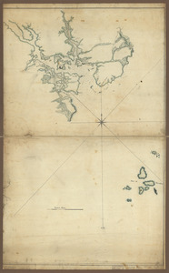
18
Urban Maps
14
Mapping Boston Collection
10
more
Collection
»
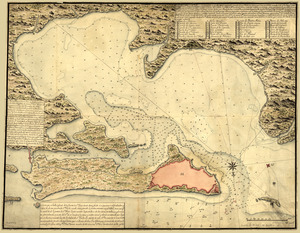
Available to use
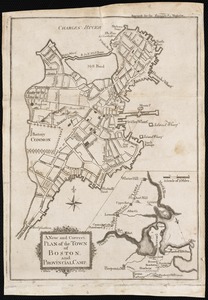
Creative Commons license
250
No known restrictions
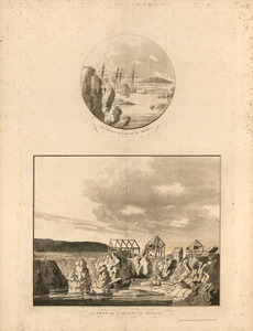
11
Search Constraints
Sort by title
relevance
title
date (asc)
date (desc)
Number of results to display per page
20 per page
10
per page
20
per page
50
per page
100
per page
View results as:
grid view
map view
Search Results
121.
A map of Potomack and James rivers in North America shewing their several communications with the navigable waters of the new...
122.
Map of the coast of Georgia, bordering on Camden and Glynn counties : showing also the course and soundings of the Alatamaha,...
123.
Map of the country between and bordering the Delaware River and Chesapeake Bay : showing roads to Philadelphia and localities
124.
Map of the environs of Boston
125.
Map of the environs of Roxbury showing roads to Jamaica, Cambridge, Dorchester, Milton, etc
126.
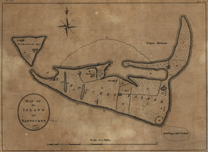
Map of the island of Nantucket
127.
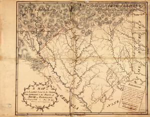
A Map of the lands ceded by the Cherokee Indians to the State of South-Carolina : at a congress held in May, A.D. 1777;...
128.
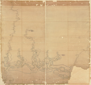
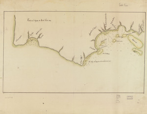
Map showing coast in the regions of Aguadilla, Añasco, and Mayagüez
129.
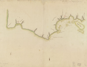
Map showing coast in the regions of Aguadilla, Añasco, and Mayagüez
130.
A map with part of the Florida coast from Cape Blaise to Apalachie : with the boundaries betwixt East & West Floridas, 160...
131.
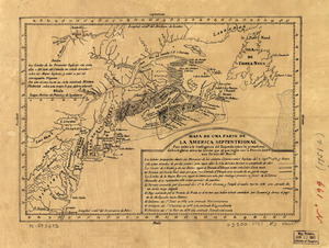
Mapa de una parte de la America Septentrional
132.
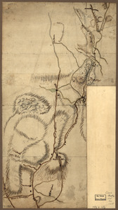
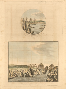
Mechios River near the mills ; A sketch of Mechios mills
133.
Mechios River near the mills ; A sketch of Mechios mills
134.
A new and accurate chart of the harbour of Boston in New England in North America
135.
A new and correct plan of the town of Boston
136.
A new and correct plan of the town of Boston, and provincial camp
137.
New Hampshire
138.
The north point of Grandmanan Island in the bay Fundy bearing e.n.e distant two leagues ; A view of Campo Bello at the entrance...
139.
The north point of Grandmanan Island in the bay Fundy bearing e.n.e distant two leagues ; A view of Campo Bello at the entrance...
140.
Nuevo plano de Puerto Rico
‹ Prev
Next ›
1
2
3
4
5
6
7
8
9
10
11
…
14
15