Toggle navigation
LMEC Home
Exhibitions
Georeferencing
Tools for Teachers
Collections
My Favorites
Sign Up / Log In
Search
Search the map portal
Map Collection
Map Collection
Map Sets
Search
Search
Search for
Search In
All Fields
Creator
Title
Subject
Place
Search All Digital Collections
Advanced Search
161 Results
My Search
Start Over
More Like
commonwealth:z603vj38b
Remove constraint More Like: commonwealth:z603vj38b
Filter your Search
Place
North and Central America
122
United States
78
Canada
62
Suffolk (county)
55
Boston
54
Nova Scotia
22
Massachusetts
18
Boston Harbor
13
more
Place
»
Topic
Coasts--Nova Scotia--Maps
62
Fortification--Massachusetts--Boston--Maps--Early works to 1800
30
Boston (Mass.)--History--Revolution, 1775-1783--Maps--Early works to 1800
22
Boston (Mass.)--Buildings, structures, etc--Maps, Manuscript--Early works to 1800
16
Fortification--Massachusetts--Boston--Maps, Manuscript--Early works to 1800
11
Coasts--Nova Scotia--Pictorial works
10
Atlantic Coast (N.S.)--Maps
8
Boston Harbor (Mass.)--Maps--Early works to 1800
8
more
Topic
»
Date
Date range begin
–
Date range end
Current results range from
1747
to
1782
View distribution
Creator
Des Barres, Joseph F. W. (Joseph Frederick Wallet), 1722-1824
95
Page, Thomas Hyde, Sir, 1746-1821
9
Aitken, Robert, 1735-1802
7
Montrésor, John, 1736-1799
6
Beaurain, Jean de, 1696-1771
5
Faden, William, 1749-1836
3
Gage, Thomas, 1721-1787
3
Pelham, Henry, 1749-1806
3
more
Creator
»
Format
Maps/Atlases
160
Manuscripts
34
Prints
1
Georeferenced
Yes
7
No
154
Collection
American Revolutionary War-Era Maps
160
Library of Congress Collection
136
Norman B. Leventhal Map & Education Center Collection
16
Boston and New England Maps
15
Mapping Boston Collection
10
Richard H. Brown Revolutionary War Map Collection at Mount Vernon
6
Urban Maps
5
Harvard Map Collection
2
more
Collection
»
Available to use
Creative Commons license
154
No known restrictions
7
Search Constraints
Sort by relevance
relevance
title
date (asc)
date (desc)
Number of results to display per page
20 per page
10
per page
20
per page
50
per page
100
per page
View results as:
grid view
map view
Search Results
41.
A plan of Boston in New England with its environs : including Milton, Dorchester, Roxbury, Brooklin, Cambridge, Medford,...
42.
A plan of Boston in New England with its environs : including Milton, Dorchester, Roxbury, Brooklin, Cambridge, Medford,...
43.
A plan of the town of Boston with the intrenchments & ca. of His Majesty's forces in 1775 : from the observations of Lieut....
44.
A plan of the town of Boston, with the intrenchments &c. of His Majestys forces in 1775 : from the observations of Lieut. Page...
45.
A plan of the town of Boston, with the intrenchments &c. of His Majestys forces in 1775 : from the observations of Lieut. Page...
46.
Annapolis Royal
47.
Annapolis Royal ; St. Mary's Bay
48.
Annapolis Royal ; St. Mary's Bay
49.
Annapolis Royal ; St. Mary's Bay
50.
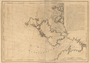
Barrington Bay
51.
Barrington Bay
52.
[Battle of Bunker Hill]
53.
[Boston Harbour, with the surroundings, &c]
54.
[Bunker Hill--rough sketch]
55.
Buzzards Bay and shoals of Nantucket
56.
Canso Harbor
57.
Canso Harbor
58.
Cape Blowmedown ; Cape Split ; Spencers Island and the entrance of Mines Bason ; Isle Haut and Cape Chegnecto
59.
Cape Blowmedown ; Cape Split ; The entrance of Mines Bason ; Isle Haut and Cape Chegnecto
60.
Cape Prospect ... Cape Sambro ... ; The high lands of Haspotagoen ... ; The Ovens at the entrance of Lunenburg Bay ; Cape Sable...
‹ Prev
Next ›
1
2
3
4
5
6
7
8
9


![[Battle of Bunker Hill]](https://bpldcassets.blob.core.windows.net/derivatives/images/commonwealth:z603vj11x/image_thumbnail_300.jpg)
![[Boston Harbour, with the surroundings, &c]](https://bpldcassets.blob.core.windows.net/derivatives/images/commonwealth:t722hs94d/image_thumbnail_300.jpg)
![[Bunker Hill--rough sketch]](https://bpldcassets.blob.core.windows.net/derivatives/images/commonwealth:z603vj151/image_thumbnail_300.jpg)