Toggle navigation
LMEC Home
Exhibitions
Georeferencing
Tools for Teachers
Collections
My Favorites
Sign Up / Log In
Search
Search the map portal
Map Collection
Map Collection
Map Sets
Search
Search
Search for
Search In
All Fields
Creator
Title
Subject
Place
Search All Digital Collections
Advanced Search
107 Results
My Search
Start Over
More Like
commonwealth:z603vh63g
Remove constraint More Like: commonwealth:z603vh63g
Filter your Search
Place
North and Central America
97
United States
93
Boston
75
Suffolk (county)
75
Massachusetts
54
Boston Harbor
24
Charleston (county)
7
Charleston
6
more
Place
»
Topic
Boston (Mass.)--Maps--Early works to 1800
49
Fortification--Massachusetts--Boston--Maps--Early works to 1800
30
Boston Harbor (Mass.)--Maps--Early works to 1800
23
Boston (Mass.)--History--Revolution, 1775-1783--Maps--Early works to 1800
22
Boston (Mass.)--History--Siege, 1775-1776--Maps--Early works to 1800
8
Boston (Mass.)--Buildings, structures, etc--Maps, Manuscript--Early works to 1800
6
Boston (Mass.)--Buildings, structures, etc--Maps--Early works to 1800
6
Bunker Hill, Battle of, Boston, Mass., 1775--Maps--Early works to 1800
6
more
Topic
»
Date
Date range begin
–
Date range end
Current results range from
1694
to
1879
View distribution
Creator
Faden, William, 1749-1836
12
Aitken, Robert, 1735-1802
9
Page, Thomas Hyde, Sir, 1746-1821
8
Beaurain, Jean de, 1696-1771
5
Bonner, John, ca. 1643-1726
4
Des Barres, Joseph F. W. (Joseph Frederick Wallet), 1722-1824
4
Bellin, Jacques Nicolas, 1703-1772
3
Callendar, George
3
more
Creator
»
Format
Maps/Atlases
99
Manuscripts
11
Books
7
Prints
1
Georeferenced
Yes
12
No
95
Collection
American Revolutionary War-Era Maps
97
Norman B. Leventhal Map & Education Center Collection
52
Boston and New England Maps
51
Harvard Map Collection
31
Urban Maps
26
Mapping Boston Collection
16
Library of Congress Collection
11
Richard H. Brown Revolutionary War Map Collection at Mount Vernon
9
more
Collection
»
Available to use
Creative Commons license
67
No known restrictions
38
Search Constraints
Sort by relevance
relevance
title
date (asc)
date (desc)
Number of results to display per page
20 per page
10
per page
20
per page
50
per page
100
per page
View results as:
grid view
map view
Search Results
21.
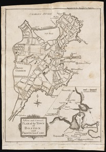
A new and correct plan of the town of Boston, and provincial camp
22.
A Plan oe [i.e. of] the British lines on Boston Neck in August 1775
23.
Plan of Boston & vicinity
24.
A plan of Boston, and its environs : shewing the true situation of His Majesty's army, and also those of the rebels
25.
A plan of Boston, and its environs : shewing the true situation of His Majesty's army, and also those of the rebels
26.
[Plan of the Neck and environs]
27.
A plan of the town of Boston with the intrenchments & ca. of His Majesty's forces in 1775 : from the observations of Lieut....
28.
A plan of the town of Boston, with the intrenchments &c. of His Majestys forces in 1775 : from the observations of Lieut. Page...
29.
A plan of the town of Boston, with the intrenchments &c. of His Majestys forces in 1775 : from the observations of Lieut. Page...
30.
[Rough draught of Boston and harbour]
31.
Boston
32.
Boston
33.
Boston, its environs and harbour, with the rebel works raised against that town in 1775 : from the observations of Lieut. Page...
34.
Bowles's map of the seat of war in New England, comprehending the provinces of Massachusets Bay, and New Hampshire : with the...
35.
Carte de la ville, baye et environs de Baston
36.
Carte des environs de Boston, capitale de la Nlle. Angleterre en Amerique
37.
A chart of the coast of New England, from Beverly to Scituate harbour, including the ports of Boston and Salem
38.
A chart of the harbour of Boston
39.
A chart of the harbour of Boston
40.
A chart of the harbour of Boston
‹ Prev
Next ›
1
2
3
4
5
6
![A Plan oe [i.e. of] the British lines on Boston Neck in August 1775](https://bpldcassets.blob.core.windows.net/derivatives/images/commonwealth:z603vj41n/image_thumbnail_300.jpg)


![[Plan of the Neck and environs]](https://bpldcassets.blob.core.windows.net/derivatives/images/commonwealth:z603vj436/image_thumbnail_300.jpg)


![[Rough draught of Boston and harbour]](https://bpldcassets.blob.core.windows.net/derivatives/images/commonwealth:z603vj39m/image_thumbnail_300.jpg)


