Toggle navigation
LMEC Home
Exhibitions
Georeferencing
Tools for Teachers
Collections
My Favorites
Sign Up / Log In
Search
Search the map portal
Map Collection
Map Collection
Map Sets
Search
Search
Search for
Search In
All Fields
Creator
Title
Subject
Place
Search All Digital Collections
Advanced Search
639 Results
My Search
Start Over
More Like
commonwealth:z603vh006
Remove constraint More Like: commonwealth:z603vh006
Filter your Search
Place
North and Central America
597
United States
443
Canada
151
Quebec
73
New York
60
North America
32
Saint Lawrence River
27
West Indies
23
more
Place
»
Topic
United States--Maps
330
United States--History--French and Indian War, 1754-1763--Maps
162
Canada--Maps
55
Elections--United States--Maps
36
Railroads--United States--Maps
34
North America--Maps
30
Saint Lawrence River--Maps
27
West Indies--Maps
24
more
Topic
»
Date
Date range begin
–
Date range end
Current results range from
1750
to
2023
View distribution
Creator
Paullin, Charles Oscar, 1868 or 1869-1944
70
Wright, John Kirtland, 1891-1969
70
Rocque, Mary Ann
24
Jefferys, Thomas, -1771
18
Geological Survey (U.S.)
15
Orme, Robert, -1781
14
Reid, John, 1764?-1828
11
Bellin, Jacques Nicolas, 1703-1772
10
more
Creator
»
Format
Maps/Atlases
636
Manuscripts
13
Prints
3
Books
1
Objects/Artifacts
1
Posters
1
Georeferenced
Yes
77
No
562
Collection
American Revolutionary War-Era Maps
325
Norman B. Leventhal Map & Education Center Collection
317
William L. Clements Library Collection
167
American Antiquarian Society Collection
138
MacLean Collection Map Library
11
Richard H. Brown Revolutionary War Map Collection at Mount Vernon
4
Boston and New England Maps
3
David Judkins Weaver Papers
2
more
Collection
»
Available to use
No known restrictions
243
Creative Commons license
10
Search Constraints
Sort by relevance
relevance
title
date (asc)
date (desc)
Number of results to display per page
20 per page
10
per page
20
per page
50
per page
100
per page
View results as:
grid view
map view
Search Results
281.
Eastern section of the United States
282.
Election map of the United States with 49 novel diagrams
283.
Electoral vote for President, 1789
284.
Electoral vote for President, 1792
285.
Electoral vote for President, 1796
286.
Electoral votes for President in 1916 and for Congress in 1918 : make your guess for 1920
287.
Ensign, Bridgman & Fanning's rail road map of the United States, showing the depots & stations
288.
États Unis
289.
Etats Unis de l'Amerique
290.
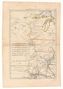
Les Etats Unis de l'Amérique Septentrional partie occidentale ; les Etats Unis de l'Amérique Septentrional partie orientale
291.
The facts of prohibition in the United States
292.
The fifth column menaces America on a thousand fronts
293.
Fredonia or the United States of North-America : including also Cabotia, or the Canadian provinces; the Western Territory to...
294.
F.T. Neely's new commercial map of the United States, Canada, British Columbia, and Northern Mexico, showing all the railroads,...
295.
G. Woolworth Colton's new guide map of the United States & Canada : with railroads, counties etc
296.
Gay days around America : a pleasure map of festivals, pageants, and special events best reached by Greyhound ... the...
297.
A good-natured map of the United States : setting forth the services of the Greyhound Lines and a few principal connecting bus...
298.
Growth of the Commonwealth (A)
299.
Hammond's comprehensive map of the United States with portions of Canada and Mexico
300.
Illustrated map of the route of Transcontinental Air Transport, Inc.
‹ Prev
Next ›
1
2
…
11
12
13
14
15
16
17
18
19
…
31
32