Toggle navigation
LMEC Home
Exhibitions
Georeferencing
Tools for Teachers
Collections
My Favorites
Sign Up / Log In
Search
Search the map portal
Map Collection
Map Collection
Map Sets
Search
Search
Search for
Search In
All Fields
Creator
Title
Subject
Place
Search All Digital Collections
Advanced Search
451 Results
My Search
Start Over
More Like
commonwealth:z603vg948
Remove constraint More Like: commonwealth:z603vg948
Filter your Search
Place
North and Central America
434
United States
408
Canada
36
North America
29
West Indies
23
Massachusetts
19
New York
14
Boston
11
more
Place
»
Topic
United States--Maps
330
Elections--United States--Maps
36
Railroads--United States--Maps
34
North America--Maps
28
Canada--Maps
25
West Indies--Maps
24
Population density--United States--Maps
14
New England--Maps
11
more
Topic
»
Date
Date range begin
–
Date range end
Current results range from
1750
to
2023
View distribution
Creator
Paullin, Charles Oscar, 1868 or 1869-1944
70
Wright, John Kirtland, 1891-1969
70
Geological Survey (U.S.)
15
Reid, John, 1764?-1828
11
Farwell, John Whittemore, 1843-1929
9
Bellin, Jacques Nicolas, 1703-1772
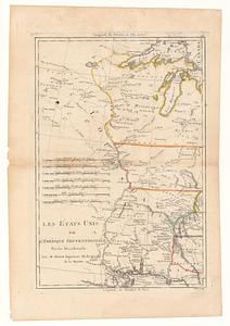
8
Carleton, Osgood, 1742-1816
8
Kitchin, Thomas, 1719-1784
8
more
Creator
»
Format
Maps/Atlases
449
Manuscripts
13
Prints
2
Books
1
Objects/Artifacts
1
Posters
1
Georeferenced
Yes
75
No
376
Collection
Norman B. Leventhal Map & Education Center Collection
288
American Revolutionary War-Era Maps
162
Maps from AAS
138
William L. Clements Library Collection
14
MacLean Collection Map Library
10
David Judkins Weaver Papers
2
Mapping Boston Collection
2
Applied Geographics, Inc. Records
1
more
Collection
»
Available to use
No known restrictions
213
Creative Commons license
6
Search Constraints
Sort by relevance
relevance
title
date (asc)
date (desc)
Number of results to display per page
20 per page
10
per page
20
per page
50
per page
100
per page
View results as:
grid view
map view
Search Results
81.
The Dominion of Canada from the latest surveys and data
82.
The eagle map of the United States
83.
Eastern section of the United States
84.
Election map of the United States with 49 novel diagrams
85.
Electoral vote for President, 1789
86.
Electoral vote for President, 1792
87.
Electoral vote for President, 1796
88.
Electoral votes for President in 1916 and for Congress in 1918 : make your guess for 1920
89.
Ensign, Bridgman & Fanning's rail road map of the United States, showing the depots & stations
90.
États Unis
91.
Etats Unis de l'Amerique
92.
Les Etats Unis de l'Amérique Septentrional partie occidentale ; les Etats Unis de l'Amérique Septentrional partie orientale
93.
The facts of prohibition in the United States
94.
The fifth column menaces America on a thousand fronts
95.
Fredonia or the United States of North-America : including also Cabotia, or the Canadian provinces; the Western Territory to...
96.
F.T. Neely's new commercial map of the United States, Canada, British Columbia, and Northern Mexico, showing all the railroads,...
97.
G. Woolworth Colton's new guide map of the United States & Canada : with railroads, counties etc
98.
Gay days around America : a pleasure map of festivals, pageants, and special events best reached by Greyhound ... the...
99.
General railway map engraved expressly for the Official guide of the railways and steam navigation lines of the United States,...
100.
A good-natured map of the United States : setting forth the services of the Greyhound Lines and a few principal connecting bus...
‹ Prev
Next ›
1
2
3
4
5
6
7
8
9
…
22
23