Toggle navigation
LMEC Home
Exhibitions
Georeferencing
Tools for Teachers
Collections
My Favorites
Sign Up / Log In
Search
Search the map portal
Map Collection
Map Collection
Map Sets
Search
Search
Search for
Search In
All Fields
Creator
Title
Subject
Place
Search All Digital Collections
Advanced Search
320 Results
My Search
Start Over
More Like
commonwealth:z603vg69x
Remove constraint More Like: commonwealth:z603vg69x
Filter your Search
Place
North and Central America
307
United States
275
New York
151
New Jersey
43
Canada
30
Hudson River
29
New England
25
Massachusetts
22
more
Place
»
Topic
New York (State)--Maps
85
New York (N.Y.)--Maps
48
United States--History--Revolution, 1775-1783--Maps
47
New Jersey--Maps
40
Hudson River (N.Y. and N.J.)--Maps
29
New England--Maps
27
United States--Maps
21
Railroads--New York (State)--Maps
20
more
Topic
»
Date
Date range begin
–
Date range end
Current results range from
1700
to
1976
View distribution
Creator
Kitchin, Thomas, 1719-1784
11
Reid, John, 1764?-1828
11
Bellin, Jacques Nicolas, 1703-1772
9
Farwell, John Whittemore, 1843-1929
9
Carey, Mathew, 1760-1839
6
Carleton, Osgood, 1742-1816
6
Tanner, Benjamin, 1775-1848
6
United States. Post Office Dept
6
more
Creator
»
Format
Maps/Atlases
320
Manuscripts
14
Drawings/Illustrations
1
Georeferenced
Yes
36
No
284
Collection
American Revolutionary War-Era Maps
220
Maps from AAS
138
Norman B. Leventhal Map & Education Center Collection
101
William L. Clements Library Collection
68
Urban Maps
21
Boston and New England Maps
15
MacLean Collection Map Library
7
New-York Historical Society Collection
3
more
Collection
»
Available to use
No known restrictions
104
Creative Commons license
4
Search Constraints
Sort by relevance
relevance
title
date (asc)
date (desc)
Number of results to display per page
20 per page
10
per page
20
per page
50
per page
100
per page
View results as:
grid view
map view
Search Results
161.
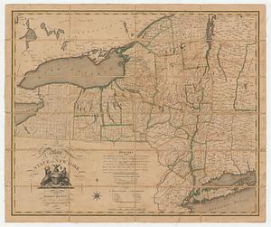
A map of the State of New York
162.
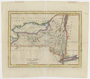
A map of the state of New York
163.
Map of the State of New-York : showing its water and rail road lines, Jany. 1854
164.
Map of the Troy & Greenfield Rail Road and its connections
165.
Map showing the comparative merits, and benefits to Massachusetts, of the proposed extension of the New York and Massachusetts...
166.
A new and accurate map of the present seat of war in North America
167.
New England and New York in 1697
168.
New York
169.
New York
170.
New York
171.
The official map of New York : compiled from United States government surveys, official state surveys, and other sources
172.
Part of the counties of Charlotte and Albany, in the province of New York; being the seat of war between the king's forces...
173.
Plan of the roads between Boston and Albany : survey'd by order of the governor in pursuance of a resolution of the General...
174.
Post road & Kaskutahook
175.
Post route map of the State of New York and parts of Vermont, Massachusetts, Connecticut, New Jersey, and Pennsylvania also the...
176.
Post route map of the State of New York and parts of Vermont, Massachusetts, Connecticut, New Jersey, and Pennsylvania also the...
177.
Post route map of the state of New York showing post offices with the intermediate distances on mail routes in operation on the...
178.
Post route map of the states of New Hampshire, Vermont, Massachusetts, Rhode Island, Connecticut, and parts of New York and Maine
179.
Rail road map of New England & eastern New York
180.
Rail road map of New England & eastern New York
‹ Prev
Next ›
1
2
…
5
6
7
8
9
10
11
12
13
…
15
16