Toggle navigation
LMEC Home
Exhibitions
Georeferencing
Tools for Teachers
Collections
My Favorites
Sign Up / Log In
Search
Search the map portal
Map Collection
Map Collection
Map Sets
Search
Search
Search for
Search In
All Fields
Creator
Title
Subject
Place
Search All Digital Collections
Advanced Search
186 Results
My Search
Start Over
More Like
commonwealth:z603vg310
Remove constraint More Like: commonwealth:z603vg310
Filter your Search
Place
North and Central America
152
United States
95
Maine
54
Canada
31
North America
17
West Indies
17
New England
13
New York
13
more
Place
»
Topic
Maine--Maps
55
United States--Maps
20
North America--Maps
17
West Indies--Maps
17
Canada--Maps
14
New England--Maps
14
New Hampshire--Maps
12
New York (State)--Maps
11
more
Topic
»
Date
Date range begin
–
Date range end
Current results range from
1750
to
1983
View distribution
Creator
Carleton, Osgood, 1742-1816
11
Reid, John, 1764?-1828
11
Farwell, John Whittemore, 1843-1929
9
Bellin, Jacques Nicolas, 1703-1772
8
Kitchin, Thomas, 1719-1784
8
Norman, John, 1748?-1817
8
Tanner, Benjamin, 1775-1848
6
Anderson, Alexander, 1775-1870
5
more
Creator
»
Format
Maps/Atlases
186
Manuscripts
11
Objects/Artifacts
1
Georeferenced
Yes
13
No
173
Collection
American Revolutionary War-Era Maps
146
American Antiquarian Society Collection
138
Norman B. Leventhal Map & Education Center Collection
37
Boston and New England Maps
32
William L. Clements Library Collection
6
Applied Geographics, Inc. Records
4
MacLean Collection Map Library
3
David Judkins Weaver Papers
2
more
Collection
»
Available to use
No known restrictions
37
Creative Commons license
2
Search Constraints
Sort by relevance
relevance
title
date (asc)
date (desc)
Number of results to display per page
20 per page
10
per page
20
per page
50
per page
100
per page
View results as:
grid view
map view
Search Results
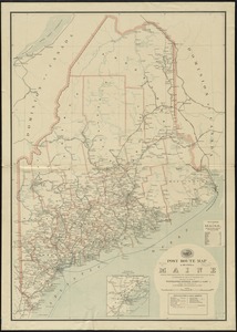
41.
Post route map of the state of Maine showing post offices with the intermediate distances on mail routes in operation on the...
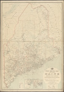
42.
Post route map of the state of Maine showing post offices with the intermediate distances on mail routes in operation on the...
43.
Province of Maine
44.
The province of Maine, from the best authorities
45.
Rand McNally official 1924 auto trails map Maine ; Rand McNally official 1924 auto trails map New Hampshire, Vermont
46.
Route and pictorial map of Maine
47.
Sketch of different passes into Canada from our lower provinces
48.
State of Maine
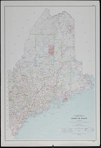
49.
State of Maine
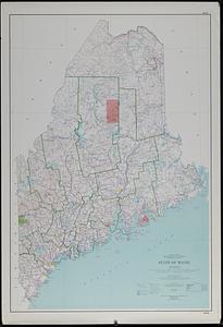
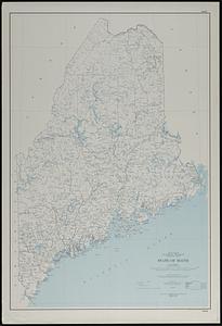
50.
State of Maine
51.
State of Maine : base map with highways and contours
52.
State of Maine : base map with highways and contours
53.
State of Maine : base map
54.
This plan of Kennebeck & Sagadahock Rivers & country adjacent
55.
Topographical map of the province of New Hampshire, including Montresor's survey of the St. Lawrence and the Kennebec route to...
56.
1st. sheet of De Witt's state-map of New York
57.
An accurate map of North America
58.
An Accurate map of the United States of America. : According to the Treaty of Peace of 1783
59.
An accurate map of the West Indies, : containing the Bahama & Carribe islands, the Great & Little Antilles, with the Leward and...
60.
An accurate map of the West Indies
‹ Prev
Next ›
1
2
3
4
5
6
7
…
9
10