Toggle navigation
LMEC Home
Exhibitions
Georeferencing
Tools for Teachers
Collections
My Favorites
Sign Up / Log In
Search
Search the map portal
Map Collection
Map Collection
Map Sets
Search
Search
Search for
Search In
All Fields
Creator
Title
Subject
Place
Search All Digital Collections
Advanced Search
1241 Results
My Search
Start Over
More Like
commonwealth:z603vg02j
Remove constraint More Like: commonwealth:z603vg02j
Filter your Search
Place
North and Central America
1,202
United States
1,109
Suffolk (county)
760
Boston
754
Massachusetts
690
New York
95
Boston Harbor
67
New Jersey
54
more
Place
»
Topic
Boston (Mass.)--Maps
752
United States--History--Revolution, 1775-1783--Maps
330
City planning--Massachusetts--Boston--Maps
105
Real property--Massachusetts--Boston--Maps
99
Landowners--Massachusetts--Boston--Maps
74
Boston Harbor (Mass.)--Maps
67
Urban renewal--Massachusetts--Boston--Maps
63
Massachusetts--Maps
52
more
Topic
»
Date
Date range begin
–
Date range end
Current results range from
1708
to
2023
View distribution
Creator
Boston Redevelopment Authority
114
Geo. H. Walker & Co
28
Boynton, George W., d. 1884
21
Sampson, Davenport & Co
21
Sampson, Murdock & Co
20
Bromley, George Washington
18
Bromley, Walter Scott
17
Clinton, Henry, Sir, 1738?-1795
17
more
Creator
»
Format
Maps/Atlases
1,236
Manuscripts
25
Drawings/Illustrations
5
Posters
1
Georeferenced
Yes
108
No
1,133
Collection
Norman B. Leventhal Map & Education Center Collection
662
Boston and New England Maps
623
Urban Maps
493
American Revolutionary War-Era Maps
466
William L. Clements Library Collection
310
American Antiquarian Society Collection
138
Boston Redevelopment Authority Collection
121
Mapping Boston Collection
27
more
Collection
»
Available to use
No known restrictions
729
Creative Commons license
46
Search Constraints
Sort by relevance
relevance
title
date (asc)
date (desc)
Number of results to display per page
20 per page
10
per page
20
per page
50
per page
100
per page
View results as:
grid view
map view
Search Results
181.
Part of modern Brunswick County
182.
Part of modern Brunswick County
183.
Part of modern Charleston County
184.
Part of modern Monmouth County, 1778
185.
Part of modern Westchester County
186.
Part of modern Westchester County
187.
Part of Monmouth County, New Jersey
188.
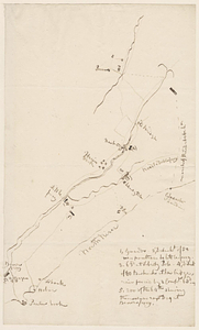
Part of the city of New York, 27th Augt: 1778 [and] part of Long Island
189.
Part of the counties of Charlotte and Albany, in the province of New York; being the seat of war between the king's forces...
190.
Part of the modern counties of Burlington and Camden, New Jersey
191.
Part of the modern counties of Currituck, Camden, and Pasquotank, North Carolina
192.
Part of the modern counties of Dutchess, Putnam, and Westchester
193.
Part of the modern counties of Essex and Hudson, New Jersey
194.
Part of the modern counties of Hudson and Bergen, New Jersey
195.
Part of the modern counties of Litchfield and Fairfield, Connecticut, and Westchester and Putnam, New York
196.
Part of the modern counties of Manhattan, Westchester and Queens
197.
Part of the modern counties of Monmouth, Middlesex, Somerset, Hunterdon, Mercer, Burlington, and Ocean in New Jersey and...
198.
Part of the modern counties of Princess Anne, Norfolk, and Nansemond, Virginia
199.
Part of the modern counties of Union and Middlesex, New Jersey
200.
Part of the modern counties of Union, Middlesex, and Somerset, New Jersey and Staten Island, New York
‹ Prev
Next ›
1
2
…
6
7
8
9
10
11
12
13
14
…
62
63

![Part of the city of New York, 27th Augt: 1778 [and] part of Long Island](https://bpldcassets.blob.core.windows.net/derivatives/metadata/commonwealth-oai:6d573t30q/image_thumbnail_300.jpg)