Toggle navigation
LMEC Home
Exhibitions
Georeferencing
Tools for Teachers
Collections
My Favorites
Sign Up / Log In
Search
Search the map portal
Map Collection
Map Collection
Map Sets
Search
Search
Search for
Search In
All Fields
Creator
Title
Subject
Place
Search All Digital Collections
Advanced Search
8873 Results
My Search
Start Over
More Like
commonwealth:xw42qq88h
Remove constraint More Like: commonwealth:xw42qq88h
Filter your Search
Place
North and Central America
6,104
United States
5,020
Massachusetts
2,139
Europe
1,396
Suffolk (county)
1,219
Boston
1,192
Canada
449
Asia
438
more
Place
»
Topic
Boston (Mass.)--Maps
752
United States--Maps
282
Real property--Massachusetts--Boston--Maps
195
City planning--Massachusetts--Boston--Maps
168
Massachusetts--Maps
166
Landowners--Massachusetts--Boston--Maps
142
New England--Maps
104
North America--Maps--Early works to 1800
103
more
Topic
»
Date
Date range begin
–
Date range end
Current results range from
1482
to
2023
View distribution
Creator
United States. Hydrographic Office
595
Boston Redevelopment Authority
171
O.H. Bailey & Co
148
Des Barres, Joseph F. W. (Joseph Frederick Wallet), 1722-1824
124
United States. Post Office Dept
120
Ptolemy, 2nd cent
100
Walling, Henry Francis, 1825-1888
94
Geological Survey (U.S.)
87
more
Creator
»
Format
Maps/Atlases
8,813
Manuscripts
215
Prints
56
Books
36
Objects/Artifacts
10
Drawings/Illustrations
8
Posters
5
Georeferenced
Yes
885
No
7,988
Collection
Norman B. Leventhal Map & Education Center Collection
8,723
Boston and New England Maps
2,369
Urban Maps
2,152
Maritime Charts and Atlases
1,083
American Revolutionary War-Era Maps
638
Boston Redevelopment Authority Collection
203
Mapping Boston Collection
20
Massachusetts Real Estate Atlases
12
more
Collection
»
Available to use
No known restrictions
8,676
Creative Commons license
70
Search Constraints
Sort by relevance
relevance
title
date (asc)
date (desc)
Number of results to display per page
20 per page
10
per page
20
per page
50
per page
100
per page
View results as:
grid view
map view
Search Results
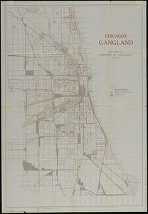
2181.
Chicago's gangland
2182.
Chickamauga and Chattanooga National Military Park and approaches
2183.
Chicopee River
2184.
[Chignecto Bay and vicinity]
2185.
Chikyū bankoku hōzu
2186.
Chili
2187.
Chili
2188.
Chili
2189.
Le Chili
2190.
China : waterways and stage routes
2191.
China
2192.
China
2193.
China : sheet IV south coast from Chauan Bay to Port Matheson including the Pescadore Islands
2194.
China : sheet V eastern coast from Port Matheson to Ragged Point
2195.
China : sheet VIII eastern coast Hieshan Isles to the Yang-Tse-Kiang including the Chusan Islands
2196.
China
2197.
China
2198.
China
2199.
China
2200.
China, divided into it's great provinces according to the best authorities
‹ Prev
Next ›
1
2
…
106
107
108
109
110
111
112
113
114
…
443
444