Toggle navigation
LMEC Home
Exhibitions
Georeferencing
Tools for Teachers
Collections
My Favorites
Sign Up / Log In
Search
Search the map portal
Map Collection
Map Collection
Map Sets
Search
Search
Search for
Search In
All Fields
Creator
Title
Subject
Place
Search All Digital Collections
Advanced Search
8769 Results
My Search
Start Over
More Like
commonwealth:x633j6818
Remove constraint More Like: commonwealth:x633j6818
Filter your Search
Place
North and Central America
6,000
United States
4,916
Massachusetts
2,087
Europe
1,396
Suffolk (county)
1,047
Boston
1,020
Canada
451
Asia
438
more
Place
»
Topic
Boston (Mass.)--Maps
587
United States--Maps
284
Real property--Massachusetts--Boston--Maps
175
Massachusetts--Maps
171
Landowners--Massachusetts--Boston--Maps
133
New England--Maps
108
North America--Maps--Early works to 1800
103
Europe--Maps
79
more
Topic
»
Date
Date range begin
–
Date range end
Current results range from
1482
to
2023
View distribution
Creator
United States. Hydrographic Office
595
O.H. Bailey & Co
148
Des Barres, Joseph F. W. (Joseph Frederick Wallet), 1722-1824
123
United States. Post Office Dept
120
Ptolemy, 2nd cent
100
Walling, Henry Francis, 1825-1888
94
Geological Survey (U.S.)
91
Jefferys, Thomas, -1771
86
more
Creator
»
Format
Maps/Atlases
8,709
Manuscripts
216
Prints
56
Books
36
Objects/Artifacts
10
Drawings/Illustrations
8
Posters
5
Georeferenced
Yes
872
No
7,897
Collection
Norman B. Leventhal Map & Education Center Collection
8,702
Boston and New England Maps
2,240
Urban Maps
2,023
Maritime Charts and Atlases
1,083
American Revolutionary War-Era Maps
680
Boston Redevelopment Authority Collection
87
William L. Clements Library Collection
35
Maps from AAS
25
more
Collection
»
Available to use
No known restrictions
8,559
Creative Commons license
49
Search Constraints
Sort by relevance
relevance
title
date (asc)
date (desc)
Number of results to display per page
20 per page
10
per page
20
per page
50
per page
100
per page
View results as:
grid view
map view
Search Results
121.
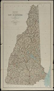
New Hampshire
122.
New Hampshire
123.
New Hampshire by recent survey : made under the supreme authority and published according to law
124.
New-Hampshire : from late survey
125.
Official map of the state of Virginia : from actual surveys by order of the executive, 1828 & 1859
126.
Post route map of the states of New Hampshire, Vermont showing post offices with the intermediate distances on mail routes in...
127.
Rand McNally official 1924 auto trails map Maine ; Rand McNally official 1924 auto trails map New Hampshire, Vermont
128.
Relief map of New Hampshire
129.
Seat of war in Virginia and Maryland
130.
Smith's topographical map of Virginia and Maryland
131.
The state of Maryland, from the best authorities
132.
The state of New Hampshire
133.
The state of New Hampshire : compiled chiefly from actual surveys
134.
State of West Virginia and part of Maryland : coal fields and producing districts
135.
Baton Rouge
136.
Breton Sound
137.
From Vicksburg to New Orleans
138.
Gallup's map of Louisiana
139.
Louisiana : Chef Menteur sheet
140.
Louisiana : Hahnville sheet
‹ Prev
Next ›
1
2
3
4
5
6
7
8
9
10
11
…
438
439