Toggle navigation
LMEC Home
Exhibitions
Georeferencing
Tools for Teachers
Collections
My Favorites
Sign Up / Log In
Search
Search the map portal
Map Collection
Map Collection
Map Sets
Search
Search
Search for
Search In
All Fields
Creator
Title
Subject
Place
Search All Digital Collections
Advanced Search
8769 Results
My Search
Start Over
More Like
commonwealth:x633j6818
Remove constraint More Like: commonwealth:x633j6818
Filter your Search
Place
North and Central America
6,000
United States
4,916
Massachusetts
2,087
Europe
1,396
Suffolk (county)
1,047
Boston
1,020
Canada
451
Asia
438
more
Place
»
Topic
Boston (Mass.)--Maps
587
United States--Maps
284
Real property--Massachusetts--Boston--Maps
175
Massachusetts--Maps
171
Landowners--Massachusetts--Boston--Maps
133
New England--Maps
108
North America--Maps--Early works to 1800
103
Europe--Maps
79
more
Topic
»
Date
Date range begin
–
Date range end
Current results range from
1482
to
2023
View distribution
Creator
United States. Hydrographic Office
595
O.H. Bailey & Co
148
Des Barres, Joseph F. W. (Joseph Frederick Wallet), 1722-1824
123
United States. Post Office Dept
120
Ptolemy, 2nd cent
100
Walling, Henry Francis, 1825-1888
94
Geological Survey (U.S.)
91
Jefferys, Thomas, -1771
86
more
Creator
»
Format
Maps/Atlases
8,709
Manuscripts
216
Prints
56
Books
36
Objects/Artifacts
10
Drawings/Illustrations
8
Posters
5
Georeferenced
Yes
872
No
7,897
Collection
Norman B. Leventhal Map & Education Center Collection
8,702
Boston and New England Maps
2,240
Urban Maps
2,023
Maritime Charts and Atlases
1,083
American Revolutionary War-Era Maps
680
Boston Redevelopment Authority Collection
87
William L. Clements Library Collection
35
Maps from AAS
25
more
Collection
»
Available to use
No known restrictions
8,559
Creative Commons license
49
Search Constraints
Sort by relevance
relevance
title
date (asc)
date (desc)
Number of results to display per page
20 per page
10
per page
20
per page
50
per page
100
per page
View results as:
grid view
map view
Search Results
81.
Railroad map of Illinois
82.
State of Illinois
83.
State of Illinois
84.
State of Illinois coal fields and producing districts
85.
Coast of North Carolina & Virginia
86.
Colton's new topographical map of the eastern portion of the State of North Carolina with part of Virginia & South Carolina...
87.
Colton's new topographical map of the eastern portion of the State of North Carolina with part of Virginia & South Carolina...
88.
Colton's North Carolina
89.
J.H. Colton's topographical map of North and South Carolina : a large portion of Georgia & part of adjoining states
90.
Map of North Carolina
91.
Map of North Carolina
92.
Middle Virginia and North Carolina
93.
Mountain region of North Carolina and Tennessee
94.
Mountain region of North Carolina and Tennessee
95.
Mountain region of North Carolina and Tennessee
96.
North Carolina
97.
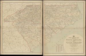
North Carolina & South Carolina
98.
Physiographical map of North Carolina
99.
Post route map of the states of North Carolina and South Carolina showing post offices with the intermediate distances and mail...
100.
Post route map of the states of North Carolina and South Carolina showing post offices with the intermediate distances and mail...
‹ Prev
Next ›
1
2
3
4
5
6
7
8
9
…
438
439