Toggle navigation
LMEC Home
Exhibitions
Georeferencing
Tools for Teachers
Collections
My Favorites
Sign Up / Log In
Search
Search the map portal
Map Collection
Map Collection
Map Sets
Search
Search
Search for
Search In
All Fields
Creator
Title
Subject
Place
Search All Digital Collections
Advanced Search
8582 Results
My Search
Start Over
More Like
commonwealth:x633f9693
Remove constraint More Like: commonwealth:x633f9693
Filter your Search
Place
North and Central America
5,845
United States
4,769
Massachusetts
2,052
Europe
1,360
Suffolk (county)
1,034
Boston
1,007
Canada
448
Asia
423
more
Place
»
Topic
Boston (Mass.)--Maps
577
United States--Maps
273
Real property--Massachusetts--Boston--Maps
174
Massachusetts--Maps
160
Landowners--Massachusetts--Boston--Maps
132
North America--Maps--Early works to 1800
103
New England--Maps
99
Europe--Maps
79
more
Topic
»
Date
Date range begin
–
Date range end
Current results range from
1482
to
2023
View distribution
Creator
United States. Hydrographic Office
594
O.H. Bailey & Co
148
Des Barres, Joseph F. W. (Joseph Frederick Wallet), 1722-1824
123
United States. Post Office Dept
120
Ptolemy, 2nd cent
100
Walling, Henry Francis, 1825-1888
94
Geological Survey (U.S.)
86
Jefferys, Thomas, -1771
85
more
Creator
»
Format
Maps/Atlases
8,523
Manuscripts
214
Prints
56
Books
36
Objects/Artifacts
10
Drawings/Illustrations
8
Posters
4
Georeferenced
Yes
869
No
7,713
Collection
Norman B. Leventhal Map & Education Center Collection
8,569
Boston and New England Maps
2,204
Urban Maps
1,936
Maritime Charts and Atlases
1,081
American Revolutionary War-Era Maps
615
Boston Redevelopment Authority Collection
87
Mapping Boston Collection
19
Sidney R. Knafel Map Collection at Phillips Academy
13
Available to use
No known restrictions
8,409
Creative Commons license
65
Search Constraints
Sort by relevance
relevance
title
date (asc)
date (desc)
Number of results to display per page
20 per page
10
per page
20
per page
50
per page
100
per page
View results as:
grid view
map view
Search Results
7341.
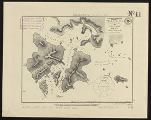
South America-- Magellan Strait, Desolation I., Week Islands : from a British survey in 1830
7342.
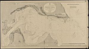
South America, Magellan Strait from the eastern entrance to the First Narrows : compiled from the most recent surveys to 1883
7343.
South America, Magellan Strait from the First Narrows to Broad Reach : compiled from the most recent surveys to 1883
7344.
South America, north coast of Colombia and Venezuela, Gulf of Darien to Puerto Cabello : compiled from the latest information 1886
7345.
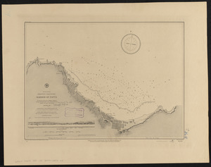
South America, north-west coast of Peru, harbor of Payta
7346.
South America, ports in Desolation and Sta. Ines Is. : from British surveys corrected to 1877
7347.
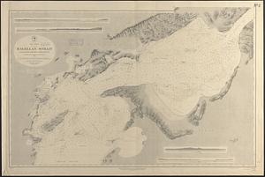
South America, ports in the Strait of Magellan : from British surveys corrected to 1877
7348.
South America, ports on the south side of Tierra del Fuego : from British surveys corrected to 1877
7349.
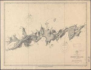
South America, Staten Island : from a British survey
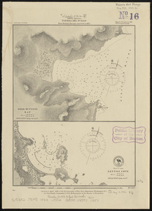
7350.
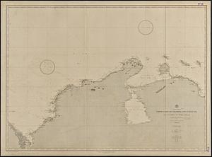
South America, Tierra del Fuego : from British surveys corrected to 1877
7351.
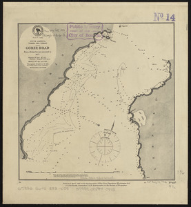
South America, Tierra del Fuego, Goree Road : from a British survey corrected to 1877
7352.
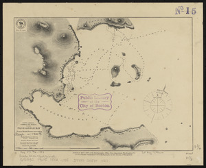
South America, Tierra del Fuego, Packsaddle Bay : from a British survey corrected to 1877
7353.
South America, United States of Colombia, Bahia Honda : from an old Spanish plan 1886
7354.
South America, United States of Colombia, Candelaria Bay : from an old Spanish plan 1886
7355.
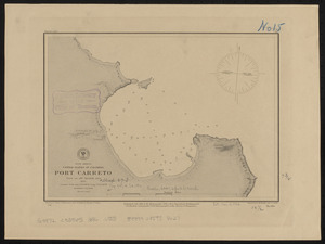
South America, United States of Colombia, Port Carreto : from an old Spanish plan 1886
7356.
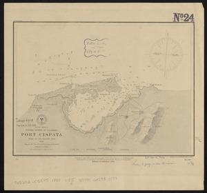
South America, United States of Colombia, Port Cispata, from an old Spanish plan, 1886
7357.
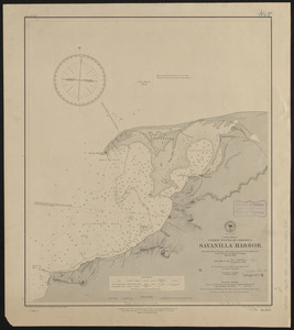
South America, United States of Colombia, Savanilla Harbor : from the latest surveys with corrections by U.S.S. Albatross,...
7358.
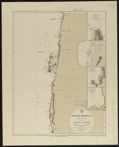
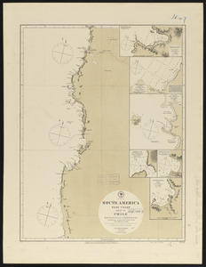
South America, west coast : republication of Brit. Admty. chart no. 1374, with additions to 1876
7359.
South America, west coast : republication of Brit. Admty. chart no. 1277, with additions to 1876
7360.
South America, west coast : republication of Brit. Admty. chart no. 1287, with additions to 1876
‹ Prev
Next ›
1
2
…
364
365
366
367
368
369
370
371
372
…
429
430