Toggle navigation
LMEC Home
Exhibitions
Georeferencing
Tools for Teachers
Collections
My Favorites
Sign Up / Log In
Search
Search the map portal
Map Collection
Map Collection
Map Sets
Search
Search
Search for
Search In
All Fields
Creator
Title
Subject
Place
Search All Digital Collections
Advanced Search
8582 Results
My Search
Start Over
More Like
commonwealth:x633f9693
Remove constraint More Like: commonwealth:x633f9693
Filter your Search
Place
North and Central America
5,845
United States
4,769
Massachusetts
2,052
Europe
1,360
Suffolk (county)
1,034
Boston
1,007
Canada
448
Asia
423
more
Place
»
Topic
Boston (Mass.)--Maps
577
United States--Maps
273
Real property--Massachusetts--Boston--Maps
174
Massachusetts--Maps
160
Landowners--Massachusetts--Boston--Maps
132
North America--Maps--Early works to 1800
103
New England--Maps
99
Europe--Maps
79
more
Topic
»
Date
Date range begin
–
Date range end
Current results range from
1482
to
2023
View distribution
Creator
United States. Hydrographic Office
594
O.H. Bailey & Co
148
Des Barres, Joseph F. W. (Joseph Frederick Wallet), 1722-1824
123
United States. Post Office Dept
120
Ptolemy, 2nd cent
100
Walling, Henry Francis, 1825-1888
94
Geological Survey (U.S.)
86
Jefferys, Thomas, -1771
85
more
Creator
»
Format
Maps/Atlases
8,523
Manuscripts
214
Prints
56
Books
36
Objects/Artifacts
10
Drawings/Illustrations
8
Posters
4
Georeferenced
Yes
869
No
7,713
Collection
Norman B. Leventhal Map & Education Center Collection
8,569
Boston and New England Maps
2,204
Urban Maps
1,936
Maritime Charts and Atlases
1,081
American Revolutionary War-Era Maps
615
Boston Redevelopment Authority Collection
87
Mapping Boston Collection
19
Sidney R. Knafel Map Collection at Phillips Academy
13
Available to use
No known restrictions
8,409
Creative Commons license
65
Search Constraints
Sort by relevance
relevance
title
date (asc)
date (desc)
Number of results to display per page
20 per page
10
per page
20
per page
50
per page
100
per page
View results as:
grid view
map view
Search Results
7321.
South America
7322.
South America
7323.
South America
7324.
South America : corrected from the observation communicated to the Royal Societys of London & Paris
7325.
South America
7326.
South America : reduced from the sheet map
7327.
South America
7328.
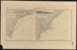
South America, anchorages in Magellan Strait : from the most recent British surveys
7329.
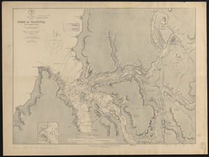
South America, Chile, Port of Valdivia and approaches : from a Chilean government survey in 1868-70 corrected to 1882
7330.
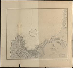
South America, Chili, Valparaiso Bay : from a Chilian survey in 1877
7331.
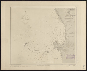
South America, coast of Peru, Ancon Bay : from an Italian survey in 1883
7332.
South America, coast of Peru, Callao Bay and vicinity : from a British survey in 1840, and a French survey in 1876
7333.
South America, coast of Peru, Pisco Bay : from the latest French and English charts, 1885
7334.
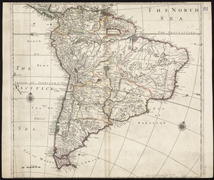
South America divided into its IIII principall parts : I Spanish part: vizt. Firmland, Guiana, Peru, Chili, pt of the country...
7335.
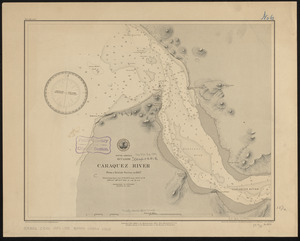
South America, Ecuador, Caraquez River : from a British survey in 1847
7336.
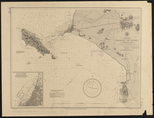
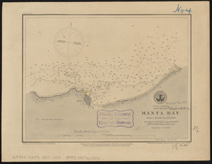
South America, Ecuador, Manta Bay : from a British survey in 1876
7337.
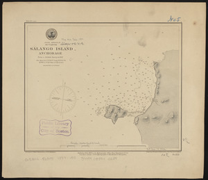
South America, Ecuador, Salango Island anchorage : from a British survey in 1847
7338.
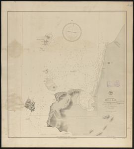
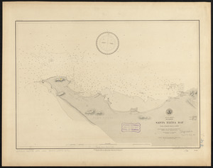
South America, Ecuador, Santa Eléna Bay : from a British survey in 1847
7339.
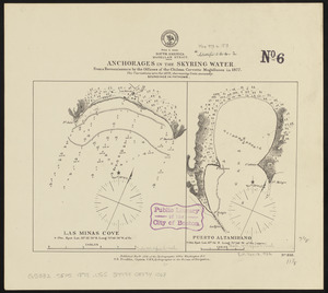
South America, Magellan Strait, anchorages in the Skyring Water : from a reconnaissance by the officers of the Chilean corvette...
7340.
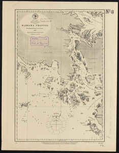
South America, Magellan Strait, Barbara Channel : from British surveys corrected to 1878
‹ Prev
Next ›
1
2
…
363
364
365
366
367
368
369
370
371
…
429
430