Toggle navigation
LMEC Home
Exhibitions
Georeferencing
Tools for Teachers
Collections
My Favorites
Sign Up / Log In
Search
Search the map portal
Map Collection
Map Collection
Map Sets
Search
Search
Search for
Search In
All Fields
Creator
Title
Subject
Place
Search All Digital Collections
Advanced Search
8712 Results
My Search
Start Over
More Like
commonwealth:wd376798v
Remove constraint More Like: commonwealth:wd376798v
Filter your Search
Place
North and Central America
5,941
United States
4,867
Massachusetts
2,088
Europe
1,392
Suffolk (county)
1,072
Boston
1,045
Canada
450
Asia
437
more
Place
»
Topic
Boston (Mass.)--Maps
582
United States--Maps
279
Real property--Massachusetts--Boston--Maps
175
Massachusetts--Maps
161
Landowners--Massachusetts--Boston--Maps
133
North America--Maps--Early works to 1800
105
New England--Maps
101
Europe--Maps
79
more
Topic
»
Date
Date range begin
–
Date range end
Current results range from
1482
to
2023
View distribution
Creator
United States. Hydrographic Office
595
O.H. Bailey & Co
148
Des Barres, Joseph F. W. (Joseph Frederick Wallet), 1722-1824
125
United States. Post Office Dept
120
Ptolemy, 2nd cent
100
Walling, Henry Francis, 1825-1888
94
Geological Survey (U.S.)
86
Jefferys, Thomas, -1771
86
more
Creator
»
Format
Maps/Atlases
8,650
Manuscripts
221
Prints
56
Books
36
Drawings/Illustrations
10
Objects/Artifacts
10
Posters
5
Georeferenced
Yes
875
No
7,837
Collection
Norman B. Leventhal Map & Education Center Collection
8,665
Boston and New England Maps
2,239
Urban Maps
1,998
Maritime Charts and Atlases
1,090
American Revolutionary War-Era Maps
673
Boston Redevelopment Authority Collection
87
Richard H. Brown Revolutionary War Map Collection at Mount Vernon
20
Mapping Boston Collection
19
more
Collection
»
Available to use
No known restrictions
8,508
Creative Commons license
103
Search Constraints
Sort by relevance
relevance
title
date (asc)
date (desc)
Number of results to display per page
20 per page
10
per page
20
per page
50
per page
100
per page
View results as:
grid view
map view
Search Results
61.
A plan of the town of Boston, with the intrenchments &c. of His Majestys forces in 1775 : from the observations of Lieut. Page...
62.
[The burnt ruins of Charlestown from across the Charles River]
63.
[Troops on parade, the Charles River and Castle Island]
64.
Carte de l'Amérique Septle. pour servir à l'intelligence de la guerre entre les Anglois et les insurgents
65.
Carte de l'Amerique Sept.le pour servir à l'intelligence de la guerre entre les anglois et les insurgents : dédiée à M.gr de...
66.
Carte des Etats-Unis d'Amérique, et du cours du Mississippi : rédigée d'après différentes cartes et relations Anglaises et...
67.
Carte des Etats-Unis de l'Amerique suivant le Traité de Paix de 1783
68.
Carte des Etats-Unis de l'Amerique suivant le traité de paix de 1783 : dédiée et présentée a s. excellence M.r Benjamin...
69.
Carte générale des colonies Angloises : dans l'Amérique Septentrionale
70.
Carte generale des colonies angloises dans l'Amerique Septentrionale pour l'intelligence de la guerre presente : d'apres des...
71.
Carte generale des colonies angloises dans l'Amerique Septentrionale pour l'intelligence de la guerre presente : d'apres des...
72.
The Country twenty five miles round New York
73.
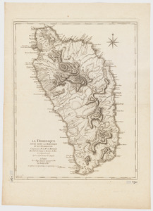
La Dominique située entre La Martinique et La Guadeloupe : conquise par M. le Mis. de Bouillé Marechal des camps et armées du...
74.
Karte von Neu England, Neu Yorck und Pensilvanien
75.
Map for the interior travels through America : delineating the march of the army
76.
A MAP of the BRITISH COLONIES in North America : WITH THE Roads, Distances, Limits, and Extent of the SETTLEMENTS, Humbly...
77.
A new and accurate map of the present seat of war in North America : from a late survey
78.
A new and correct map of North America : in which the places of the principal engagements during the present war are accurately...
79.
A new and correct map of North America : in which the places of the principal engagements during the present war are accurately...
80.
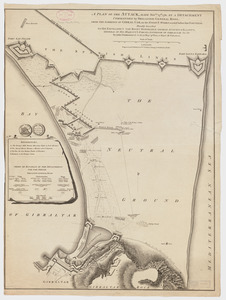
A plan of the attack made Nov.ber 27t. 1781 : by a detachment commanded by Brigadier-General Ross, from the Garrison of...
‹ Prev
Next ›
1
2
3
4
5
6
7
8
…
435
436

![[The burnt ruins of Charlestown from across the Charles River]](https://bpldcassets.blob.core.windows.net/derivatives/images/commonwealth:dz010v71m/image_thumbnail_300.jpg)
![[Troops on parade, the Charles River and Castle Island]](https://bpldcassets.blob.core.windows.net/derivatives/images/commonwealth:dz010v69k/image_thumbnail_300.jpg)