Toggle navigation
LMEC Home
Exhibitions
Georeferencing
Tools for Teachers
Collections
My Favorites
Sign Up / Log In
Search
Search the map portal
Map Collection
Map Collection
Map Sets
Search
Search
Search for
Search In
All Fields
Creator
Title
Subject
Place
Search All Digital Collections
Advanced Search
8712 Results
My Search
Start Over
More Like
commonwealth:wd376798v
Remove constraint More Like: commonwealth:wd376798v
Filter your Search
Place
North and Central America
5,941
United States
4,867
Massachusetts
2,088
Europe
1,392
Suffolk (county)
1,072
Boston
1,045
Canada
450
Asia
437
more
Place
»
Topic
Boston (Mass.)--Maps
582
United States--Maps
279
Real property--Massachusetts--Boston--Maps
175
Massachusetts--Maps
161
Landowners--Massachusetts--Boston--Maps
133
North America--Maps--Early works to 1800
105
New England--Maps
101
Europe--Maps
79
more
Topic
»
Date
Date range begin
–
Date range end
Current results range from
1482
to
2023
View distribution
Creator
United States. Hydrographic Office
595
O.H. Bailey & Co
148
Des Barres, Joseph F. W. (Joseph Frederick Wallet), 1722-1824
125
United States. Post Office Dept
120
Ptolemy, 2nd cent
100
Walling, Henry Francis, 1825-1888
94
Geological Survey (U.S.)
86
Jefferys, Thomas, -1771
86
more
Creator
»
Format
Maps/Atlases
8,650
Manuscripts
221
Prints
56
Books
36
Drawings/Illustrations
10
Objects/Artifacts
10
Posters
5
Georeferenced
Yes
875
No
7,837
Collection
Norman B. Leventhal Map & Education Center Collection
8,665
Boston and New England Maps
2,239
Urban Maps
1,998
Maritime Charts and Atlases
1,090
American Revolutionary War-Era Maps
673
Boston Redevelopment Authority Collection
87
Richard H. Brown Revolutionary War Map Collection at Mount Vernon
20
Mapping Boston Collection
19
more
Collection
»
Available to use
No known restrictions
8,508
Creative Commons license
103
Search Constraints
Sort by relevance
relevance
title
date (asc)
date (desc)
Number of results to display per page
20 per page
10
per page
20
per page
50
per page
100
per page
View results as:
grid view
map view
Search Results
21.
Carte des Etats-Unis de l'Amerique suivant le Traité de Paix de 1783
22.
Carte du théatre de la guerre entre les Anglais et les Américains
23.
A general map of the southern British colonies in America comprehending North and South Carolina, Georgia, East and West...
24.
Map for the interior travels through America, delineating the march of the army
25.
A new and accurate map of the present seat of war in North America
26.
Partie de l'Amerique Septentrionale, qui comprend le Canada, la Louisiane, le Labrador, le Groenland, la Nouvelle Angleterre,...
27.
Plan der landung der Gebrüdere Howe, bey dem ausfluss des Elk Strom ...Lords Cornwallis
28.
Plan of the town of Boston, with the attack on Bunkers-Hill, in the peninsula of Charlestown, the 17th of June, 1775
29.
The provinces of New York and New Jersey : with part of Pensilvania, and the Province of Quebec
30.
Theatre de la guerre en Amerique
31.
Théatre de la guerre en Amerique, avec les Isles Antilles : projetté et assujettie aux observations
32.
Théatre de la guerre en Amerique, avec les Isles Antilles : projetté et assujettie aux observations
33.
The theatre of war in North America, with the roads, and tables, of the superficial contents, distances, &ca
34.
Carta rappresentante il porto di Boston
35.
Carte du port et havre de Boston avec les côtes adjacentes, dans laquel on a tracée les camps et les retranchemens occupé,...
36.
A chart of the Harbour of Boston, with the soundings, sailing-marks, and other directions
37.
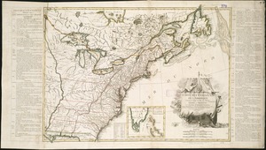
A map of the most inhabited part of New England : containing the provinces of Massachusets Bay and New Hampshire, with the...
38.
Boston
39.
A chart of the coast of New England, from Beverly to Scituate harbour, including the ports of Boston and Salem
40.
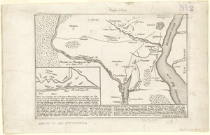
Die gegend um Boston
‹ Prev
Next ›
1
2
3
4
5
6
…
435
436