Toggle navigation
LMEC Home
Exhibitions
Georeferencing
Tools for Teachers
Collections
My Favorites
Sign Up / Log In
Search
Search the map portal
Map Collection
Map Collection
Map Sets
Search
Search
Search for
Search In
All Fields
Creator
Title
Subject
Place
Search All Digital Collections
Advanced Search
8939 Results
My Search
Start Over
More Like
commonwealth:wd376704k
Remove constraint More Like: commonwealth:wd376704k
Filter your Search
Place
North and Central America
6,170
United States
5,074
Massachusetts
2,209
Europe
1,396
Suffolk (county)
1,215
Boston
1,188
Canada
450
Asia
438
more
Place
»
Topic
Boston (Mass.)--Maps
752
United States--Maps
282
Massachusetts--Maps
235
Real property--Massachusetts--Boston--Maps
195
City planning--Massachusetts--Boston--Maps
162
Landowners--Massachusetts--Boston--Maps
142
New England--Maps
106
North America--Maps--Early works to 1800
103
more
Topic
»
Date
Date range begin
–
Date range end
Current results range from
1482
to
2023
View distribution
Creator
United States. Hydrographic Office
595
Boston Redevelopment Authority
168
O.H. Bailey & Co
148
Des Barres, Joseph F. W. (Joseph Frederick Wallet), 1722-1824
124
United States. Post Office Dept
120
Ptolemy, 2nd cent
100
Walling, Henry Francis, 1825-1888
95
Geological Survey (U.S.)
92
more
Creator
»
Format
Maps/Atlases
8,878
Manuscripts
217
Prints
56
Books
36
Objects/Artifacts
10
Drawings/Illustrations
8
Posters
5
Ephemera
1
Georeferenced
Yes
894
No
8,045
Collection
Norman B. Leventhal Map & Education Center Collection
8,766
Boston and New England Maps
2,410
Urban Maps
2,148
Maritime Charts and Atlases
1,083
American Revolutionary War-Era Maps
657
Boston Redevelopment Authority Collection
200
David Judkins Weaver Papers
22
Mapping Boston Collection
22
more
Collection
»
Available to use
No known restrictions
8,714
Creative Commons license
73
Search Constraints
Sort by relevance
relevance
title
date (asc)
date (desc)
Number of results to display per page
20 per page
10
per page
20
per page
50
per page
100
per page
View results as:
grid view
map view
Search Results
5061.
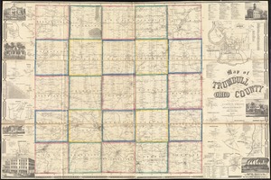
Map of Trumbull County, Ohio
5062.
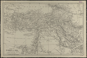
A map of Turkey in Asia
5063.
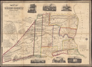
Map of Union County, Pennsylvania : entirely from original surveys
5064.
A map of Upper and Lower Canada : with part of the United States adjoining, comprising the present seat of war
5065.
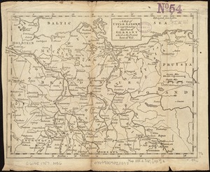
A map of Upper Saxony comprehending that part of Germany which is the present seat of war
5066.
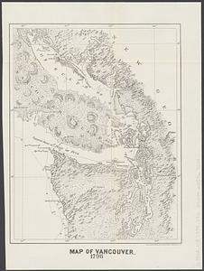
Map of Vancouver : 1798
5067.
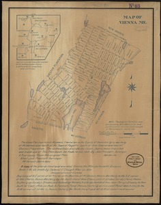
Map of Vienna, Me
5068.
A map of Virginia and Maryland
5069.
Map of Virginia and Maryland, constructed from the latest authorities
5070.
Map of Virginia and West Va., North and part of South Carolina, Maryland and Delaware, showing the situation in these states of...
5071.
Map of Virginia and West Virginia
5072.
Map of Virginia, West Virginia and Ohio : showing Norfolk and Western Railway : main line branches and connections
5073.
[Map of W. Dall's lots in Athens County, Washington County, and Gallia County, Ohio]
5074.
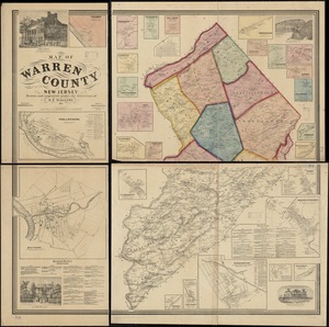
Map of Warren County, New Jersey
5075.
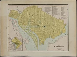
Map of Washington
5076.
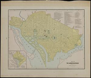
Map of Washington ; map of Cincinnati
5077.
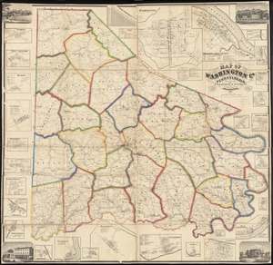
Map of Washington Co., Pennsylvania : from actual surveys
5078.
Map of Washington County, Ohio
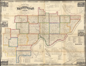
5079.
Map of Washington County, Vermont
5080.
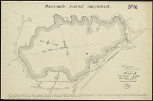
Map of Webster Lake, Franklin, N.H
‹ Prev
Next ›
1
2
…
250
251
252
253
254
255
256
257
258
…
446
447


![[Map of W. Dall's lots in Athens County, Washington County, and Gallia County, Ohio]](https://bpldcassets.blob.core.windows.net/derivatives/images/commonwealth:w9505s00n/image_thumbnail_300.jpg)