Toggle navigation
LMEC Home
Exhibitions
Georeferencing
Tools for Teachers
Collections
My Favorites
Sign Up / Log In
Search
Search the map portal
Map Collection
Map Collection
Map Sets
Search
Search
Search for
Search In
All Fields
Creator
Title
Subject
Place
Search All Digital Collections
Advanced Search
8863 Results
My Search
Start Over
More Like
commonwealth:wd376664t
Remove constraint More Like: commonwealth:wd376664t
Filter your Search
Place
North and Central America
6,094
United States
5,010
Massachusetts
2,136
Europe
1,396
Suffolk (county)
1,207
Boston
1,180
Canada
449
Asia
438
more
Place
»
Topic
Boston (Mass.)--Maps
752
United States--Maps
282
Real property--Massachusetts--Boston--Maps
195
Massachusetts--Maps
166
City planning--Massachusetts--Boston--Maps
157
Landowners--Massachusetts--Boston--Maps
142
New England--Maps
104
North America--Maps--Early works to 1800
103
more
Topic
»
Date
Date range begin
–
Date range end
Current results range from
1482
to
2023
View distribution
Creator
United States. Hydrographic Office
595
Boston Redevelopment Authority
162
O.H. Bailey & Co
148
Des Barres, Joseph F. W. (Joseph Frederick Wallet), 1722-1824
124
United States. Post Office Dept
120
Ptolemy, 2nd cent
100
Walling, Henry Francis, 1825-1888
94
Geological Survey (U.S.)
87
more
Creator
»
Format
Maps/Atlases
8,803
Manuscripts
215
Prints
56
Books
36
Objects/Artifacts
10
Drawings/Illustrations
8
Posters
5
Georeferenced
Yes
885
No
7,978
Collection
Norman B. Leventhal Map & Education Center Collection
8,725
Boston and New England Maps
2,359
Urban Maps
2,141
Maritime Charts and Atlases
1,083
American Revolutionary War-Era Maps
638
Boston Redevelopment Authority Collection
191
Mapping Boston Collection
20
Massachusetts Real Estate Atlases
12
more
Collection
»
Available to use
No known restrictions
8,666
Creative Commons license
70
Search Constraints
Sort by relevance
relevance
title
date (asc)
date (desc)
Number of results to display per page
20 per page
10
per page
20
per page
50
per page
100
per page
View results as:
grid view
map view
Search Results
1541.
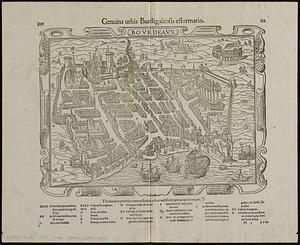
Bovrdeavx
1542.
Bowles's map of the seat of war in New England, comprehending the provinces of Massachusets Bay, and New Hampshire : with the...
1543.
Bowles's new map of the River Thames, from it's spring in Gloucester-shire, to it's influx into the sea : with a table of all...
1544.
Bowles's new one-sheet map of the independent states of Virginia, Maryland, Delaware, Pensylvania, New Jersey, New York,...
1545.
Boyle and Mercer counties
1546.
Boylston Street : Fenway to Massachusetts Avenue
1547.
Boylston Street improvements
1548.
Bradford, Massachusetts
1549.
Bradshaw's map of Europe shewing the railways opened and in progress
1550.
Bradshaw's map of the railways, in Central Europe
1551.
Bradshaw's map of the Rhine from Rotterdam to Schafhausen
1552.
Bradshaw's new map of the railways in Great Britain for 1872
1553.
Bradshaw's plan of Paris, and map of the environs
1554.
Brasilia
1555.
Brattleboro, Vt : 1876
1556.
Brattleboro, Vt : 1886
1557.
Brazil : from official and other sources
1558.
Brazil, Bolivia, & Peru
1559.
Brésil : carte politique et économique
1560.
Brésil
‹ Prev
Next ›
1
2
…
74
75
76
77
78
79
80
81
82
…
443
444