Toggle navigation
LMEC Home
Exhibitions
Georeferencing
Tools for Teachers
Collections
My Favorites
Sign Up / Log In
Search
Search the map portal
Map Collection
Map Collection
Map Sets
Search
Search
Search for
Search In
All Fields
Creator
Title
Subject
Place
Search All Digital Collections
Advanced Search
8763 Results
My Search
Start Over
More Like
commonwealth:wd3763069
Remove constraint More Like: commonwealth:wd3763069
Filter your Search
Place
North and Central America
5,994
United States
4,904
Massachusetts
2,082
Europe
1,396
Suffolk (county)
1,045
Boston
1,018
Canada
463
Asia
438
more
Place
»
Topic
Boston (Mass.)--Maps
586
United States--Maps
282
Real property--Massachusetts--Boston--Maps
175
Massachusetts--Maps
162
Landowners--Massachusetts--Boston--Maps
133
North America--Maps--Early works to 1800
108
New England--Maps
102
New England--Maps--Early works to 1800
97
more
Topic
»
Date
Date range begin
–
Date range end
Current results range from
1482
to
2023
View distribution
Creator
United States. Hydrographic Office
595
O.H. Bailey & Co
148
Des Barres, Joseph F. W. (Joseph Frederick Wallet), 1722-1824
123
United States. Post Office Dept
120
Ptolemy, 2nd cent
100
Walling, Henry Francis, 1825-1888
94
Jefferys, Thomas, -1771
89
Geological Survey (U.S.)
86
more
Creator
»
Format
Maps/Atlases
8,703
Manuscripts
217
Prints
56
Books
36
Objects/Artifacts
10
Drawings/Illustrations
8
Posters
5
Georeferenced
Yes
875
No
7,888
Collection
Norman B. Leventhal Map & Education Center Collection
8,721
Boston and New England Maps
2,242
Urban Maps
2,023
Maritime Charts and Atlases
1,086
American Revolutionary War-Era Maps
652
Boston Redevelopment Authority Collection
87
Mapping Boston Collection
26
Sidney R. Knafel Map Collection at Phillips Academy
15
more
Collection
»
Available to use
No known restrictions
8,554
Creative Commons license
87
Search Constraints
Sort by relevance
relevance
title
date (asc)
date (desc)
Number of results to display per page
20 per page
10
per page
20
per page
50
per page
100
per page
View results as:
grid view
map view
Search Results
1.
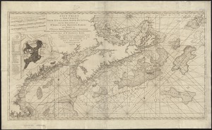
A new chart of the coast of New England, Nova Scotia, New France or Canada, with the islands of Newfoundld. Cape Breton St....
2.
An actual survey of the sea coast from New York to the I. Cape Brition : with tables of the direct and thwart courses &...
3.
A map of the coast of New England, from Staten Island to the island of Breton
4.
An actual survey of the sea coast from New York to the I. Cape Briton : with tables of the direct and thwart courses &...
5.
The American Pilot [title page]
6.
A chart of the sea coast of New Found Land, New Scotland, New England, New York, New Jersey, with Virginia and Maryland
7.
A chart of the West Indies from Cape Cod to the River Oronoque
8.
A new chart of the coast of New England, Nova Scotia, and the islands of St. Iohn, Cape Breton, Sable, the banks of St. Peters,...
9.
Pascaerte vande Vlaemsche, Soute, en Caribesche Eylanden, als mede Terra Nova, en de custen van Nova Francia, Nova Anglia, Nieu...
10.
Pascaerte vande Vlaemsche, Soute, en Caribesche Eylanden, als mede Terra Nova, en de custen van Nova Francia, Nova Anglia, Nieu...
11.
Carte du Canada ou de la Nouvelle France et des decouvertes qui y ont été faites
12.
Carte geographique de la Nouvelle Franse
13.
New Found Land, St. Laurence Bay, the fishing banks, Acadia, and part of New Scotland
14.
Partie orientale de la Nouvelle France ou du Canada
15.
Partie orientale de la Nouvelle France ou du Canada
16.
An authentic plan of the River St. Laurence, from Sillery to the Fall of Montmerenci : with the operations of the Siege of...
17.
An authentic plan of the River St. Laurence, from Sillery to the Fall of Montmorenci : with the operations of the Siege of...
18.
An authentic plan of the River St. Laurence from Sillery to the fall of Montmorenci, with the operations of the siege of Quebec...
19.
[Bay of Seven Islands]
20.
[Chart of the coast of Quebec from the Riviere St. Jean to Grand Hermine Bay]
‹ Prev
Next ›
1
2
3
4
5
…
438
439


![The American Pilot [title page]](https://bpldcassets.blob.core.windows.net/derivatives/images/commonwealth:3f462z36r/image_thumbnail_300.jpg)


![[Bay of Seven Islands]](https://bpldcassets.blob.core.windows.net/derivatives/images/commonwealth:7h149v48t/image_thumbnail_300.jpg)
![[Chart of the coast of Quebec from the Riviere St. Jean to Grand Hermine Bay]](https://bpldcassets.blob.core.windows.net/derivatives/images/commonwealth:7h149v50v/image_thumbnail_300.jpg)