Toggle navigation
LMEC Home
Exhibitions
Georeferencing
Tools for Teachers
Collections
My Favorites
Sign Up / Log In
Search
Search the map portal
Map Collection
Map Collection
Map Sets
Search
Search
Search for
Search In
All Fields
Creator
Title
Subject
Place
Search All Digital Collections
Advanced Search
8772 Results
My Search
Start Over
More Like
commonwealth:wd3762152
Remove constraint More Like: commonwealth:wd3762152
Filter your Search
Place
North and Central America
6,003
United States
4,907
Massachusetts
2,151
Europe
1,396
Suffolk (county)
1,047
Boston
1,020
Canada
450
Asia
438
more
Place
»
Topic
Boston (Mass.)--Maps
590
United States--Maps
282
Massachusetts--Maps
235
Real property--Massachusetts--Boston--Maps
175
Landowners--Massachusetts--Boston--Maps
133
New England--Maps
104
North America--Maps--Early works to 1800
103
Europe--Maps
79
more
Topic
»
Date
Date range begin
–
Date range end
Current results range from
1482
to
2023
View distribution
Creator
United States. Hydrographic Office
595
O.H. Bailey & Co
148
Des Barres, Joseph F. W. (Joseph Frederick Wallet), 1722-1824
123
United States. Post Office Dept
120
Ptolemy, 2nd cent
100
Walling, Henry Francis, 1825-1888
95
Geological Survey (U.S.)
92
Jefferys, Thomas, -1771
85
more
Creator
»
Format
Maps/Atlases
8,711
Manuscripts
217
Prints
56
Books
36
Objects/Artifacts
10
Drawings/Illustrations
8
Posters
5
Ephemera
1
Georeferenced
Yes
879
No
7,893
Collection
Norman B. Leventhal Map & Education Center Collection
8,737
Boston and New England Maps
2,279
Urban Maps
2,023
Maritime Charts and Atlases
1,083
American Revolutionary War-Era Maps
635
Boston Redevelopment Authority Collection
90
Applied Geographics, Inc. Records
20
David Judkins Weaver Papers
18
more
Collection
»
Available to use
No known restrictions
8,595
Creative Commons license
51
Search Constraints
Sort by relevance
relevance
title
date (asc)
date (desc)
Number of results to display per page
20 per page
10
per page
20
per page
50
per page
100
per page
View results as:
grid view
map view
Search Results
6621.
A plan of the west parish or Newbury new town : taken Septs. 15, 1729
6622.
Plan of the western seat of war
6623.
Plan of the yard and buildings of the Manchester Print Works
6624.
A plan of those parts of Boston, and the towns in its vicinity, with the waters and flats adjacent, which are immediately or...
6625.
[Plan of Tremont Street from Park to Boylston]
6626.
[Plan of Tremont Street, from West to Boylston]
6627.
Plan of two lots of valuable land in Washington Village, South Boston : to be sold at Public Auction, on Wednesday April 22d...
6628.
Plan of Waquoit Bay in the town of Falmouth
6629.
Plan of wards 6, 7, 8, 9, 10 and 12, Boston : showing sewers and contours :Jan., 1878
6630.
Plan of Washington Street showing proposed lines of widening from Asylum to Warren : Oct. 2nd 1860
6631.
Plan of Washington Street showing proposed lines of widening from Dover to Asylum : Oct. 3rd 1860
6632.
Plan of Washington Street showing proposed lines of widening from Warren to Kneeland : Oct. 1st 1860
6633.
A plan of West Springfield
6634.
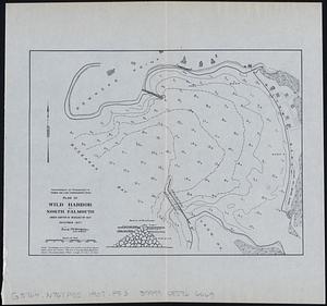
Plan of Wild Harbor at North Falmouth : under chapter 112 resolves of 1907
6635.
[Plan of William Jackson's farm, Newton]
6636.
Plan of Winnisimmet, in Chelsea
6637.
Plan of Winthrop Farm in the Town of Winthrop belonging to the City of Boston
6638.
Plan of Woodland Vale, in Newton, belonging to Wm. Kenrick
6639.
Plan of Zisapata Bay ; Plan of the harbour of Carthagena
6640.
Plan pittoresque de la ville de Paris
‹ Prev
Next ›
1
2
…
328
329
330
331
332
333
334
335
336
…
438
439

![[Plan of Tremont Street from Park to Boylston]](https://bpldcassets.blob.core.windows.net/derivatives/images/commonwealth:9s161b59r/image_thumbnail_300.jpg)
![[Plan of Tremont Street, from West to Boylston]](https://bpldcassets.blob.core.windows.net/derivatives/images/commonwealth:sn00b611k/image_thumbnail_300.jpg)


![[Plan of William Jackson's farm, Newton]](https://bpldcassets.blob.core.windows.net/derivatives/images/commonwealth:9s161g07t/image_thumbnail_300.jpg)