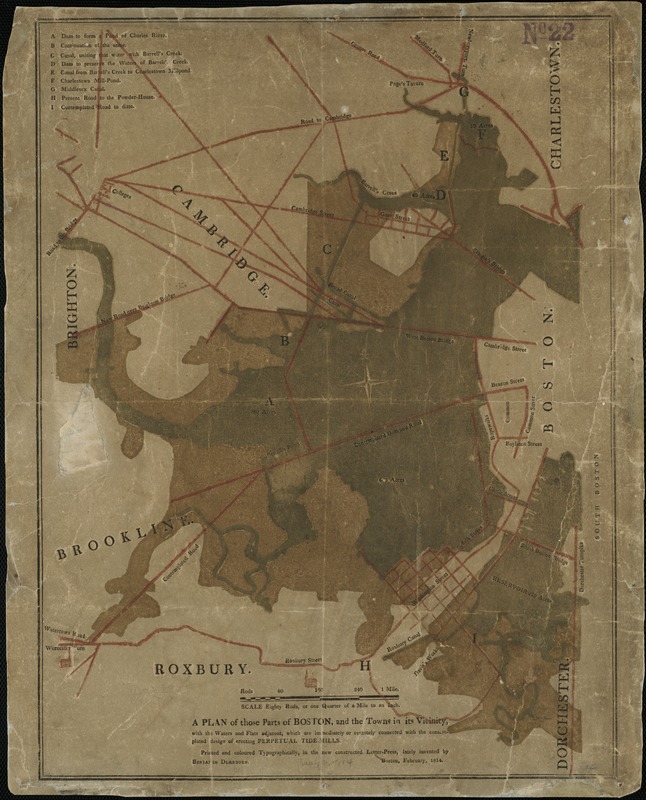
A plan of those parts of Boston, and the towns in its vicinity, with the waters and flats adjacent, which are immediately or remotely connected with the contemplated design of erecting perpetual tide-mills
Item Information
- Title:
- A plan of those parts of Boston, and the towns in its vicinity, with the waters and flats adjacent, which are immediately or remotely connected with the contemplated design of erecting perpetual tide-mills
- Creator:
- Dearborn, Benjamin, 1754-1838
- Name on Item:
-
printed and coloured typographically, in the new constructed letter-press, lately invented by Benjamin Dearborn.
- Date:
-
[1814]
- Format:
-
Maps/Atlases
- Location:
-
Boston Public Library
Norman B. Leventhal Map & Education Center - Collection (local):
-
Norman B. Leventhal Map & Education Center Collection
- Subjects:
-
Boston (Mass.)--Maps
- Places:
-
MassachusettsSuffolk (county)Boston
- Extent:
- 1 map : col. ; 47 x 36 cm.
- Terms of Use:
-
No known copyright restrictions.
No known restrictions on use.
- Publisher:
-
Boston :
s.n.
- Scale:
-
Scale 1:253,440.
- Language:
-
English
- Notes:
-
Boston, February, 1814.
Shows locations of streets, bridges, dams, canals and churches.
- Notes (date):
-
This date is inferred.
- Identifier:
-
06_01_005503
- Call #:
-
G3764.B6 1814 .D4x
- Barcode:
-
39999059014959


