Toggle navigation
LMEC Home
Exhibitions
Georeferencing
Tools for Teachers
Collections
My Favorites
Sign Up / Log In
Search
Search the map portal
Map Collection
Map Collection
Map Sets
Search
Search
Search for
Search In
All Fields
Creator
Title
Subject
Place
Search All Digital Collections
Advanced Search
8786 Results
My Search
Start Over
More Like
commonwealth:tt44pw229
Remove constraint More Like: commonwealth:tt44pw229
Filter your Search
Place
North and Central America
6,017
United States
4,934
Massachusetts
2,089
Europe
1,396
Suffolk (county)
1,136
Boston
1,109
Canada
449
Asia
438
more
Place
»
Topic
Boston (Mass.)--Maps
607
United States--Maps
282
Real property--Massachusetts--Boston--Maps
253
Landowners--Massachusetts--Boston--Maps
169
Massachusetts--Maps
163
City planning--Massachusetts--Boston--Maps
118
North America--Maps--Early works to 1800
103
New England--Maps
102
more
Topic
»
Date
Date range begin
–
Date range end
Current results range from
1482
to
2023
View distribution
Creator
United States. Hydrographic Office
595
O.H. Bailey & Co
148
Des Barres, Joseph F. W. (Joseph Frederick Wallet), 1722-1824
123
United States. Post Office Dept
120
Boston Redevelopment Authority
119
Ptolemy, 2nd cent
100
Walling, Henry Francis, 1825-1888
94
Geological Survey (U.S.)
87
more
Creator
»
Format
Maps/Atlases
8,726
Manuscripts
215
Prints
56
Books
36
Objects/Artifacts
10
Drawings/Illustrations
8
Posters
5
Georeferenced
Yes
870
No
7,916
Collection
Norman B. Leventhal Map & Education Center Collection
8,695
Boston and New England Maps
2,288
Urban Maps
2,078
Maritime Charts and Atlases
1,083
American Revolutionary War-Era Maps
616
Boston Redevelopment Authority Collection
142
Massachusetts Real Estate Atlases
36
Applied Geographics, Inc. Records
1
Available to use
No known restrictions
8,608
Creative Commons license
47
Search Constraints
Sort by relevance
relevance
title
date (asc)
date (desc)
Number of results to display per page
20 per page
10
per page
20
per page
50
per page
100
per page
View results as:
grid view
map view
Search Results
2541.
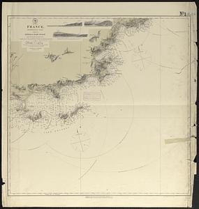
France
2542.
France
2543.
La France à la fin de la 2eme. race (843-987)
2544.
La France à la mort de Louis VII (Le Jeune) (1108-1180)
2545.
La France à la mort de Philippe 1er. (996-1108)
2546.
La France à la mort de Philippe Auguste : (1180-1223)
2547.
France as divided into departments
2548.
La France au commencement de la 3eme. race (987-996)
2549.
France divided into circles and departments
2550.
France divided into circles and departments
2551.
La France divisée en provinces et en généralités : dont le plan est celui de l'ancienne Gaule
2552.
La France divisée par généralités
2553.
France et états limitrophes
2554.
France, from the best authorities
2555.
France kilométrique : carte indiquant les distances kilométriques sur tous les réseaux de chemins de fer
2556.
France, Mediterranean coast : from the Pilote Français 1845 ; republication of Brit. Admty. chart no. 2609, with additions and...
2557.
France, Mediterranean coast : from the Pilote Français 1842 ; republication of Brit. Admty. chart no. 2608, with additions &...
2558.
France, Mediterranean coast : from the Pilote Français 1842 ; republication of Brit. Admty. chart no. 2607, with additions &...
2559.
France, Mediterranean coast : from the Pilote Français 1842 ; republication of Brit. Admty. chart no. 2604, with additions &...
2560.
France, Mediterranean coast : from the Pilote Français 1843 ; republication of Brit. Admty. chart no. 2606, with additions and...
‹ Prev
Next ›
1
2
…
124
125
126
127
128
129
130
131
132
…
439
440