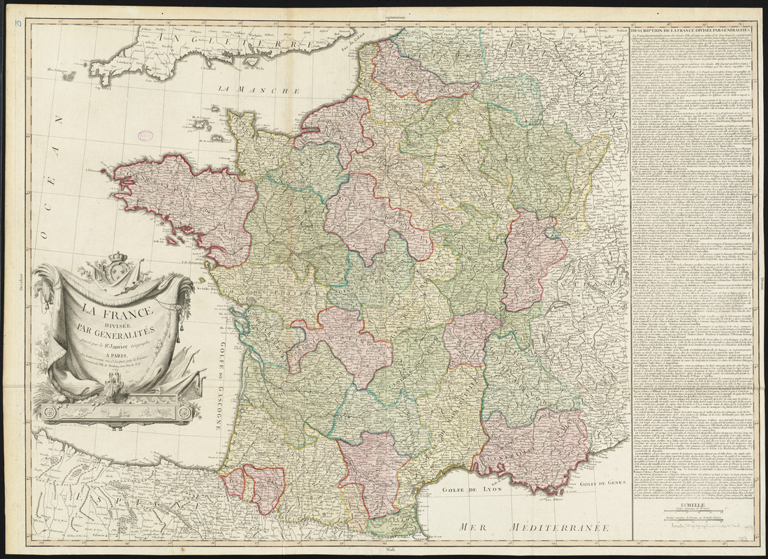
La France divisée par généralités
Item Information
- Title:
- La France divisée par généralités
- Creator:
- Janvier, Jean Denis
- Cartographer:
- Janvier, Jean Denis
- Publisher:
- Lattré, Jean
- Name on Item:
-
dressée par le Sr. Janvier, Géographe.
- Date:
-
1769
- Format:
-
Maps/Atlases
- Location:
-
Boston Public Library
Norman B. Leventhal Map & Education Center - Collection (local):
-
Norman B. Leventhal Map & Education Center Collection
- Subjects:
-
France--Maps--Early works to 1800
- Places:
-
France
- Extent:
- 1 map : hand colored ; 70 x 98 cm
- Terms of Use:
-
No known copyright restrictions.
No known restrictions on use.
- Publisher:
-
Paris :
Chez Lattre
- Scale:
-
Scale approximately 1:1,450,000
- Language:
-
French
- Notes:
-
Relief shown pictorially.
Prime meridian: [Ferro].
Includes text.
Originally on 2 sheets. Boston Public Library copy joined to 1 sheet.
Conservation of this piece was funded by Alan and Sherry Leventhal in memory of his father, Norman B. Leventhal whose vision to create this Map Center will inspire generations to come.
Map 10 in a composite atlas with the title "Atlas of the world."
- Identifier:
-
06_01_014655
- Call #:
-
G1015 .A85 1783
- Barcode:
-
30000004730205
![[Frantia]](https://bpldcassets.blob.core.windows.net/derivatives/images/commonwealth:7h14b063x/image_thumbnail_300.jpg)