Toggle navigation
LMEC Home
Exhibitions
Georeferencing
Tools for Teachers
Collections
My Favorites
Sign Up / Log In
Search
Search the map portal
Map Collection
Map Collection
Map Sets
Search
Search
Search for
Search In
All Fields
Creator
Title
Subject
Place
Search All Digital Collections
Advanced Search
8803 Results
My Search
Start Over
More Like
commonwealth:tt44pw17f
Remove constraint More Like: commonwealth:tt44pw17f
Filter your Search
Place
North and Central America
6,034
United States
4,952
Massachusetts
2,118
Europe
1,396
Suffolk (county)
1,154
Boston
1,127
Canada
449
Asia
438
more
Place
»
Topic
Boston (Mass.)--Maps
607
United States--Maps
282
Real property--Massachusetts--Boston--Maps
253
Landowners--Massachusetts--Boston--Maps
169
Massachusetts--Maps
162
City planning--Massachusetts--Boston--Maps
133
North America--Maps--Early works to 1800
103
New England--Maps
102
more
Topic
»
Date
Date range begin
–
Date range end
Current results range from
1482
to
2023
View distribution
Creator
United States. Hydrographic Office
595
O.H. Bailey & Co
148
Boston Redevelopment Authority
135
Des Barres, Joseph F. W. (Joseph Frederick Wallet), 1722-1824
123
United States. Post Office Dept
120
Ptolemy, 2nd cent
100
Walling, Henry Francis, 1825-1888
94
Geological Survey (U.S.)
86
more
Creator
»
Format
Maps/Atlases
8,742
Manuscripts
215
Prints
56
Books
36
Objects/Artifacts
10
Drawings/Illustrations
9
Posters
5
Georeferenced
Yes
870
No
7,933
Collection
Norman B. Leventhal Map & Education Center Collection
8,697
Boston and New England Maps
2,303
Urban Maps
2,092
Maritime Charts and Atlases
1,083
American Revolutionary War-Era Maps
620
Boston Redevelopment Authority Collection
155
Massachusetts Real Estate Atlases
35
William L. Clements Library Collection
3
more
Collection
»
Available to use
No known restrictions
8,621
Creative Commons license
49
Search Constraints
Sort by relevance
relevance
title
date (asc)
date (desc)
Number of results to display per page
20 per page
10
per page
20
per page
50
per page
100
per page
View results as:
grid view
map view
Search Results
5501.
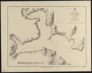
Newfoundland, east coast, Orange Bay or Great Harbor Deep : from a French survey in 1870
5502.
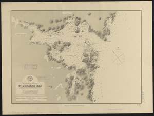
Newfoundland, n. e. coast, St. Lunaire Bay
5503.
Newfoundland--east coast, Conception Bay, Carbonear to Brigus Bay including Harbor Grace : from a Brit. survey in 1866,...
5504.
Newfoundland--south coast, the Burgeo Islands : from British surveys in 1872 ; republication of Brit. Admty. chart no. 272
5505.
New-Hampshire : from late survey
5506.
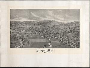
Newport, N.H. 1895
5507.
Newport, Rhode Island
5508.
Newport, R.I : view from Fort Wolcott, Goat Island
5509.
The Newport yacht race : an exciting game
5510.
Newsmap : week of October 14 to October 21, 215th week of the war, 97th week of U.S. participation. Monday, October 25, 1943
5511.
Newsmap : week of December 16 to December 22, 224th week of the war, 106th week of U.S. Participation. Monday, December 27, 1943
5512.
Newton : New Jersey
5513.
Newton Lower Falls, Massachusetts : 1880
5514.
Newton Upper Falls, Massachusetts, 1888
5515.
Niagara 1819
5516.
Niagara Falls : from surveys executed under the orders of Major C.B. Comstock, Corps of Engineers, Brvt. Brigadier General...
5517.
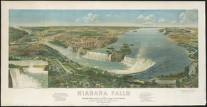
Niagara Falls and Niagara River from Lake Erie down to Lake Ontario
5518.
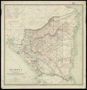
Nicaragua
5519.
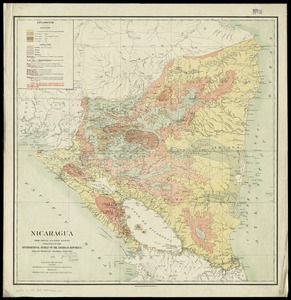
Nicaragua
5520.
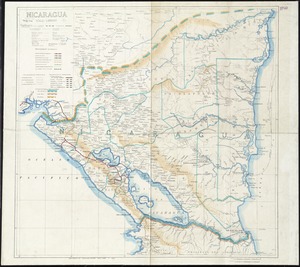
Nicaragua
‹ Prev
Next ›
1
2
…
272
273
274
275
276
277
278
279
280
…
440
441