Toggle navigation
LMEC Home
Exhibitions
Georeferencing
Tools for Teachers
Collections
My Favorites
Sign Up / Log In
Search
Search the map portal
Map Collection
Map Collection
Map Sets
Search
Search
Search for
Search In
All Fields
Creator
Title
Subject
Place
Search All Digital Collections
Advanced Search
8954 Results
My Search
Start Over
More Like
commonwealth:tt44pv73k
Remove constraint More Like: commonwealth:tt44pv73k
Filter your Search
Place
North and Central America
6,185
United States
5,101
Massachusetts
2,138
Europe
1,396
Suffolk (county)
1,300
Boston
1,273
Canada
449
Asia
438
more
Place
»
Topic
Boston (Mass.)--Maps
752
United States--Maps
282
Real property--Massachusetts--Boston--Maps
253
City planning--Massachusetts--Boston--Maps
218
Landowners--Massachusetts--Boston--Maps
169
Massachusetts--Maps
166
Urban renewal--Massachusetts--Boston--Maps
124
New England--Maps
104
more
Topic
»
Date
Date range begin
–
Date range end
Current results range from
1482
to
2023
View distribution
Creator
United States. Hydrographic Office
595
Boston Redevelopment Authority
222
O.H. Bailey & Co
148
Des Barres, Joseph F. W. (Joseph Frederick Wallet), 1722-1824
124
United States. Post Office Dept
120
Ptolemy, 2nd cent
100
Walling, Henry Francis, 1825-1888
94
Geological Survey (U.S.)
87
more
Creator
»
Format
Maps/Atlases
8,894
Manuscripts
215
Prints
56
Books
36
Objects/Artifacts
10
Drawings/Illustrations
8
Posters
5
Georeferenced
Yes
885
No
8,069
Collection
Norman B. Leventhal Map & Education Center Collection
8,725
Boston and New England Maps
2,424
Urban Maps
2,207
Maritime Charts and Atlases
1,083
American Revolutionary War-Era Maps
638
Boston Redevelopment Authority Collection
256
Massachusetts Real Estate Atlases
38
Mapping Boston Collection
20
more
Collection
»
Available to use
No known restrictions
8,731
Creative Commons license
70
Search Constraints
Sort by relevance
relevance
title
date (asc)
date (desc)
Number of results to display per page
20 per page
10
per page
20
per page
50
per page
100
per page
View results as:
grid view
map view
Search Results
6801.
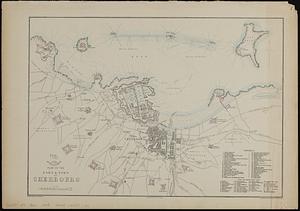
Plan of the port & town of Cherbourg
6802.
A plan of the property of the Hampton Normal and Agricultural Institute at Hampton Virginia
6803.
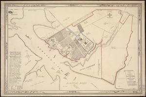
Plan of the proposed docks at South Boston
6804.
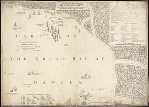
A plan of the reduction of Manila and Cavita
6805.
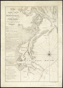
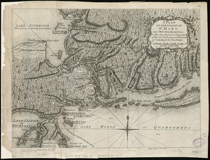
A plan of the river and sound of D'Awfoskee in South Carolina
6806.
A plan of the rivers Scoodic and Magaguadavic with their principal branches including the Bay of Passamaquoddy and the adjacent...
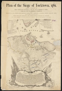
6807.
Plan of the Siege of Yorktown, 1781
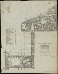
6808.
Plan of the South Open Ground, the Upper Plaisance, the Midway Plaisance, the Lake Open Ground, the Lagoon Plaisance and the...
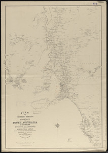
6809.
Plan of the southern portion of the province of South Australia as divided into counties and hundreds, showing agricultural...
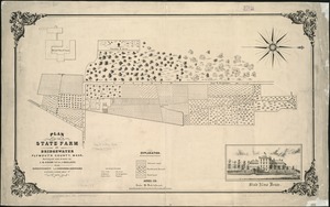
6810.
Plan of the state farm at Bridgewater, Plymouth County, Mass
6811.
A plan of the Straits of St. Mary, and Michilimakinac, to shew the situation & importance of the two westernmost settlements of...
6812.
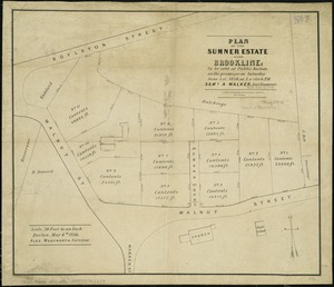
Plan of the Sumner Estate in Brookline : to be sold at public auction, on the premises on Saturday June 1st, 1850, at 3 o'clock...
6813.
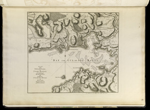
Plan of the town and citadel of Fort Royal, the capital of Martinico : with the Bay of Cul de Sac Royal
6814.
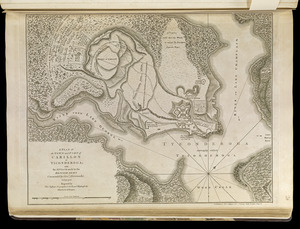
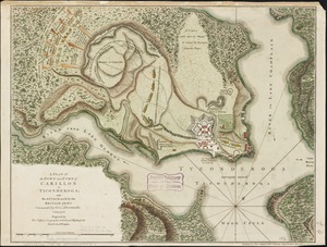
A plan of the town and Fort of Carillon at Ticonderoga : with the attack made by the British army commanded by Genl....
6815.
A plan of the town and Fort of Carillon at Ticonderoga : with the attack made by the British army commanded by Genl....
6816.
Plan of the town and fort of Grenada
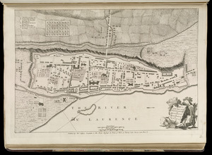
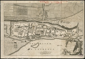
6817.
Plan of the town and fortifications of Montreal or Ville Marie in Canada
6818.
Plan of the town and fortifications of Montreal or Ville Marie in Canada
6819.
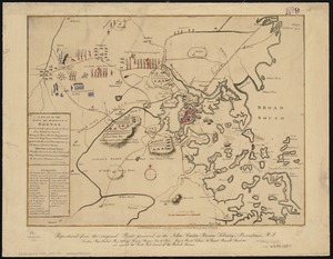
A plan of the town and harbour of Boston, and the country adjacent with the road from Boston to Concord shewing the place of...
6820.
Plan of the town and harbour of San Juan de Puerto Rico ; Plan of the Aguada Nueva de Puerto Rico
‹ Prev
Next ›
1
2
…
337
338
339
340
341
342
343
344
345
…
447
448