Toggle navigation
LMEC Home
Exhibitions
Georeferencing
Tools for Teachers
Collections
My Favorites
Sign Up / Log In
Search
Search the map portal
Map Collection
Map Collection
Map Sets
Search
Search
Search for
Search In
All Fields
Creator
Title
Subject
Place
Search All Digital Collections
Advanced Search
8791 Results
My Search
Start Over
More Like
commonwealth:st74cw76b
Remove constraint More Like: commonwealth:st74cw76b
Filter your Search
Place
North and Central America
6,022
United States
4,922
Massachusetts
2,084
Europe
1,396
Suffolk (county)
1,046
Boston
1,019
Canada
467
Asia
438
more
Place
»
Topic
Boston (Mass.)--Maps
586
United States--Maps
282
Real property--Massachusetts--Boston--Maps
175
Massachusetts--Maps
162
Landowners--Massachusetts--Boston--Maps
133
North America--Maps--Early works to 1800
107
New England--Maps
102
New England--Maps--Early works to 1800
97
more
Topic
»
Date
Date range begin
–
Date range end
Current results range from
1482
to
2023
1482 : 2024
1482
2024
View distribution
Creator
United States. Hydrographic Office
595
O.H. Bailey & Co
148
Des Barres, Joseph F. W. (Joseph Frederick Wallet), 1722-1824
123
United States. Post Office Dept
120
Ptolemy, 2nd cent
100
Walling, Henry Francis, 1825-1888
94
Jefferys, Thomas, -1771
91
Geological Survey (U.S.)
86
more
Creator
»
Format
Maps/Atlases
8,731
Manuscripts
218
Prints
56
Books
36
Objects/Artifacts
10
Drawings/Illustrations
8
Posters
5
Georeferenced
Yes
874
No
7,917
Collection
Norman B. Leventhal Map & Education Center Collection
8,724
Boston and New England Maps
2,243
Urban Maps
2,023
Maritime Charts and Atlases
1,089
American Revolutionary War-Era Maps
679
Boston Redevelopment Authority Collection
87
Mapping Boston Collection
28
MacLean Collection Map Library
17
more
Collection
»
Available to use
No known restrictions
8,557
Creative Commons license
105
Search Constraints
Sort by relevance
relevance
title
date (asc)
date (desc)
Number of results to display per page
20 per page
10
per page
20
per page
50
per page
100
per page
View results as:
grid view
map view
Search Results
7221.
Richmond and its defences : constructed and engraved to illustrate "The war with the South"
7222.
Richmond Petersburg and vicinity
7223.
Richmond Petersburg and vicinity
7224.
The River & Gulf of St. Lawrence, Newfoundland, Nova Scotia, and the banks adjacent : from the British Admiralty, French Marine...
7225.
River S Claire
7226.
The River St. John
7227.
The Riverway master plan
7228.
La Riviere de la Garomne et la Dordogne et le pays aux environs de Bordeaux
7229.
R.L. Polk & Co.'s map of Bay City, and Essexville Mich
7230.
R.L. Polk & Co's map of greater Battle Creek and suburbs
7231.
R.L. Polk & Co's map of Memphis, Tenn : from official records and original plats
7232.
Road map, drawn & engraved expressly for Road book of Boston & vicinity
7233.
Road map of the Albany-Troy district
7234.
Road map of the Boston district showing the metropolitan park system.
7235.
Road map of the Boston District, showing the metropolitan park system
7236.
Road map of the Boston district showing the metropolitan park system
7237.
Road map of the island of Rhode Island, or Aquidneck
7238.
Road map of Worcester County, Mass
7239.
Roads and communications of Sinkiang
7240.
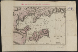
The Roads of Toulon, with the adjacent country
+
-
Redo search here
Search when I move the map
Leaflet
| ©
OpenStreetMap
contributors, ©
CartoDB
‹ Prev
Next ›
1
2
…
358
359
360
361
362
363
364
365
366
…
439
440