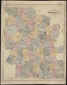
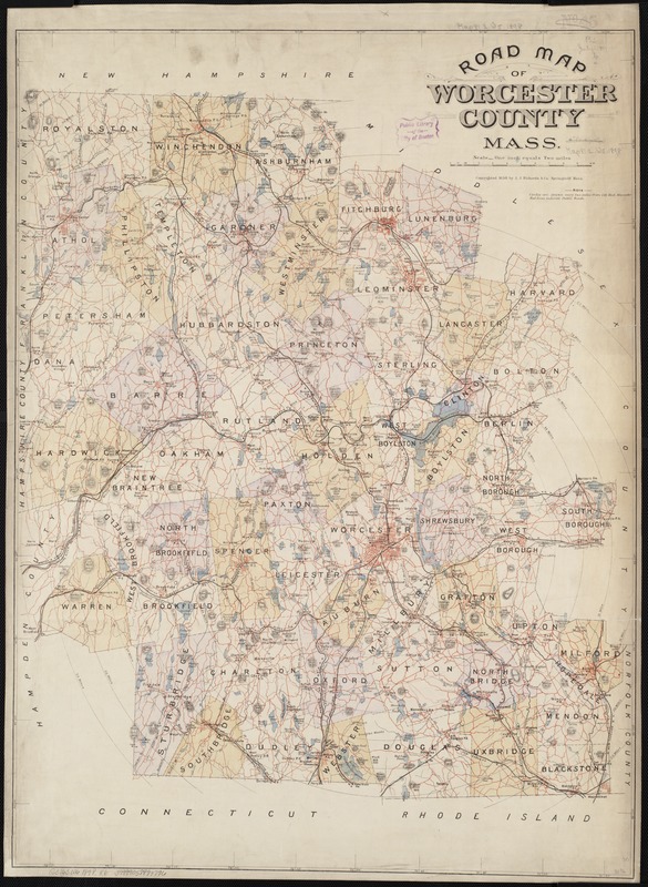
Road map of Worcester County, Mass
Item Information
- Title:
- Road map of Worcester County, Mass
- Creator:
- L.J. Richards & Co
- Date:
-
[ca. 1898]
- Format:
-
Maps/Atlases
- Location:
-
Boston Public Library
Norman B. Leventhal Map & Education Center - Collection (local):
-
Norman B. Leventhal Map & Education Center Collection
- Subjects:
-
Roads--Massachusetts--Worcester County--Maps
Worcester County (Mass.)--Maps
- Places:
-
MassachusettsWorcester (county)
- Extent:
- 1 map : col. ; 75 x 55 cm.
- Terms of Use:
-
No known copyright restrictions.
No known restrictions on use.
- Publisher:
-
Springfield, Mass :
L.J. Richards & Co.
- Scale:
-
Scale 1:126,600.
- Language:
-
English
- Notes:
-
Relief shown by hachures.
From: New topographical atlas of the county of Worcester, Mass., 1898.
- Identifier:
-
06_01_003254
- Call #:
-
G3763.W6 1898 .R6
- Barcode:
-
39999058999796