Toggle navigation
LMEC Home
Exhibitions
Georeferencing
Tools for Teachers
Collections
My Favorites
Sign Up / Log In
Search
Search the map portal
Map Collection
Map Collection
Map Sets
Search
Search
Search for
Search In
All Fields
Creator
Title
Subject
Place
Search All Digital Collections
Advanced Search
8773 Results
My Search
Start Over
More Like
commonwealth:qj72rq70n
Remove constraint More Like: commonwealth:qj72rq70n
Filter your Search
Place
North and Central America
6,004
United States
4,922
Massachusetts
2,088
Europe
1,396
Suffolk (county)
1,124
Boston
1,097
Canada
449
Asia
438
more
Place
»
Topic
Boston (Mass.)--Maps
606
United States--Maps
282
Real property--Massachusetts--Boston--Maps
253
Landowners--Massachusetts--Boston--Maps
170
Massachusetts--Maps
162
City planning--Massachusetts--Boston--Maps
108
North America--Maps--Early works to 1800
103
New England--Maps
102
more
Topic
»
Date
Date range begin
–
Date range end
Current results range from
1482
to
2023
View distribution
Creator
United States. Hydrographic Office
595
O.H. Bailey & Co
148
Des Barres, Joseph F. W. (Joseph Frederick Wallet), 1722-1824
123
United States. Post Office Dept
120
Boston Redevelopment Authority
110
Ptolemy, 2nd cent
100
Walling, Henry Francis, 1825-1888
94
Geological Survey (U.S.)
86
more
Creator
»
Format
Maps/Atlases
8,713
Manuscripts
215
Prints
56
Books
36
Objects/Artifacts
10
Drawings/Illustrations
8
Posters
5
Georeferenced
Yes
869
No
7,904
Collection
Norman B. Leventhal Map & Education Center Collection
8,695
Boston and New England Maps
2,276
Urban Maps
2,066
Maritime Charts and Atlases
1,083
American Revolutionary War-Era Maps
616
Boston Redevelopment Authority Collection
129
Massachusetts Real Estate Atlases
35
Applied Geographics, Inc. Records
1
Available to use
No known restrictions
8,596
Creative Commons license
47
Search Constraints
Sort by relevance
relevance
title
date (asc)
date (desc)
Number of results to display per page
20 per page
10
per page
20
per page
50
per page
100
per page
View results as:
grid view
map view
Search Results
3101.
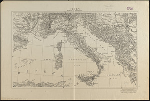
Italy
3102.
Italy
3103.
Italy
3104.
Italy
3105.
Italy, and Sardinia, from the best authorities
3106.
Italy with Vatican City
3107.
Iuliacensis et Montensis Ducatus = De Hertoghdomen Gulick en Berghe
3108.
Iutiae tabula in quae sunt dioeceses Alburgensis, Wiburgensis, Ripensis et Arhusiensis quae et sunt divisae in omnia dominia
3109.
J. Schedler's relief map of Boston and environs
3110.
J. Schedler's relief map of the White Mountains, N.H
3111.
Jackson County, Wis.
3112.
Jamaica
3113.
Jamaica, from the latest surveys
3114.
Jamaica Park and Bussey Farm Parkway : West Roxbury district
3115.
Jamaica Plain, Massachusetts : Ward 23, City of Boston, 1891
3116.
Jamaica Plain view of the world
3117.
Jamaica Pond master plan
3118.
James Hayes Park
3119.
Japan - n.w. coast of Nipon, Nanao Harbors : south harbor, surveyed by Commander C.J. Bullock and the officers of H.M.S....
3120.
Japan, anchorages in the Seto-Uchi or Inland Sea
‹ Prev
Next ›
1
2
…
152
153
154
155
156
157
158
159
160
…
438
439